


CityPlaceN1
Senior Member
So Gladstone was initially planned to go through the park and then they changed their mind.
|
|
|
So Gladstone was initially planned to go through the park and then they changed their mind.
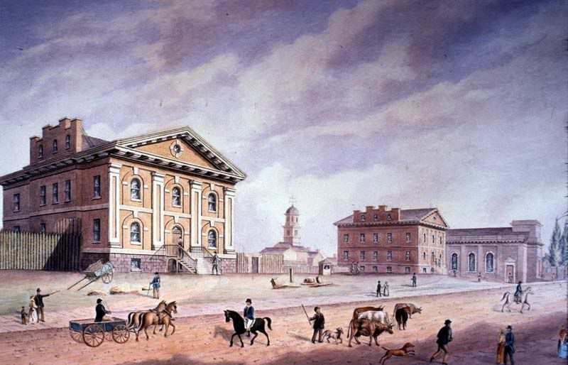
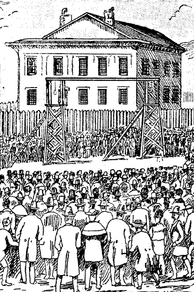
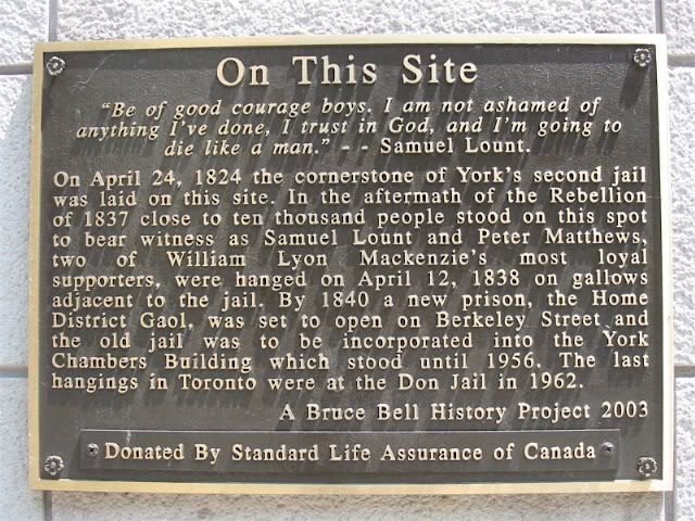
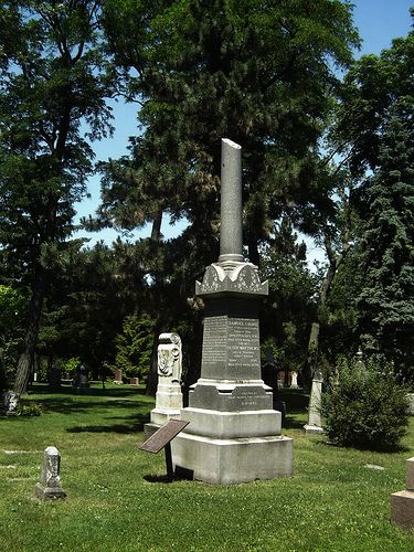
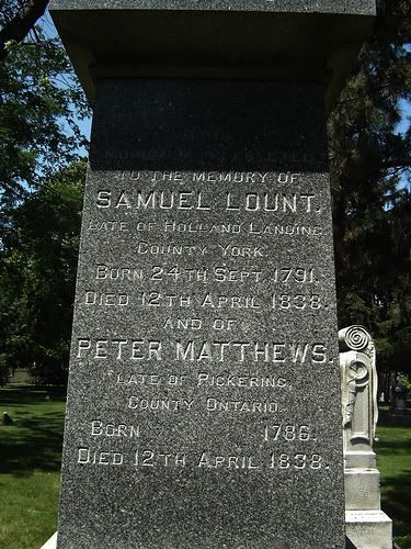
April 12, 1838: Hanging of Samuel Lount and Peter Matthews, two of the rebels from the 1837 Rebellion (corner of King and Toronto Streets):

"In March 1920, Colonel [George Cooper] Royce sold the 32-acre (13-hectare) estate, including Preston Villa to the City for $330,000. Earlscourt Park was officially opened on October 23, 1920. Preston Villa became the Earlscourt Park Community Clubhouse . The clubhouse building, considered dilapidated and a fire hazard, was closed in 1955 and subsequently demolished. ... The space was redeveloped for recreation." Excerpt from St. Clair West in Pictures, 3rd ed., 112.

April 13th: a photo of the falling apart but ornate (by today's standards) Earlscourt Park Clubhouse veranda 76 years ago, in 1934:

I think that was in fact "Earlscourt", the house that gave the park and district its name. Long gone.
These pictures are so awesome. Thanks for the share.

Wooden screw ferry with engines by Polson Iron Works and built by Clark Limited. Named for Tom (T. J.) Clark, co-operator of wooden screw ferry that began service in 1890. Operator as ferry from 1911 to 1927; sold to City of Toronto and operator by the TTC. Decommissioned 1959 and sold to Toronto Drydock Company Ltd, scrapped by 1961