News   Apr 26, 2024
 2K     4 
News   Apr 26, 2024
 450     0 
News   Apr 26, 2024
 1K     1 

Cycling: West Toronto Railpath (City of Toronto, Phase II Proposed)

I believe the Wallace Ave bridge (which is a gem in some ways, but certainly not for cyclists - although at least it has a bike rail thingy) is due for replacement when electrification goes in.

There should be steps as well as ramps. The space is shared with pedestrians and both types of needs should be addressed.

- Paul
 
I would like to see any bridgework over the railway (or roadways) include spiral bicycle ramps instead of steps.

I would much rather see underpasses, like the Dutch prefer...

rijnwaalpad02.jpg

From: https://bicycledutch.wordpress.com/

Much better to accelerate down 2 or 3 metres, then use the momentum to go up, instead of climbing up 10 metres, then have to brake on the way down.
 
I would much rather see underpasses, like the Dutch prefer...

rijnwaalpad02.jpg

From: https://bicycledutch.wordpress.com/

Much better to accelerate down 2 or 3 metres, then use the momentum to go up, instead of climbing up 10 metres, then have to brake on the way down.
That maybe the prefer way doing this for Wallace Bridge, but next to no room for an entrance at Dundas. Unless you turn the Dundas entrance on an angle to the south and buy the property next to the bridge, not going to happen. This would make the area accessibly to everyone with a tunnel.

Having a tunnel would be great for ML, since they wouldn't have to put barriers up on the existing bridge.

They were landscaping and putting the barrier up for the new Railpath at Dufferin St last week.
 
That maybe the prefer way doing this for Wallace Bridge, but next to no room for an entrance at Dundas. Unless you turn the Dundas entrance on an angle to the south and buy the property next to the bridge, not going to happen. This would make the area accessibly to everyone with a tunnel..

I've had that exact thought too. It would be great if there was a cycling/pedestrian tunnel aligned between Glenlake and Wallace. Yes you'd have to buy out that property (though I do find it an eyesore), and it would still be tight. You could even have connections to the GO platform, and to the railpath.

It would make for a great Glenlake-Wallace cycling route between High Park and Dufferin.
 
They should do something similar to the John Street bridge in Weston, if they don't tunnel. See link.

weston-bridge.jpg


From link.
John-Street-Pedestrian-Bridge-aerial-rendering.jpg
Again, no room on Dundas and that will be one hell of a ramp on both sides of the corridor going north, since that is the only direction you could use. You would be almost to Dupont to start/end the ramp

They kill the stairs on the east side because of the driveway and would never see a ramp going east.

What every ML was to do to the Wallace Bridge, very little was done as plan that I could see.
 
They should do something similar to the John Street bridge in Weston, if they don't tunnel. See link.

weston-bridge.jpg


From link.
John-Street-Pedestrian-Bridge-aerial-rendering.jpg

The John St Bridge had the added benefit of being over the corridor where it was depressed, reducing the grade height difference for users. That cannot be done for West Toronto unless it's in proximity to the Strachan tunnel. To add to drum's point, those would be massive ramps and stairs to meet AODA requirements.

This is another reason I'm in favour of a tunnel similar to what @brainfreezed posted. Meets AODA and it's less of a challenge to use.
 
Of course, a Wallace tunnel doesn't need to exit on the east side of Dundas Street West. Maybe steps on the east side, and continue the bicycle tunnel to the west side to emerge onto the grass area.
And how does your recommendation comply with AODA requirements, since it must come 2025? Have you looked at that area to see what can be done there in the first Place??
31360282971_438f0d2379_k.jpg


Anyway, here are shots I just fix shot on June 16 at Dufferin St and more up on site.
35574824371_9952c915b9_k.jpg

35705547905_a1b78b04e7_k.jpg

35574831111_b87b6a135f_k.jpg

35705555995_6fb7a83946_k.jpg

35705566535_f0f856e607_k.jpg
 
focussed?

Also: looks like the timeline on the railpath is going to be quite long. I would be surprised if construction started in 2019 - completion 2020 or 2021?
 
focussed?

Also: looks like the timeline on the railpath is going to be quite long. I would be surprised if construction started in 2019 - completion 2020 or 2021?

It's going to be complicated by the necessary grade separation with the Barrie Line between Dundas Street and Lansdowne Avenue. Considering how long it took to rebuild the grade separation with the defunct CP Belleville Sub at the Lower Don Trail, I can see why there's a long timeline.
 
It's going to be complicated by the necessary grade separation with the Barrie Line between Dundas Street and Lansdowne Avenue. Considering how long it took to rebuild the grade separation with the defunct CP Belleville Sub at the Lower Don Trail, I can see why there's a long timeline.

To be fair, that was an underpass and not a bridge. The bridge supports may encounter water and stability issues, but otherwise it should not be as difficult; the ground intrusion is relatively minimal.
 
Just stumbled upon a July update on the City's site.

Update July 2017

We are closer to constructing the West Toronto Railpath Extension between Dundas Street West to just south of Queen Street West. Staff are now focussed on completing the final multi-use trail design in 2018. Discussions about a construction schedule are currently underway with Metrolinx.

Implementation of the Railpath Extension is being carried out by both the City of Toronto's Transportation Services and Metrolinx. Most of the Railpath Extension will be located within the Metrolinx owned rail corridor. As a result the design will need to be coordinated with other planned Metrolinx works. Currently, Metrolinx is in the design phase for a track expansion of the rail corridor to service the Regional Express Rail (RER) and future electrification of the Kitchener and Barrie GO rail corridors. For more information about these related Metrolinx projects, visit: metrolinx.com/en/regionalplanning/rer

What needs to happen before construction can start?
The environmental assessment study established a final trail design. The Railpath Extension will be wider than originally anticipated and will be retained within the rail corridor or immediately adjacent to the rail corridor to Sudbury Street. This alignment would not have been possible without Metrolinx's agreement and cooperation.

In addition to finalizing the trail design, there have been many technical challenges which required planning, coordination and time including:

  • finalizing the consultant team to undertake detailed design
  • negotiating a shared use land agreement with Metrolinx
  • negotiations with affected private properties
  • negotiations with existing utility infrastructure owners regarding relocations
  • working with community stakeholders and local councillors who have been critical in this problem solving exercise and process
What is Detailed Design?
Detailed design will include: asphalt pavement surfaces, fencing, lighting, urban design and plantings. Refining four pedestrian-cyclist bridges over the Barrie GO Rail Corridor and over Lansdowne Avenue, Brock Street and Queen Street are included within the detailed design scope. This phase will also produce detailed design drawings including construction standards and specifications, a Construction Management Plan, Environmental Monitoring Plan and Trail Operations and Maintenance Plans.

A number of permits and approvals will be secured prior to trail construction. Acts, regulations and City by-laws that may need to be adhered to will be incorporated into the design, including the Migratory Birds Convention Act, Ontario Heritage Act and Noise Control By-law, amongst others. In addition, where the proposed trail route intercepts public utilities, review and approvals will be required from Metrolinx and utility companies including Hydro One and Enbridge Gas.

Opportunities to Get Involved
There will be two planned public events to provide project updates and receive feedback. The first event will take place during design and the second will be hosted prior to construction.

Several meetings will be scheduled with key stakeholders including property owners, community organizations and residents to discuss topics such as access points to the Railpath Extension, safety, lighting, and planting.

The City will also be seeking advice from the Design Review Panel (DRP) whose mandate is to assist City Council in fulfilling Official Plan objectives by providing City staff with professional design advice on public and private developments. The project team first presented to the DRP on September 18, 2013. The City and Metrolinx will be going back to the DRP to seek advice on the multi-use trail design for the Railpath.

RELATED PROJECTS
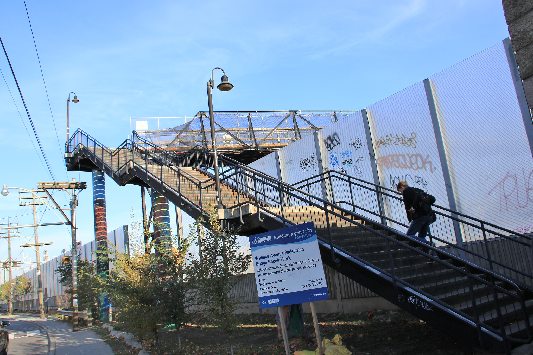
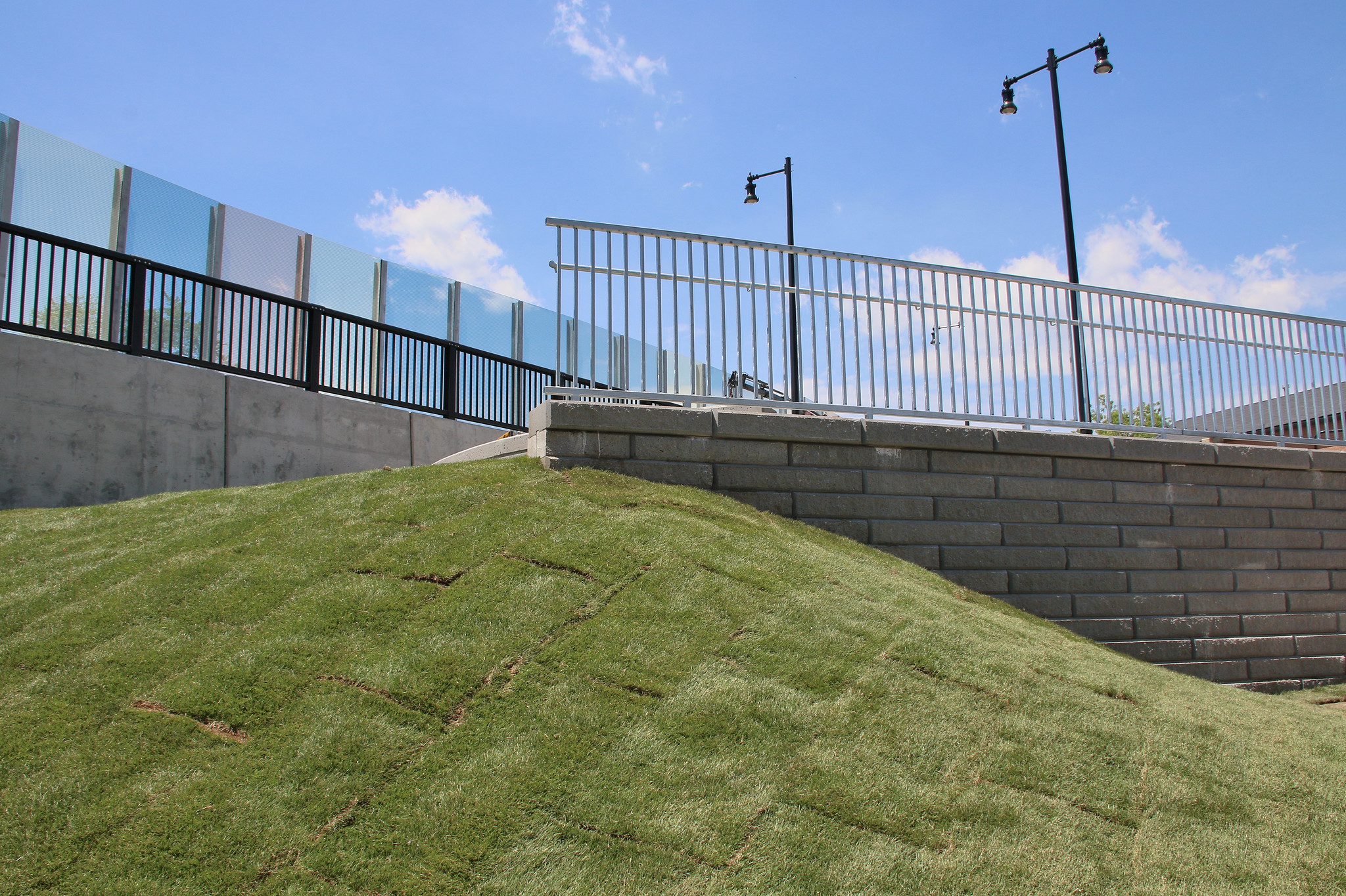
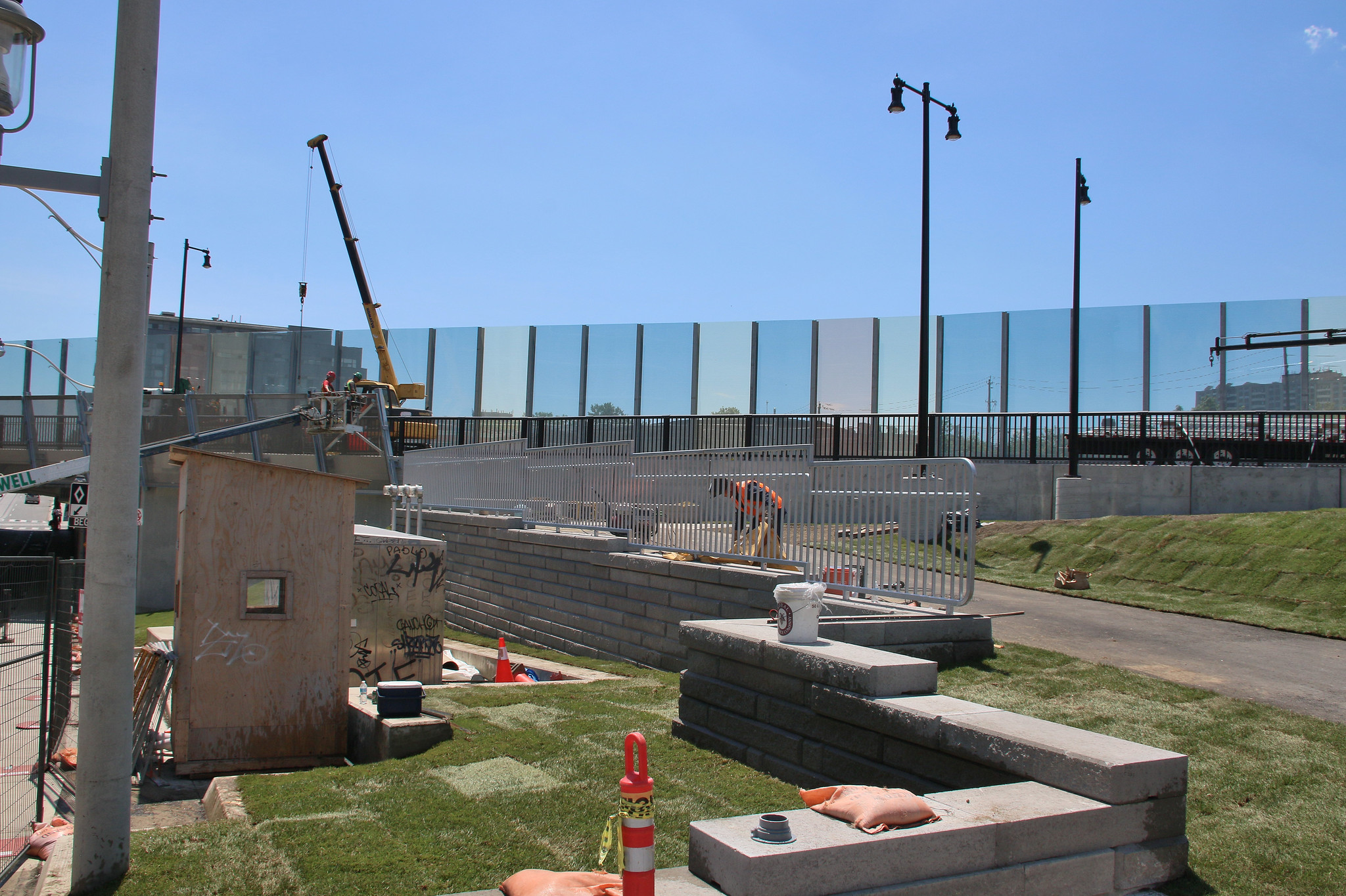
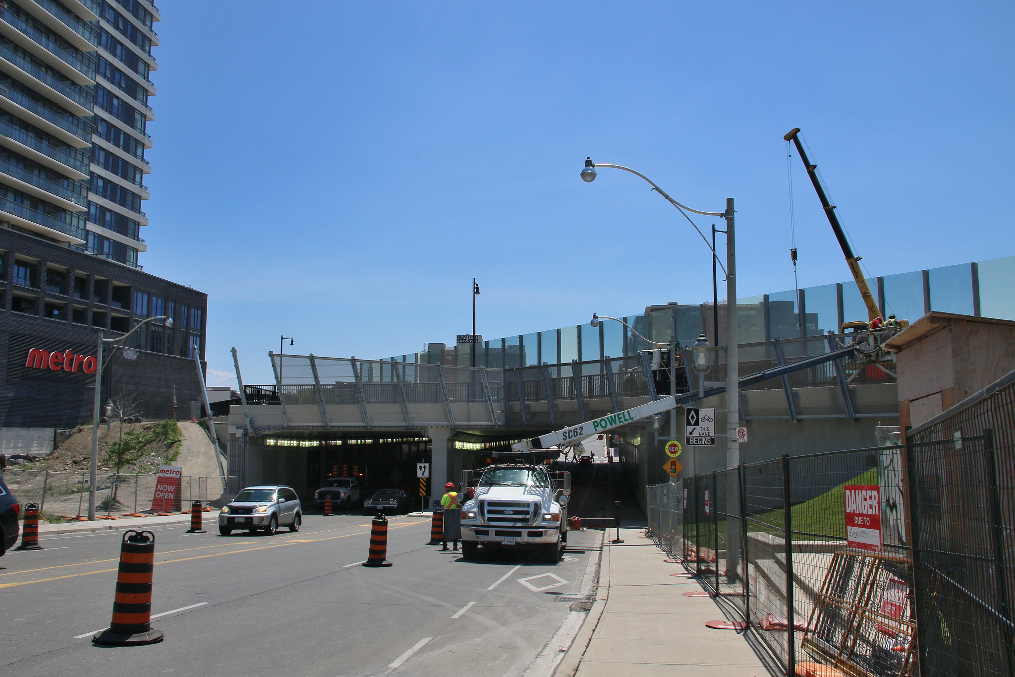
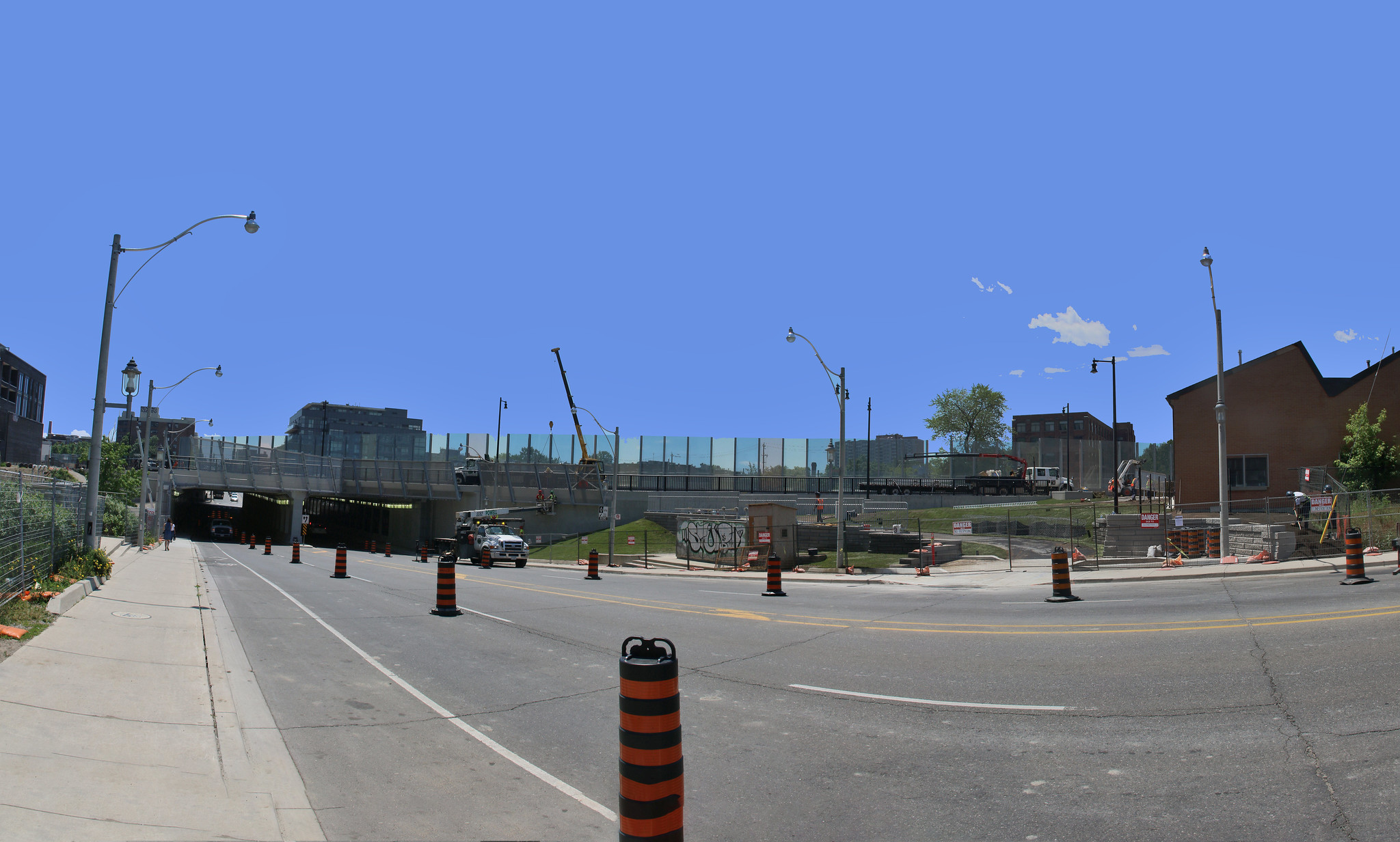
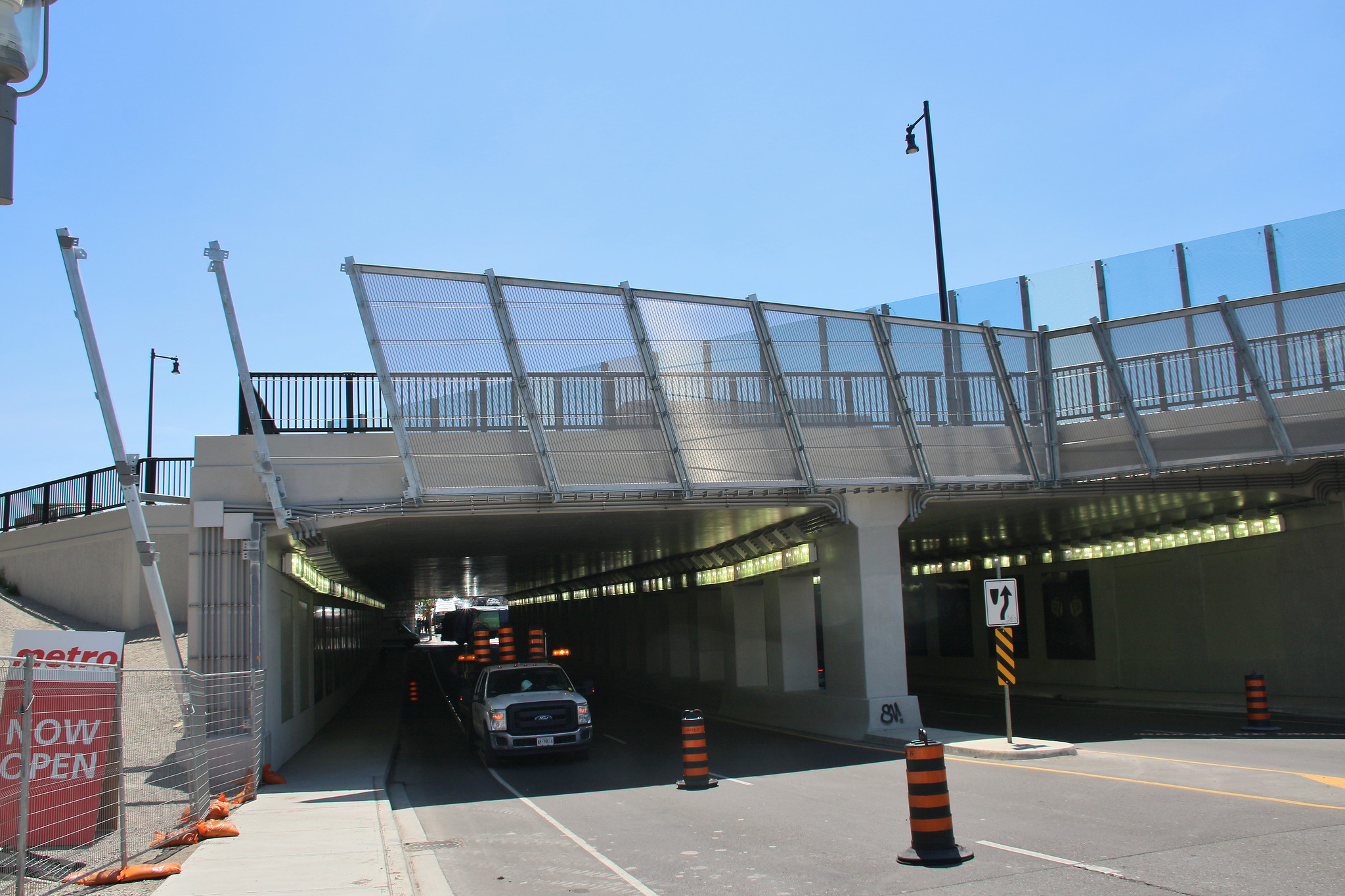
Dufferin Bridge Connection Completed

You may notice an exciting connection to the future Railpath Extension which has recently been completed at Dufferin Street. An access ramp, seating areas and future Railpath bridge across Dufferin Street were completed in June 2017 in combination with the railway bridge expansion. The seating area will open shortly, and the ramp and observation area on the bridge will open as soon as the new Pessoa Park on the East side of Dufferin is completed in the spring of 2018.

For more information about Pessoa Park, contact:

Eric Stadnyk - City of Toronto, Parks, Forestry & Recreation – Project Coordinator Landscape Architect

Eric.Stadnyk@toronto.ca

416-392-3895

Railpath and Metrolinx Track Expansion (north of Dundas) Update
As many of you know, Metrolinx RER track expansion on the Kitchener corridor will affect the existing Railpath, which runs from Dundas Street West north to Cariboo Ave. The City of Toronto is currently evaluating the proposal by Metrolinx to ensure minimal impact to the Railpath. Metrolinx will present their plans at a public meeting in 2017.

For more information about this project, contact:

Erika Richmond - City of Toronto, Parks, Forestry & Recreation – Project Coordinator Landscape Architect

Erika.Richmond@toronto.ca

416-338-8293

WEST TORONTO RAILPATH EXTENSION AND NEIGHBOURING PROJECTS MAP
Railpath%2007.26.2017_featured_800wide.jpg
 
Just stumbled upon a July update on the City's site.

...

Railpath and Metrolinx Track Expansion (north of Dundas) Update
As many of you know, Metrolinx RER track expansion on the Kitchener corridor will affect the existing Railpath, which runs from Dundas Street West north to Cariboo Ave. The City of Toronto is currently evaluating the proposal by Metrolinx to ensure minimal impact to the Railpath. Metrolinx will present their plans at a public meeting in 2017.

For more information about this project, contact:

Erika Richmond - City of Toronto, Parks, Forestry & Recreation – Project Coordinator Landscape Architect

Erika.Richmond@toronto.ca

416-338-8293

WEST TORONTO RAILPATH EXTENSION AND NEIGHBOURING PROJECTS MAP
Railpath%2007.26.2017_featured_800wide.jpg

If there are any significant impacts proposed, prepare to hear hell about it.

The other things that strike me are a) the City is now open about potential plans to extend WTR northwest, as well as create a new railpath along Barrie, and b) the WTR east of Lansdowne may become a trunk for bike traffic if significant ridership is generated by both of these expansions.
 

Back
Top