


thecharioteer
Senior Member
es·pla·nade
/ˈespləˌnäd,-ˌnād/
noun
a long, open, level area, typically beside the sea, along which people may walk for pleasure.
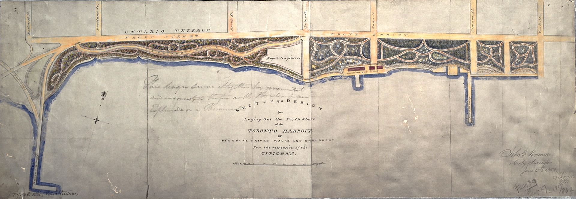
As we all know, Toronto's Esplanade did not quite turn out as originally envisioned. The 1852 Plan by John Howard described the area south of Front Street as "A design for laying out the north shore of the Toronto Harbour in pleasure drives walks and shrubbery for the recreation of the citizens."
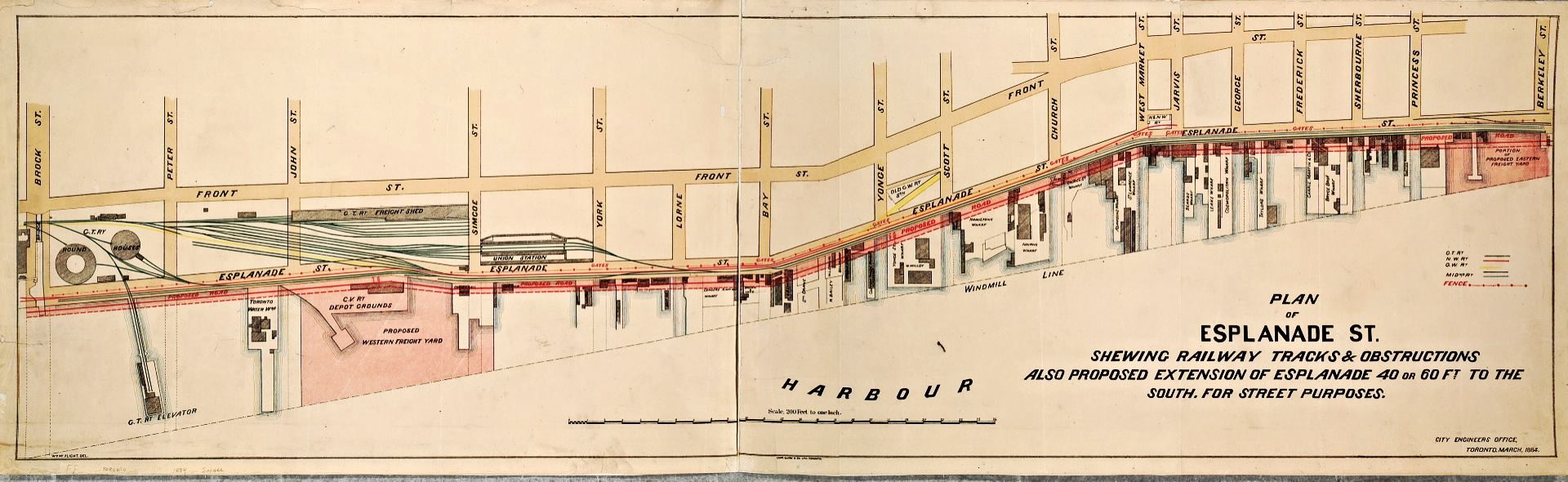
That plan was doomed by the arrival of the railways, as can be seen in this 1884 map:
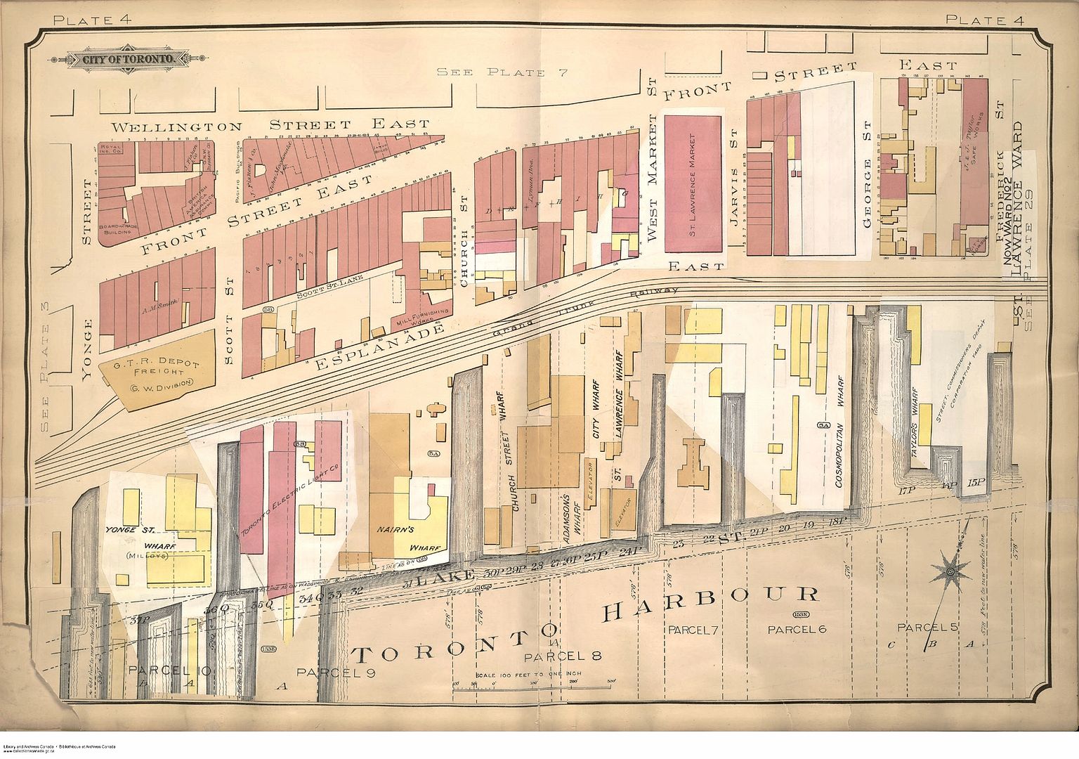
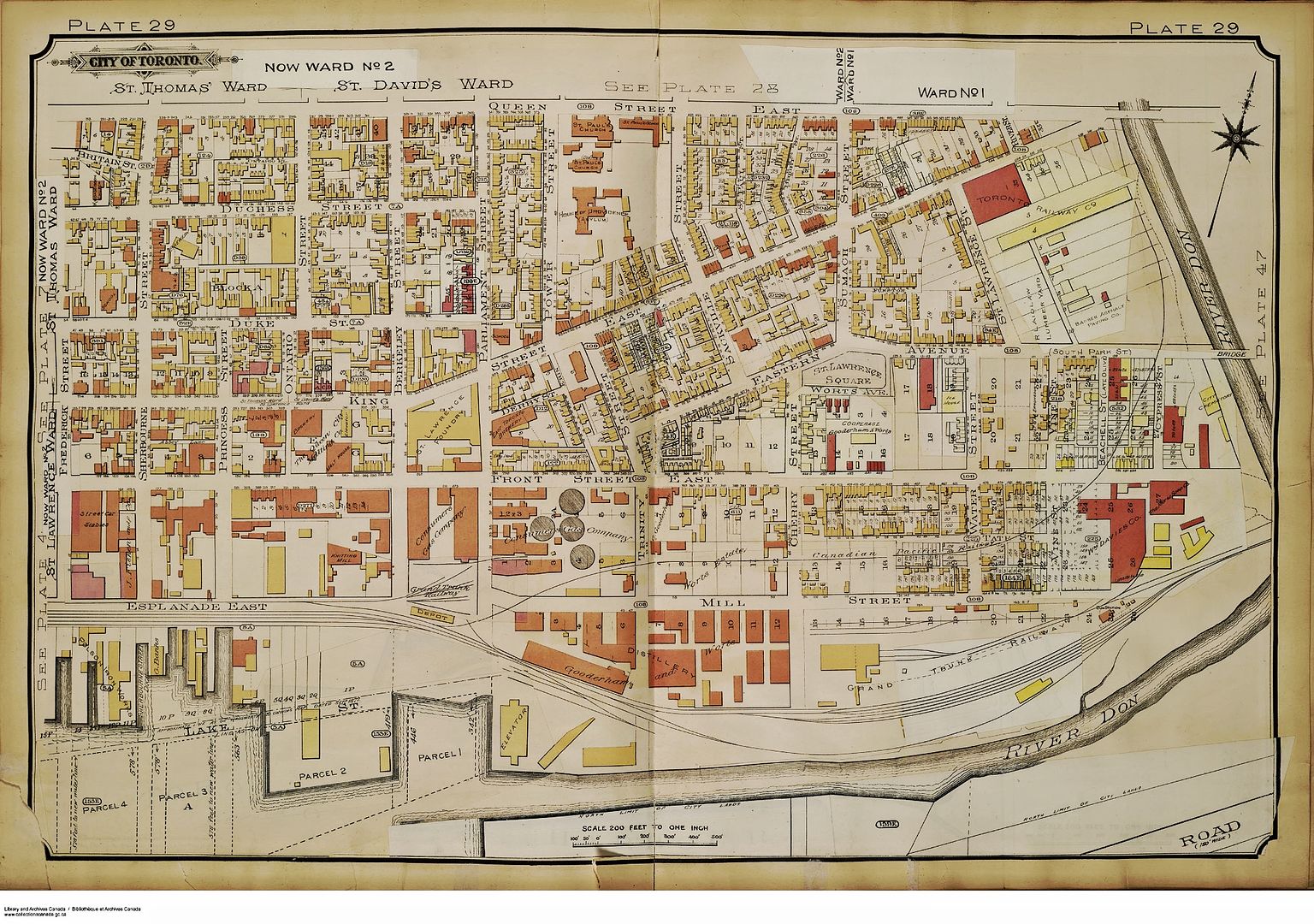
By 1903, The Esplanade was essentially a railway corridor between Front Street and the Harbour:
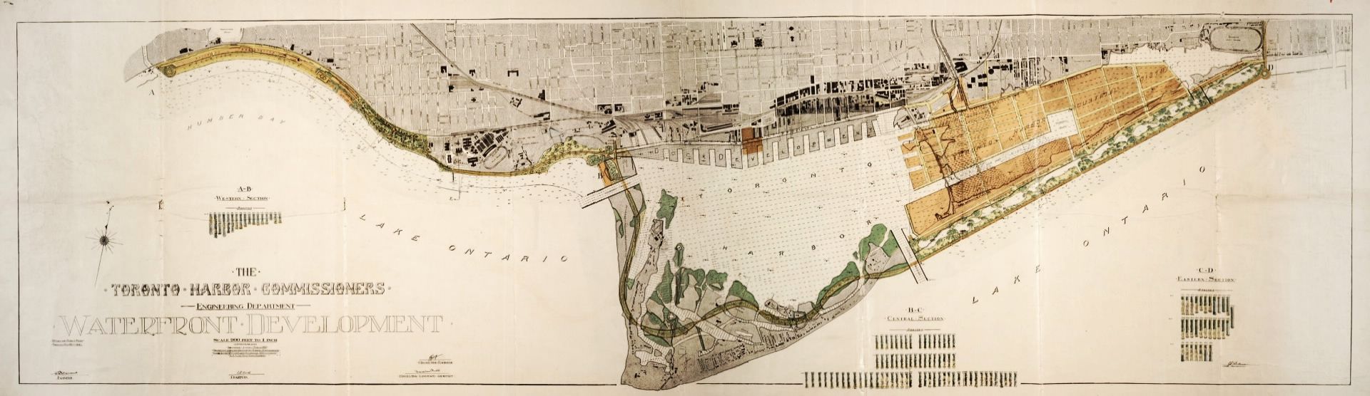
in 1912, the Toronto Harbour Commission produced plans remarkably similar to the waterfront we know today:
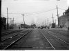
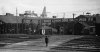
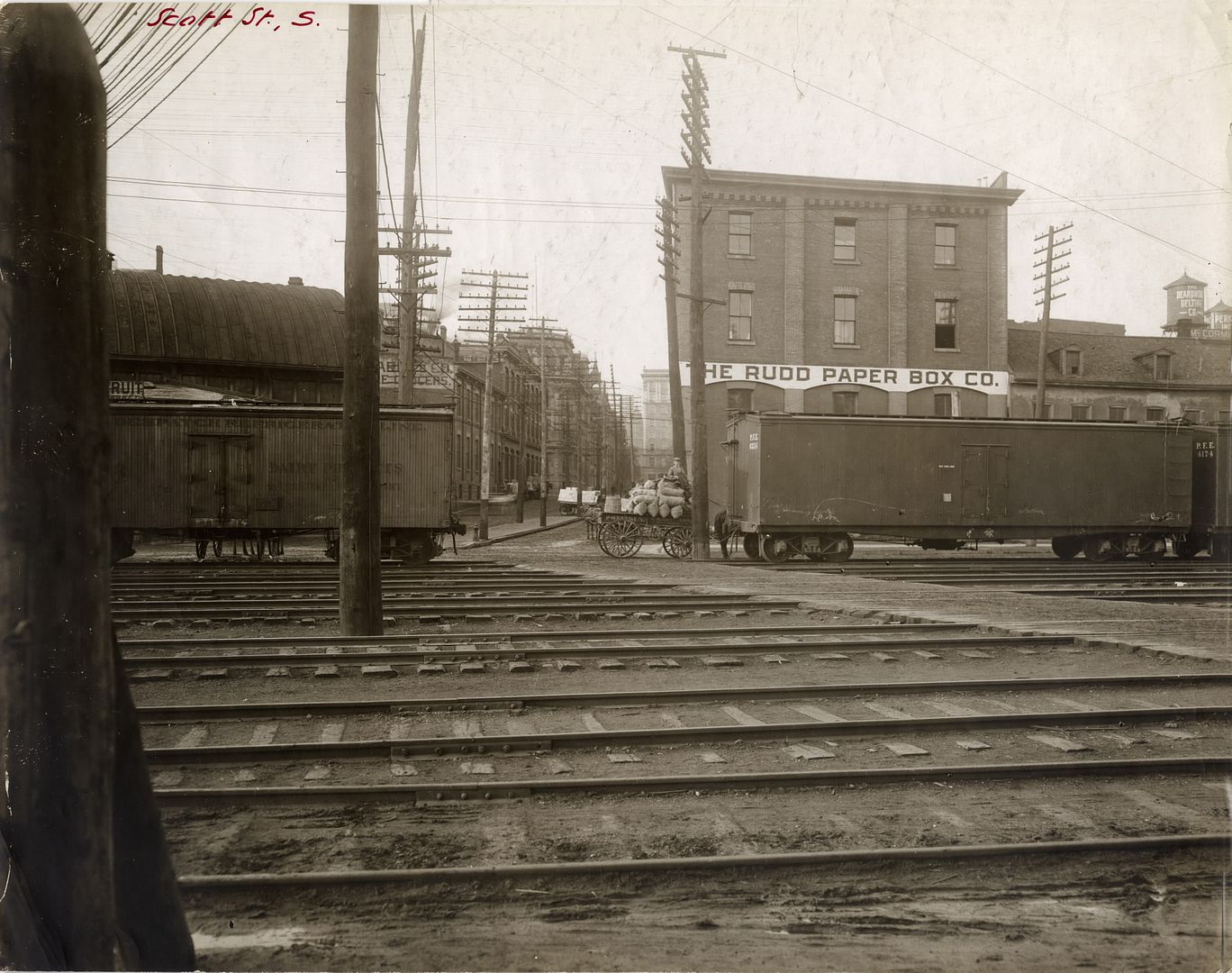
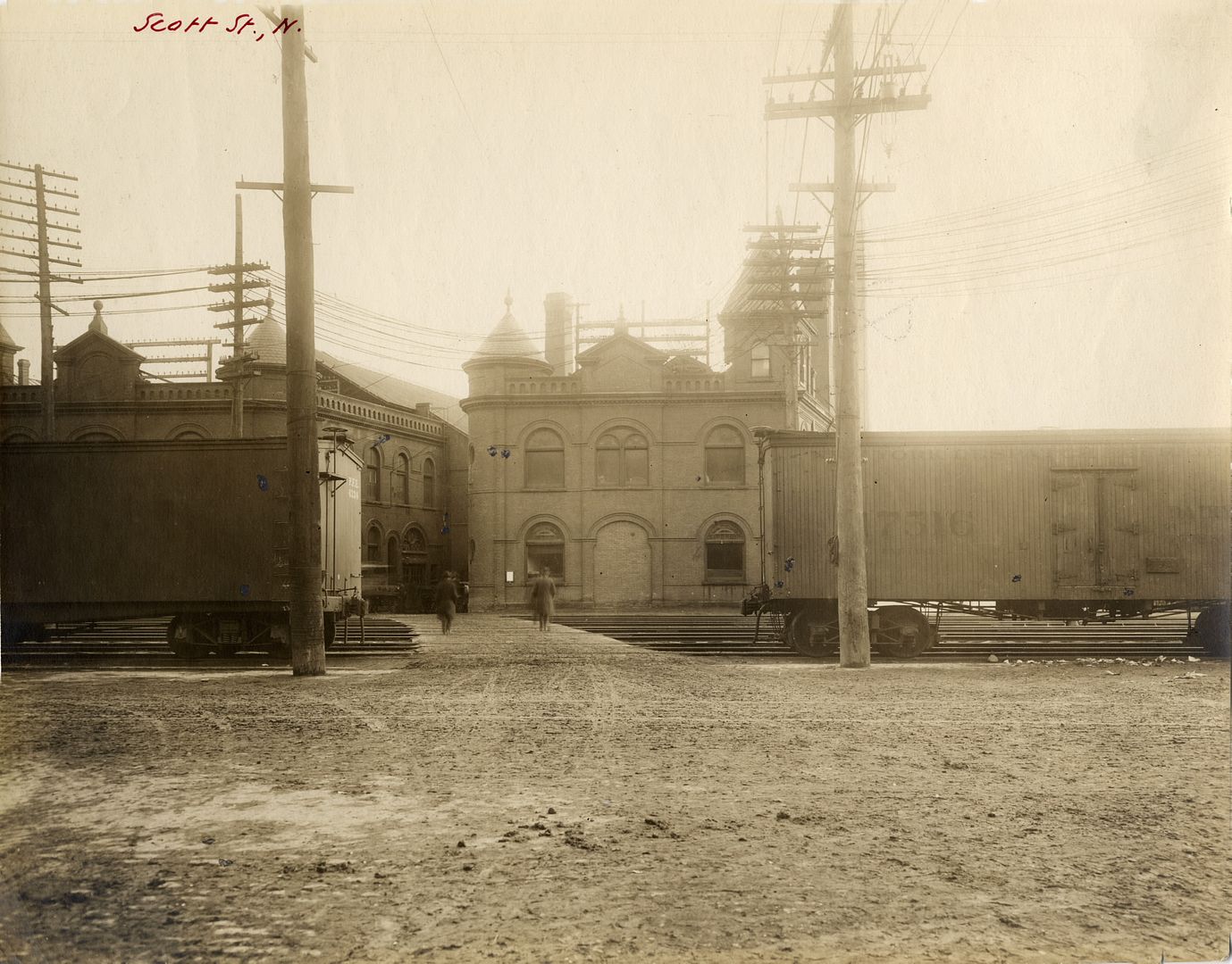
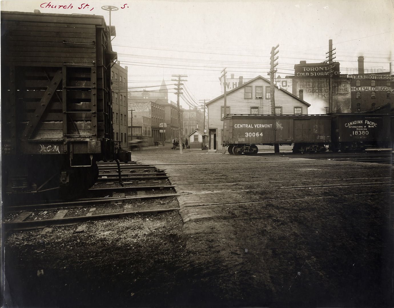
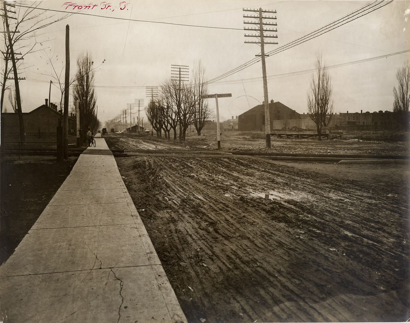
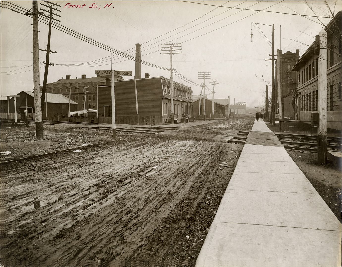
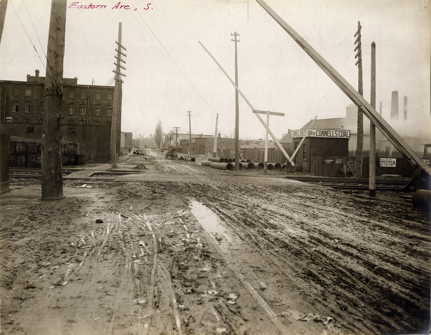
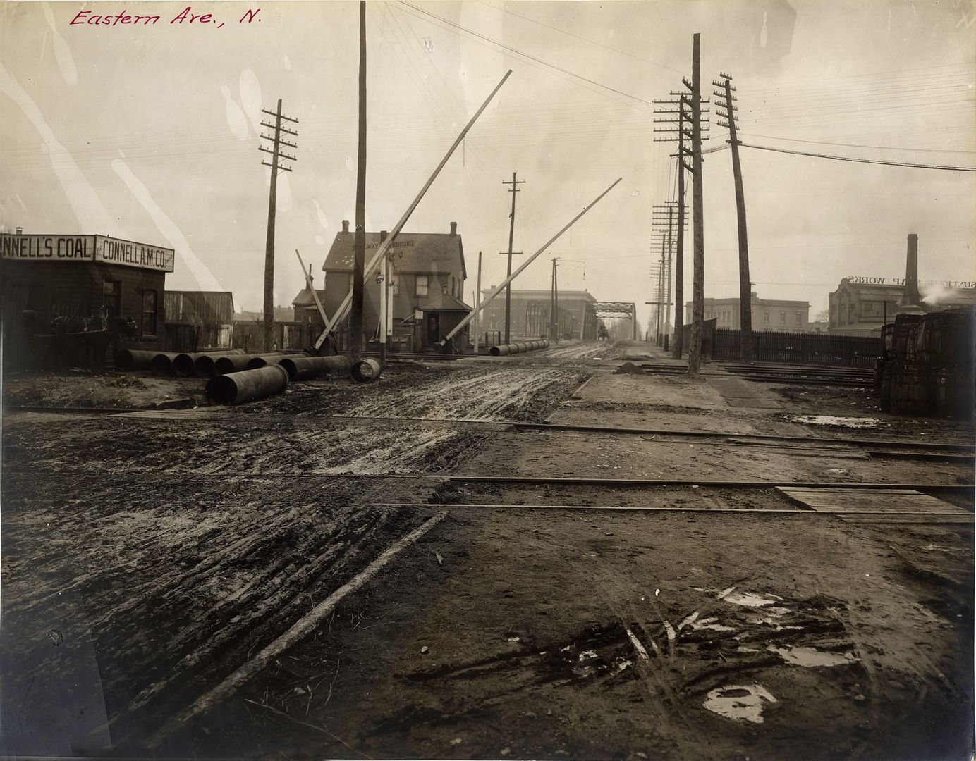
However, before that transformation (which occurred decades later), an extraordinary series of photographs were produced which documented The Esplanade in 1907, block by block (views north and south), east of Yonge, including views along Mill Street, Water Street and Eastern Avenue. The complete set is in the Toronto Public Library.
At Scott:
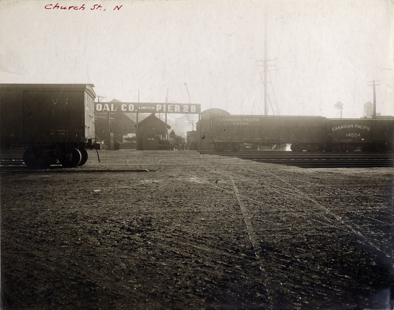
At Church:
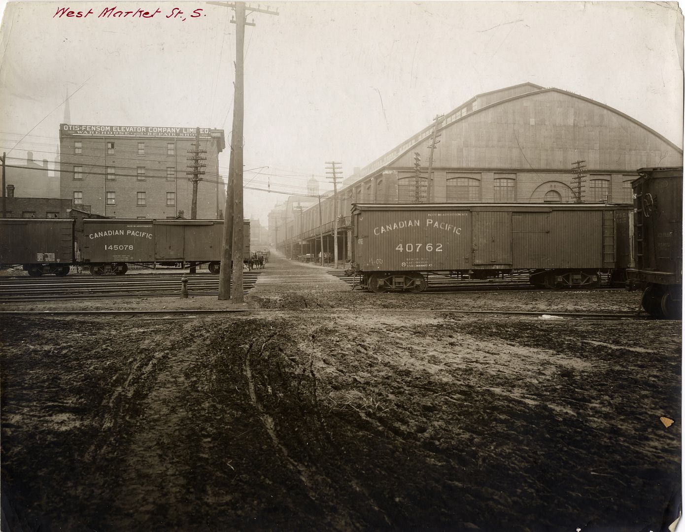
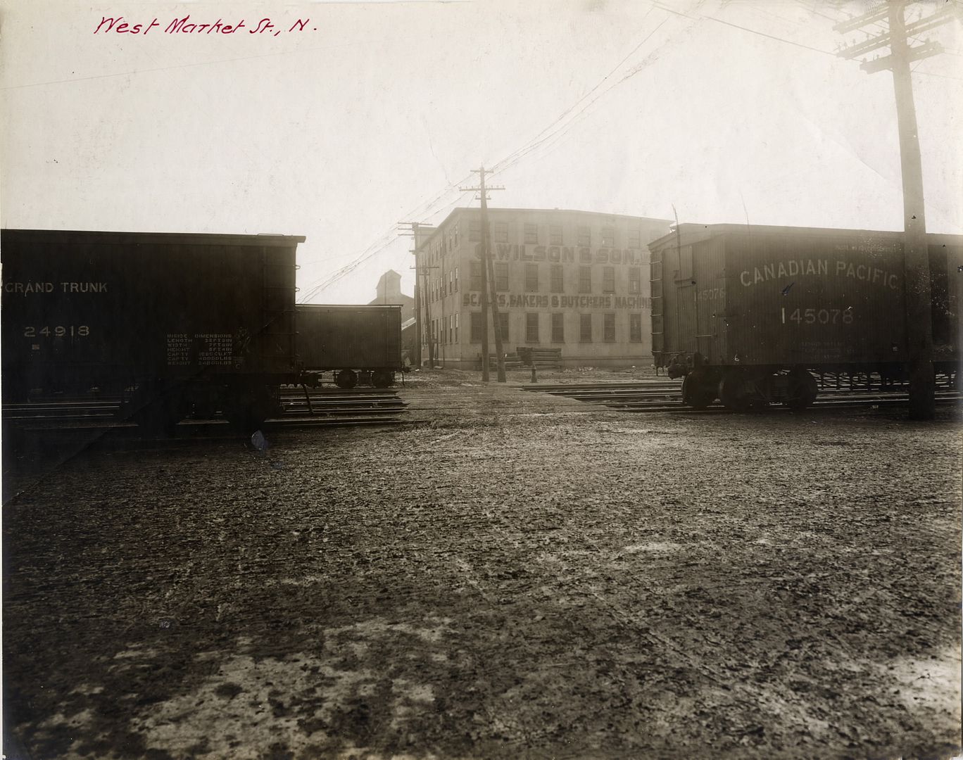
At Market:
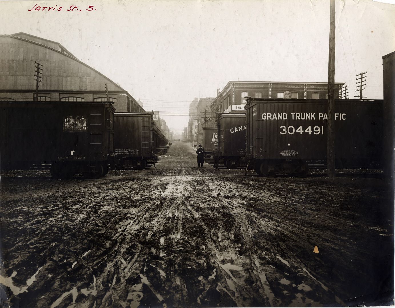
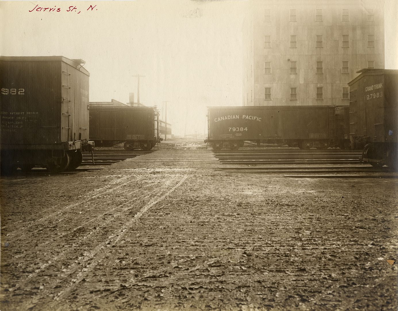
At Jarvis:
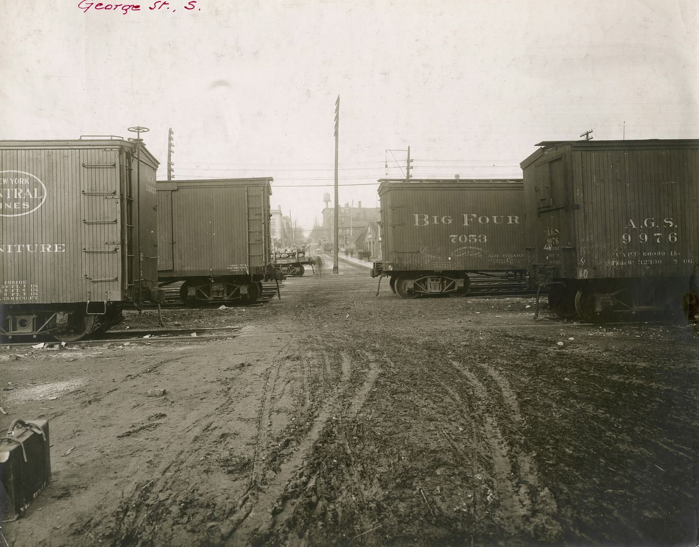
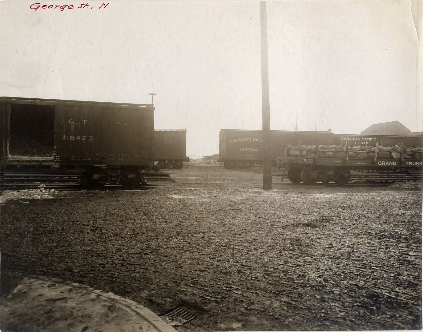
At George:
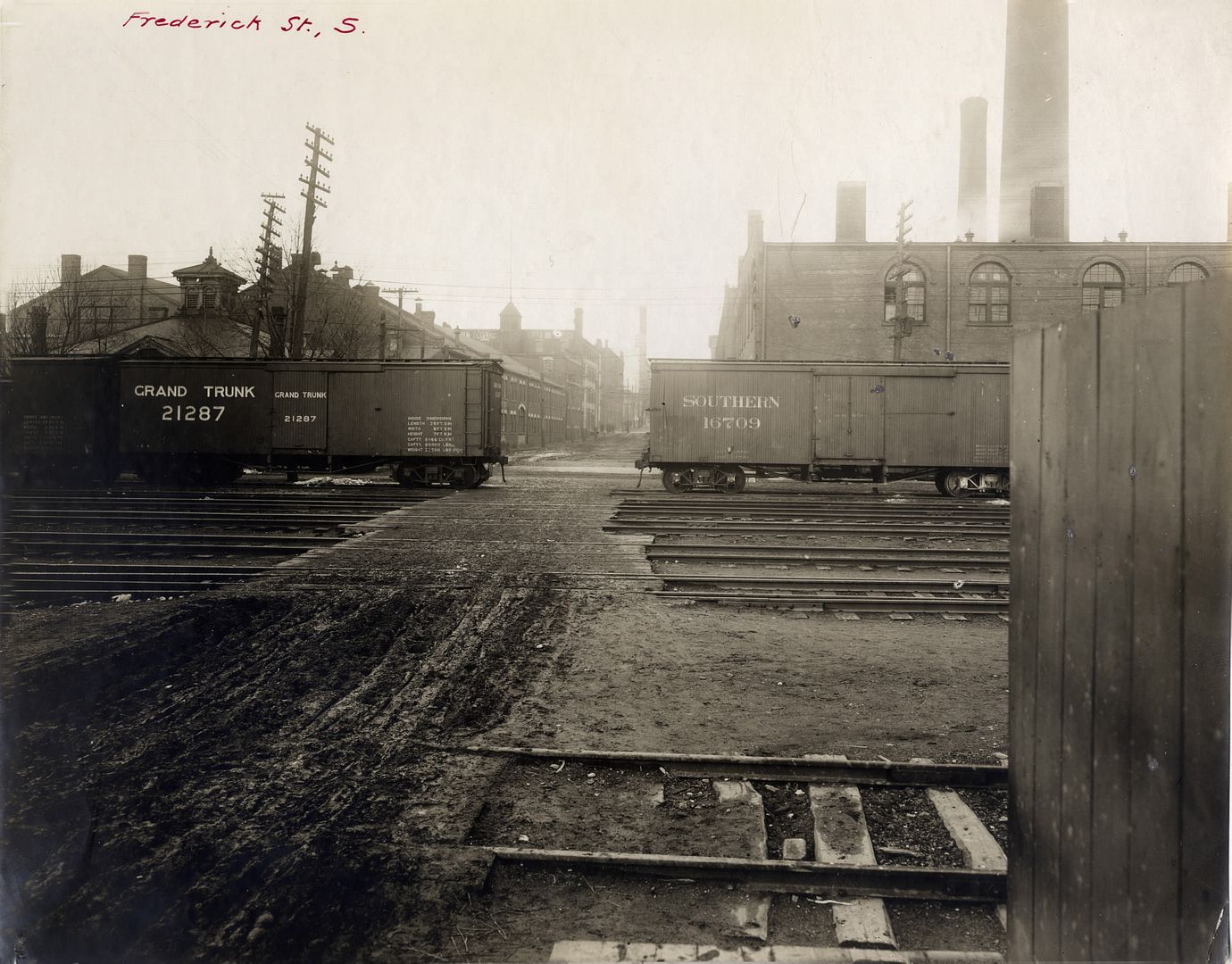
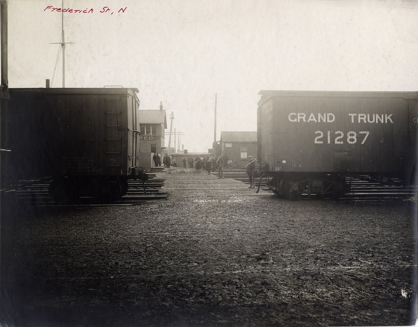
At Frederick:
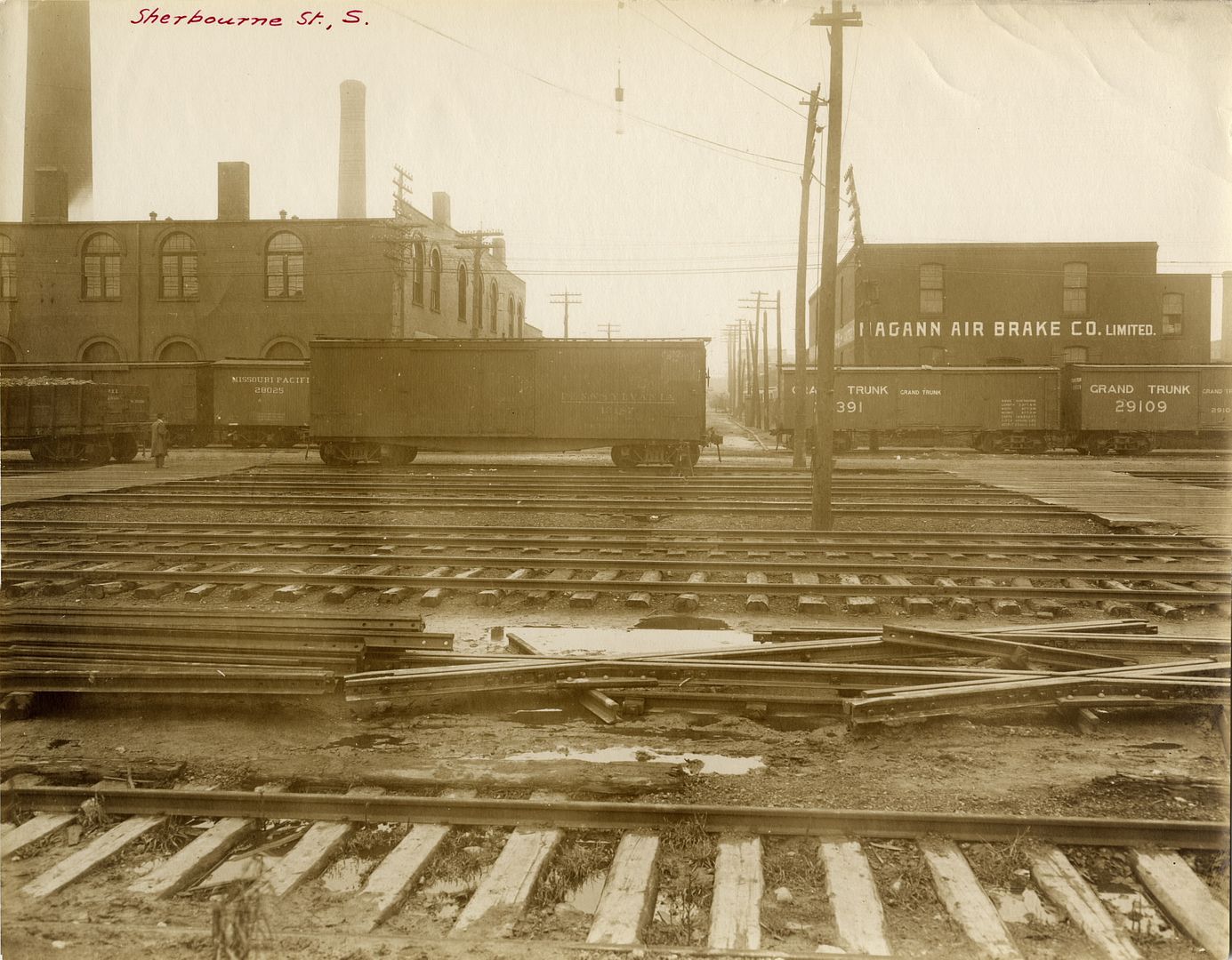
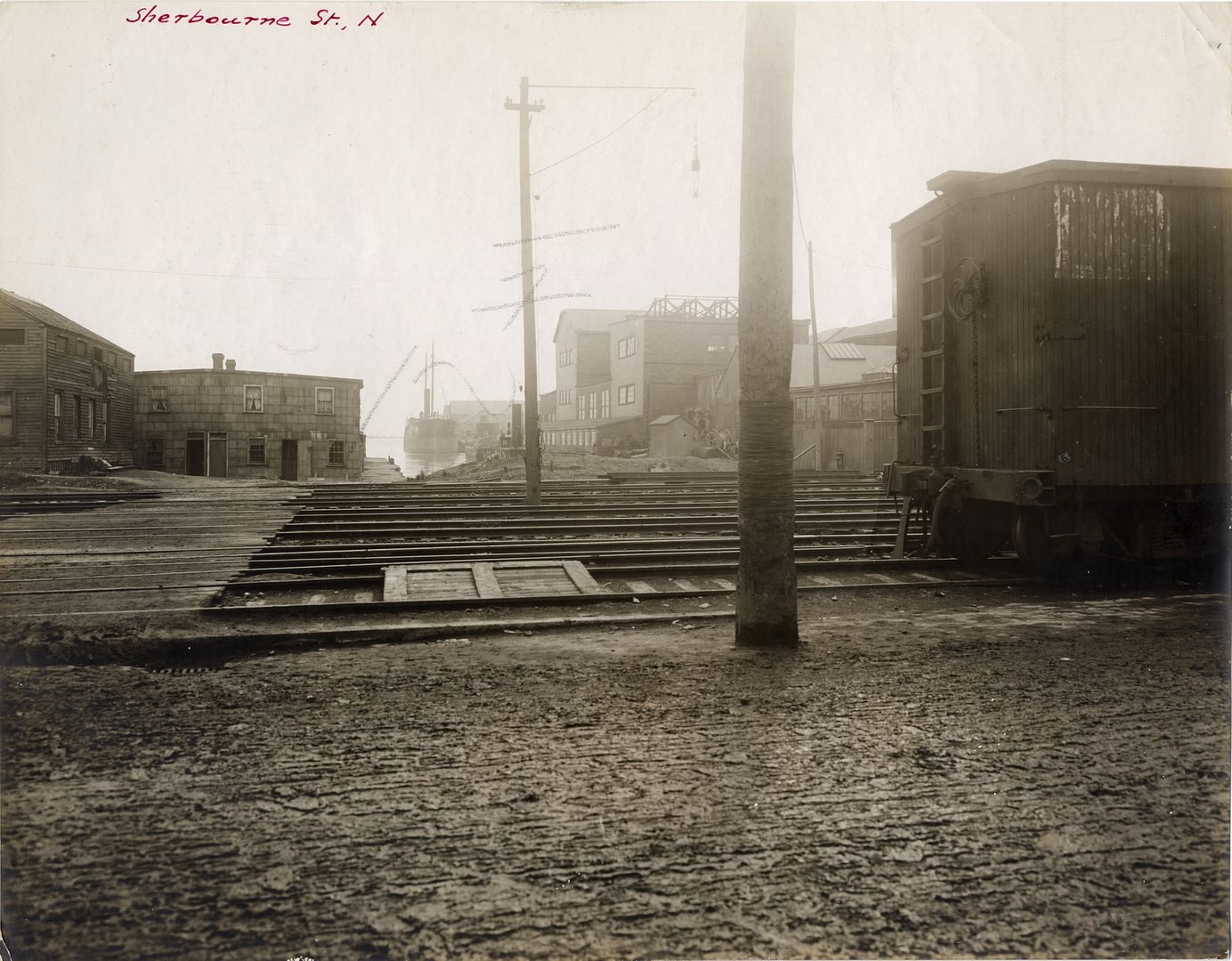
At Sherbourne:
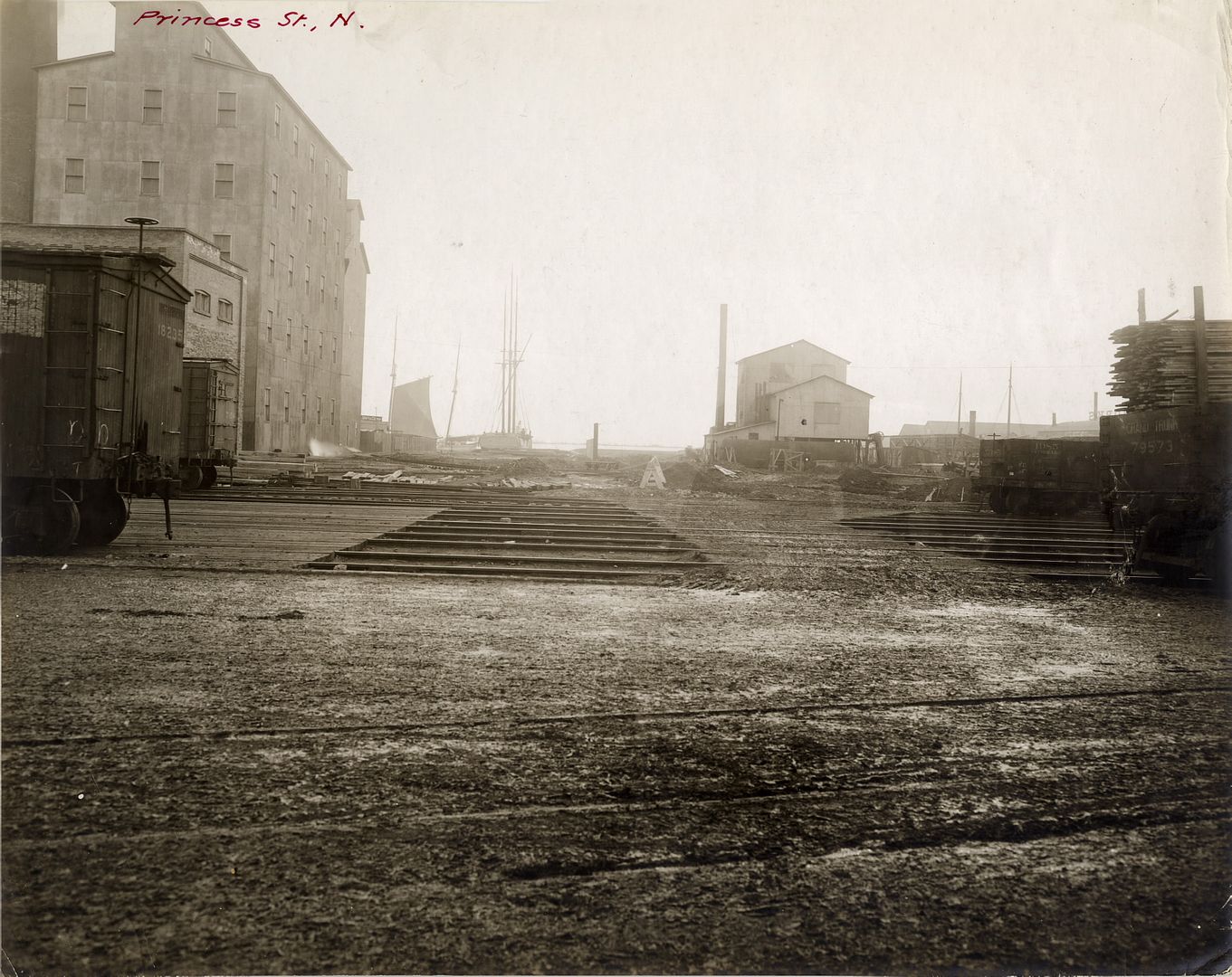
At Princess:

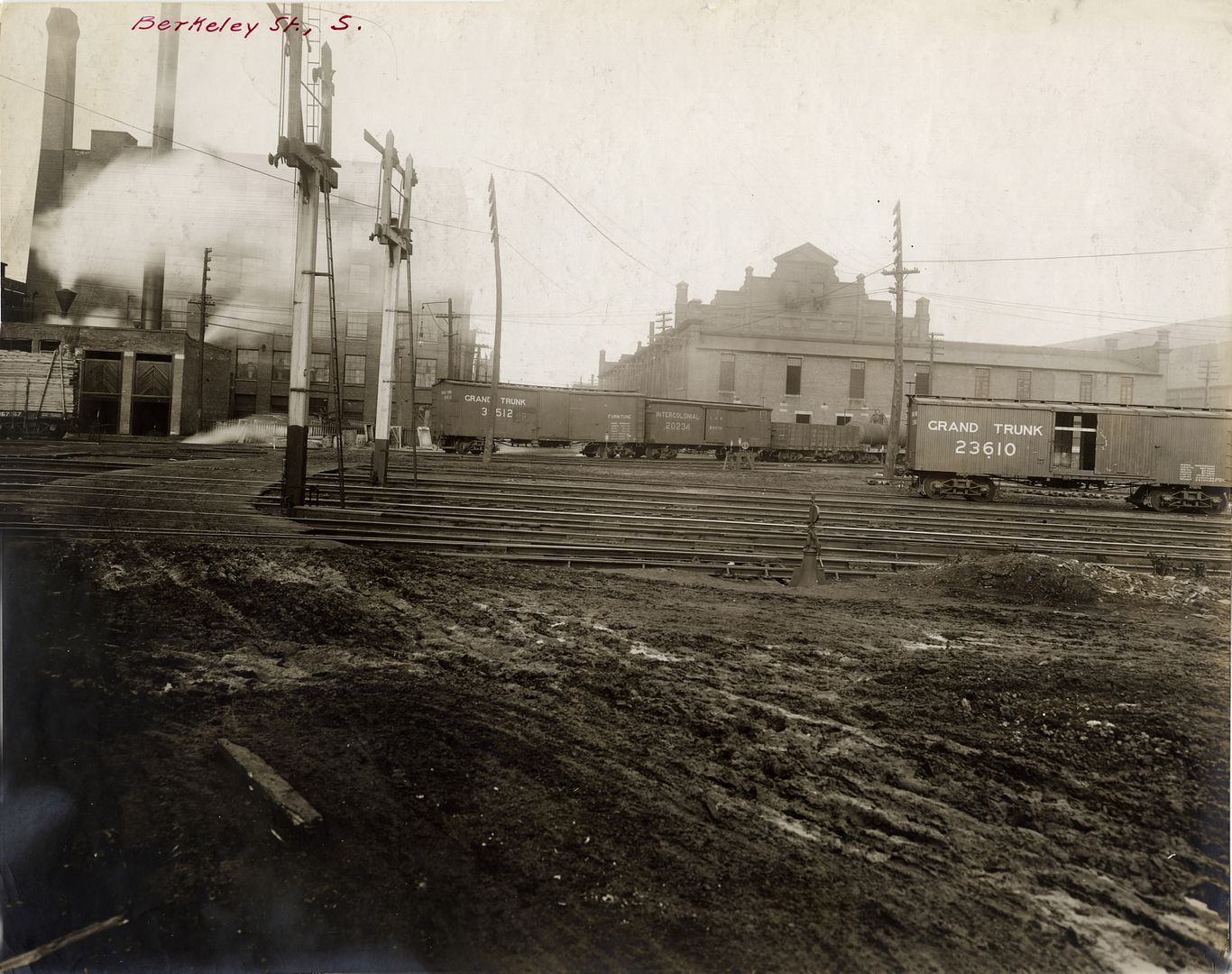
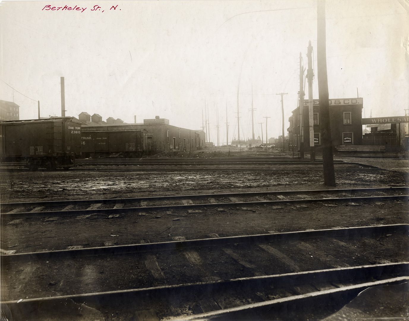
At Berkeley:
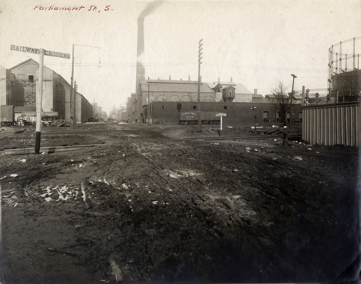
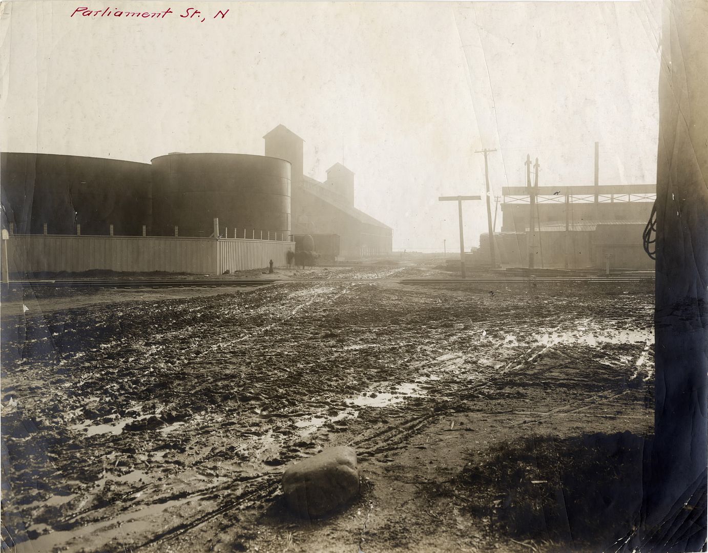
At Parliament & Mill:
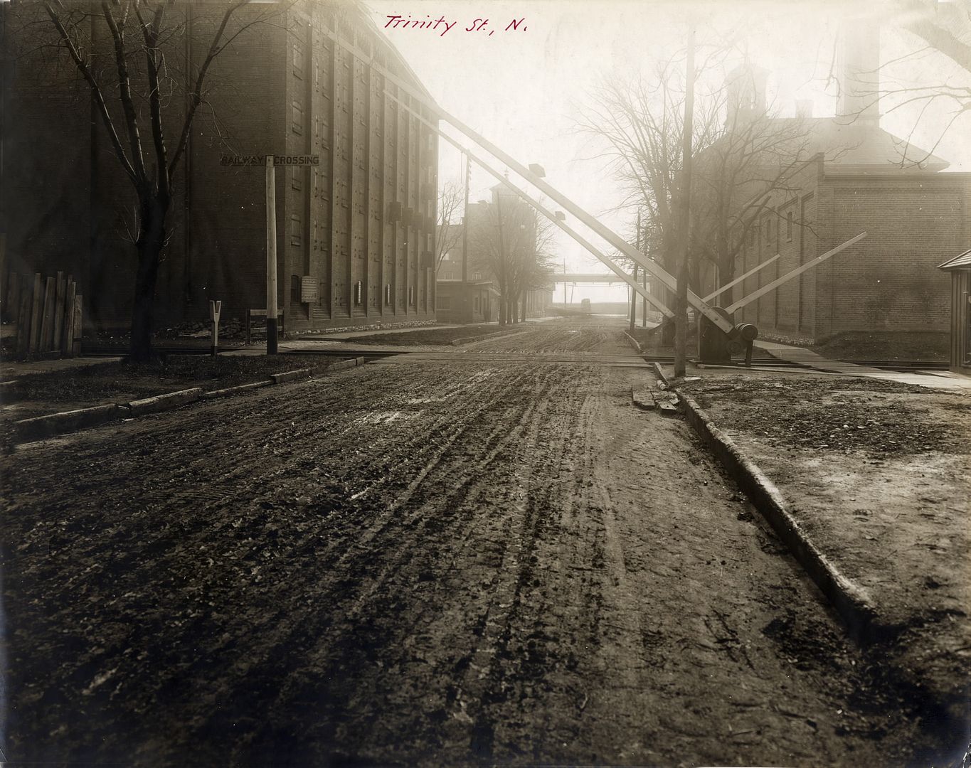
At Trinity:
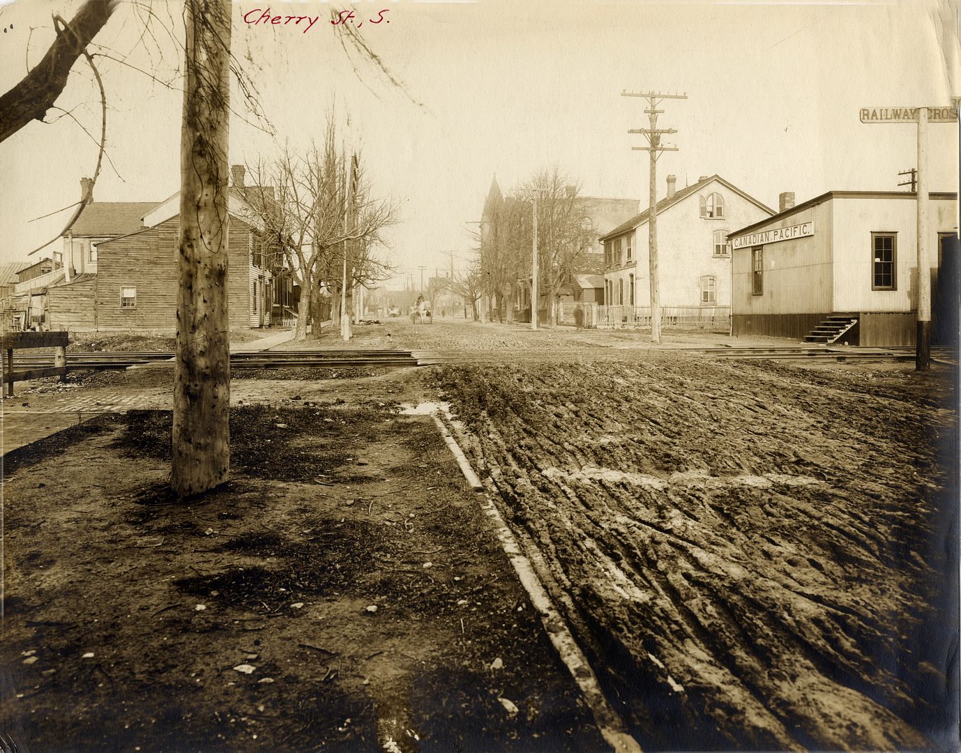
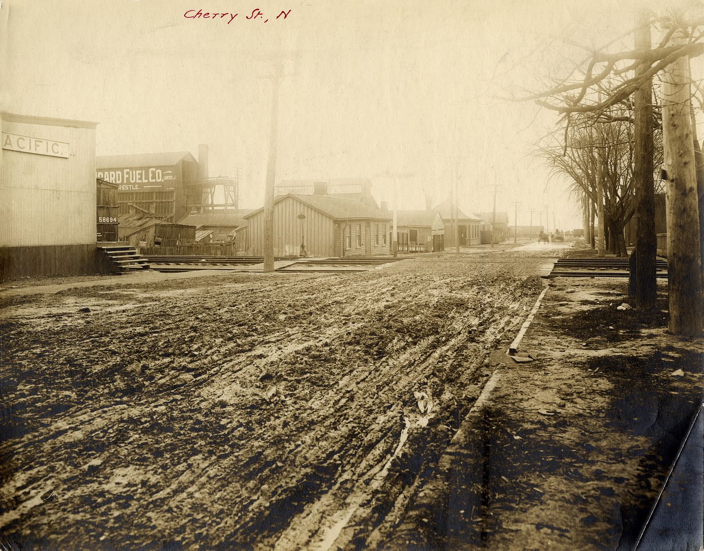
At Cherry:
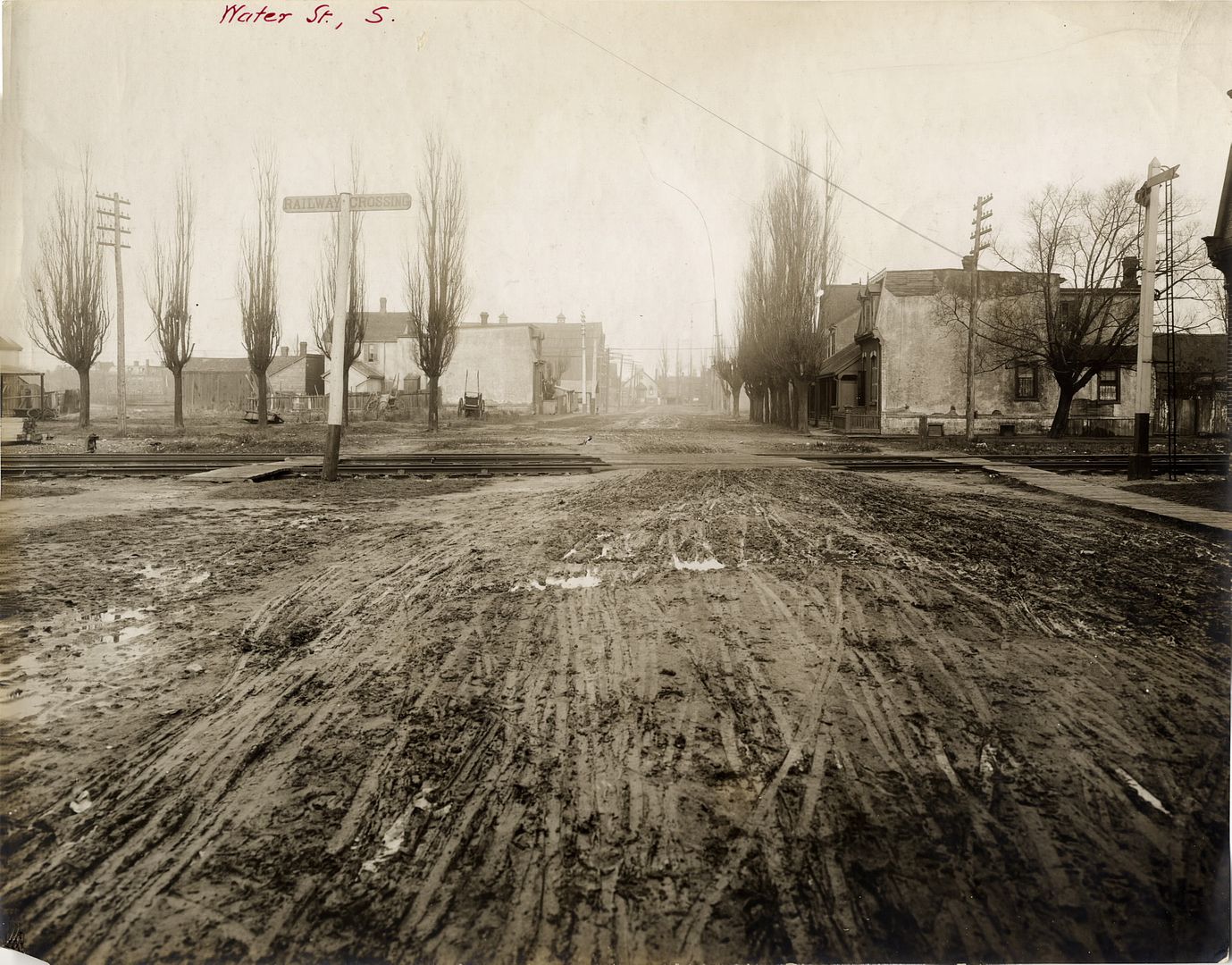
At Water Street:
At Front Street East and Cypress:
At Eastern Avenue:
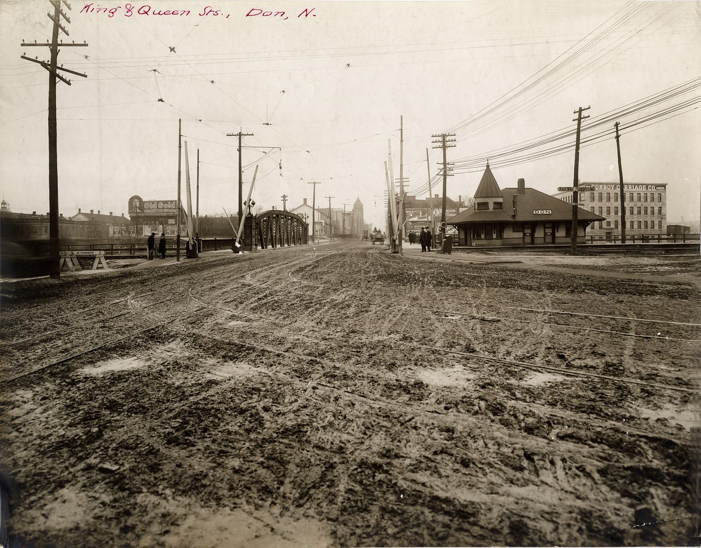
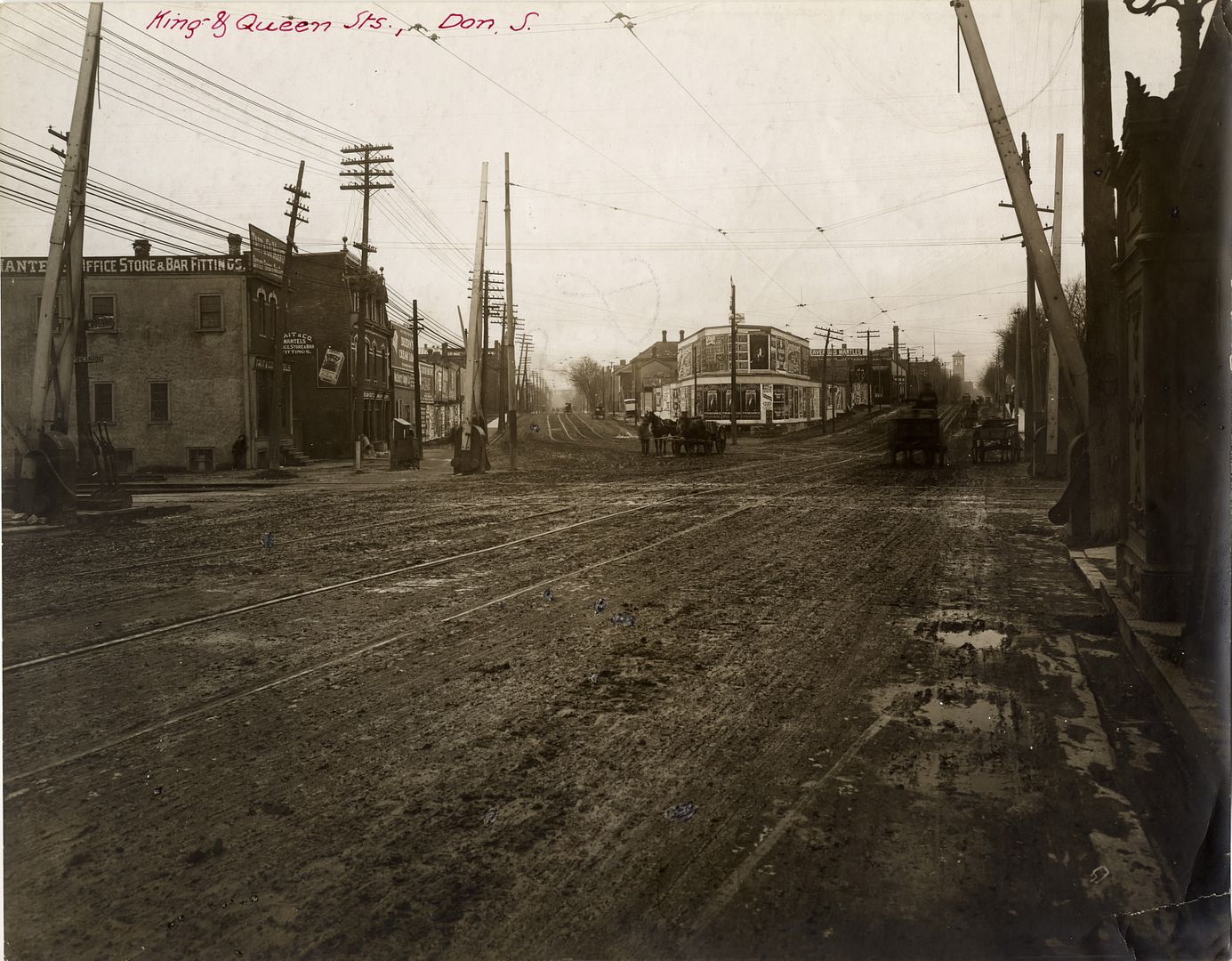
At the Don:
/ˈespləˌnäd,-ˌnād/
noun
a long, open, level area, typically beside the sea, along which people may walk for pleasure.
As we all know, Toronto's Esplanade did not quite turn out as originally envisioned. The 1852 Plan by John Howard described the area south of Front Street as "A design for laying out the north shore of the Toronto Harbour in pleasure drives walks and shrubbery for the recreation of the citizens."

That plan was doomed by the arrival of the railways, as can be seen in this 1884 map:

By 1903, The Esplanade was essentially a railway corridor between Front Street and the Harbour:


in 1912, the Toronto Harbour Commission produced plans remarkably similar to the waterfront we know today:

However, before that transformation (which occurred decades later), an extraordinary series of photographs were produced which documented The Esplanade in 1907, block by block (views north and south), east of Yonge, including views along Mill Street, Water Street and Eastern Avenue. The complete set is in the Toronto Public Library.
At Scott:


At Church:


At Market:


At Jarvis:


At George:


At Frederick:


At Sherbourne:


At Princess:


At Berkeley:


At Parliament & Mill:


At Trinity:

At Cherry:


At Water Street:

At Front Street East and Cypress:


At Eastern Avenue:


At the Don:


Last edited: