DSC
Superstar
Member Bio
- Joined
- Jan 13, 2008
- Messages
- 18,596
- Reaction score
- 25,277
- Location
- St Lawrence Market Area
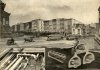
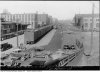
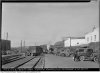
If I am reading it right, it is interesting that they were planning a link through the new viaduct at Church Street. Something that is again in the cards with the Lower Yonge Precinct plan - coming to TEYCC on August 12.


") )
)