


thecharioteer
Senior Member
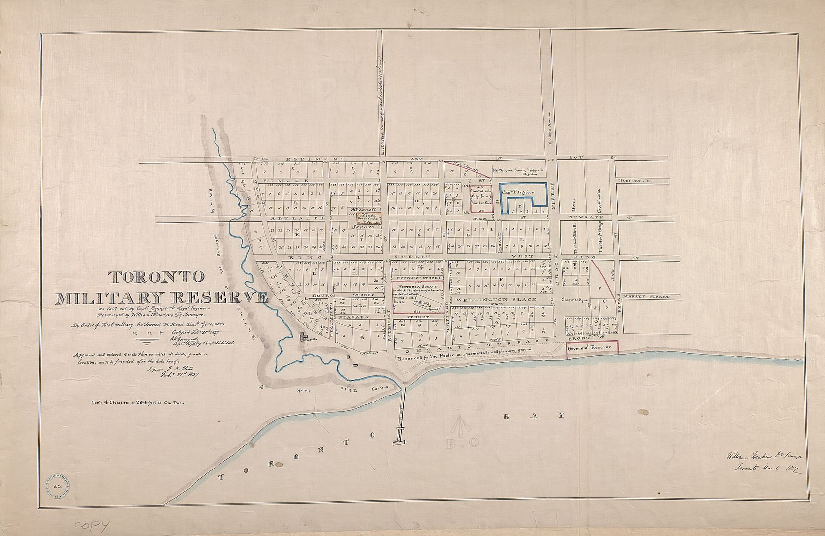
As many of you know, I love old maps, and we've all seen various editions of the Goad Fire Insurance Maps. The Toronto Public Library has recently revamped their website and have posted high-res versions of maps from their extensive collection.
Here are a few:
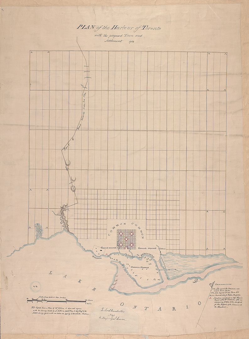
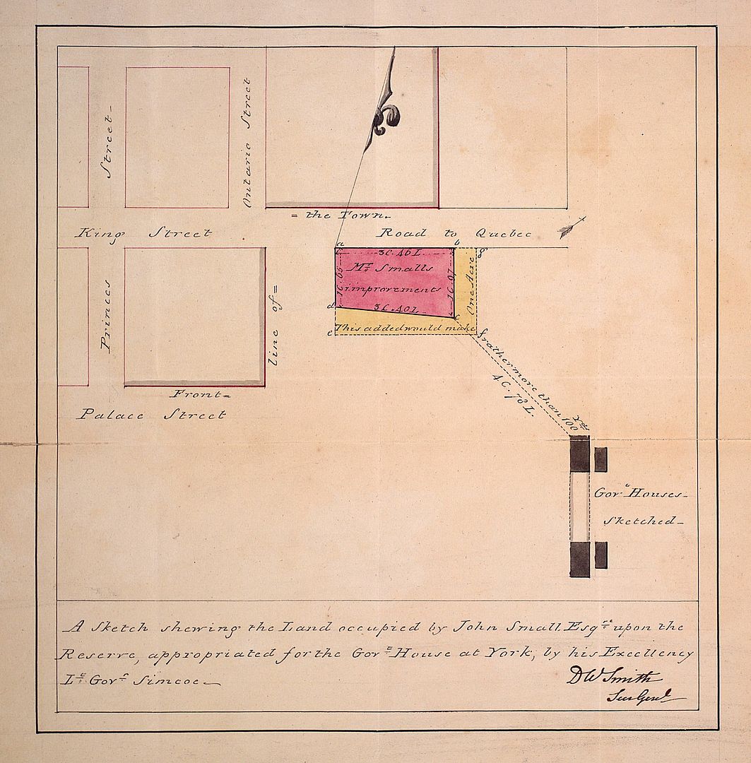
1792:
1797:
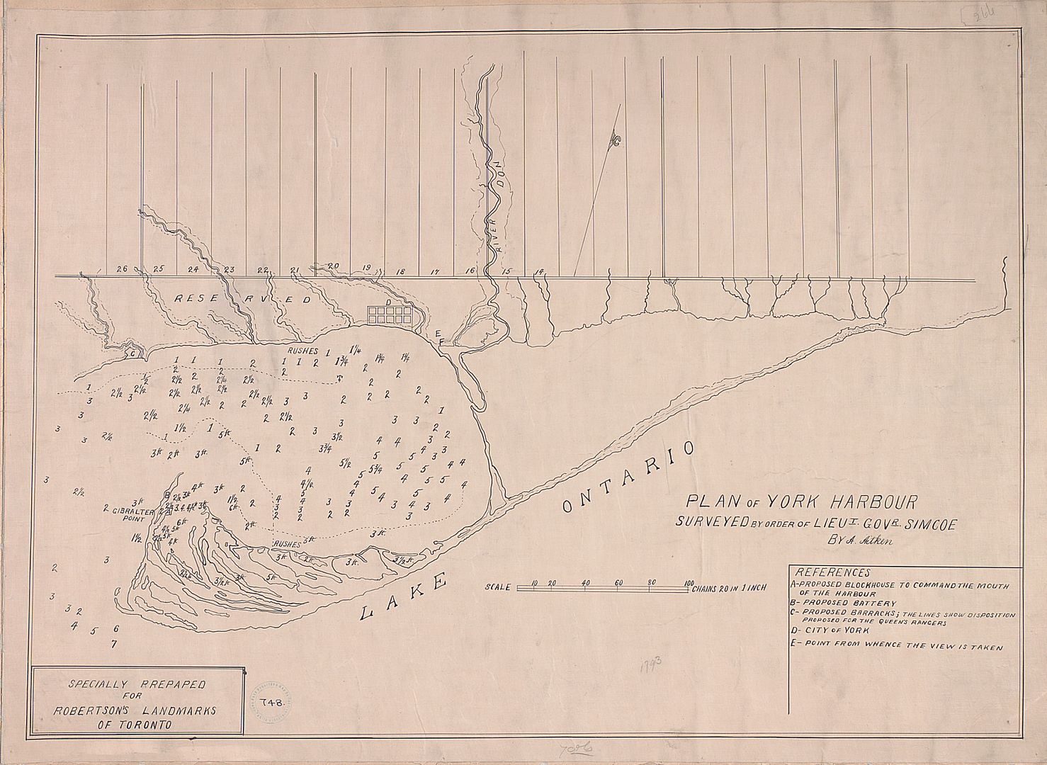
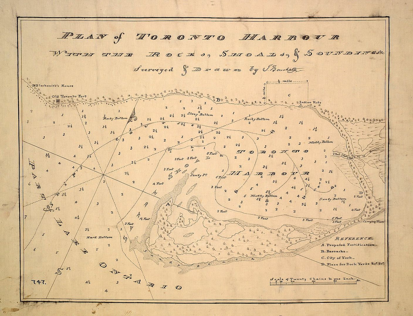
1802:
1802: An elegant survey of the property known as Berkeley House, now part of 333 King Street East:
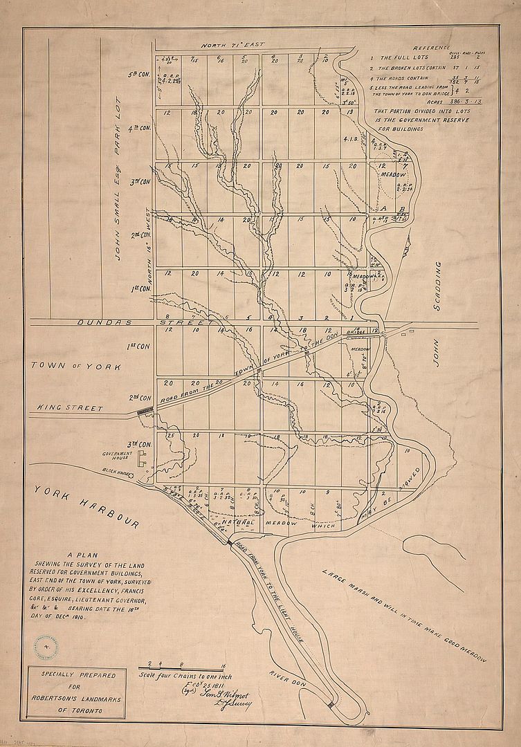
1810, the Don River:
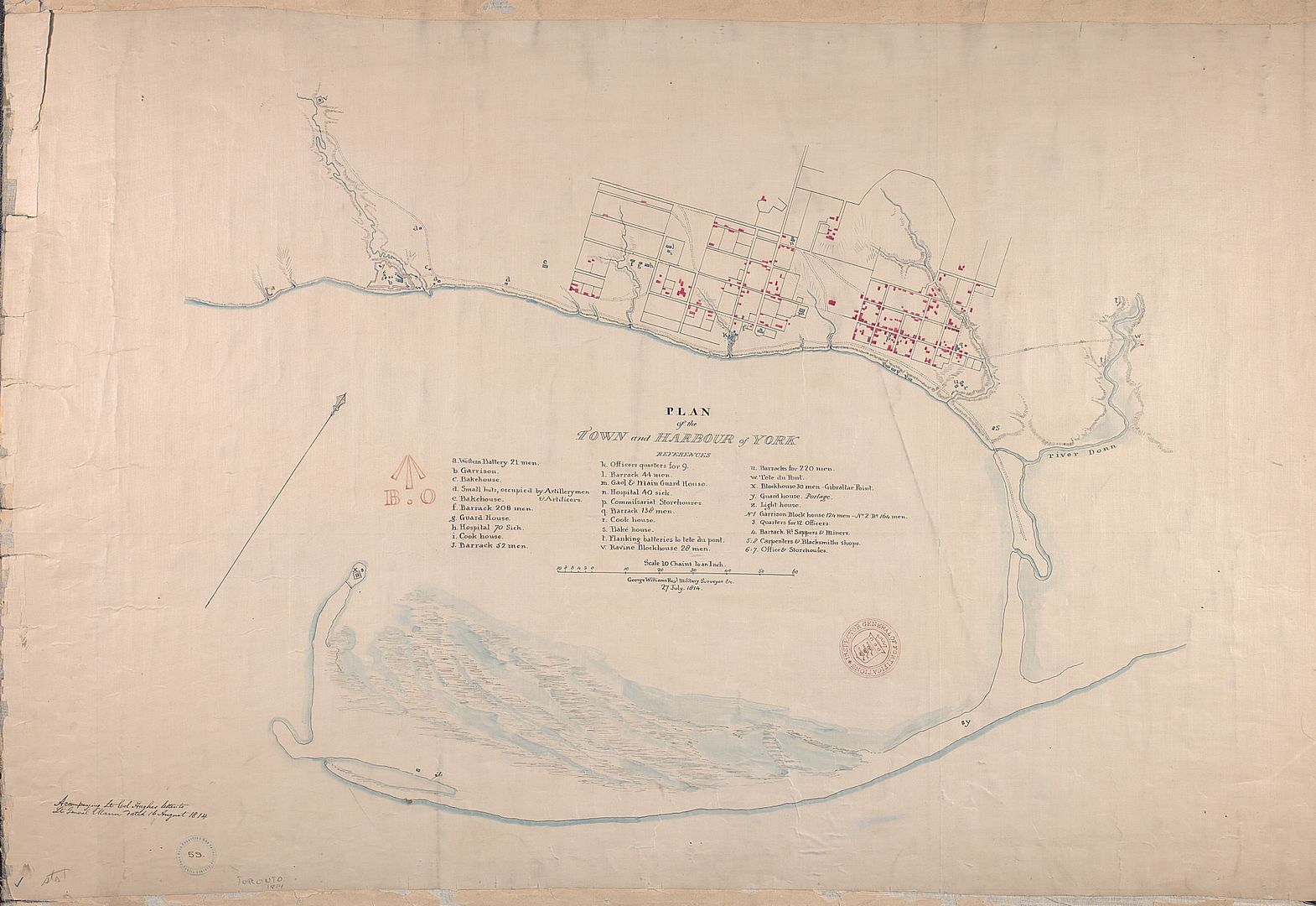
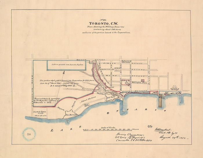
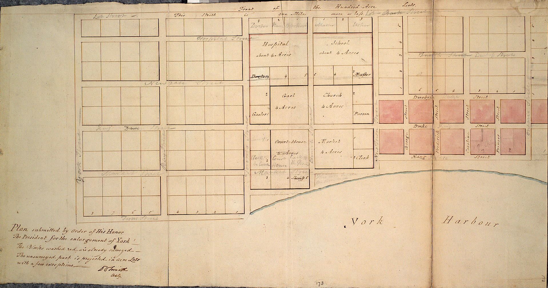
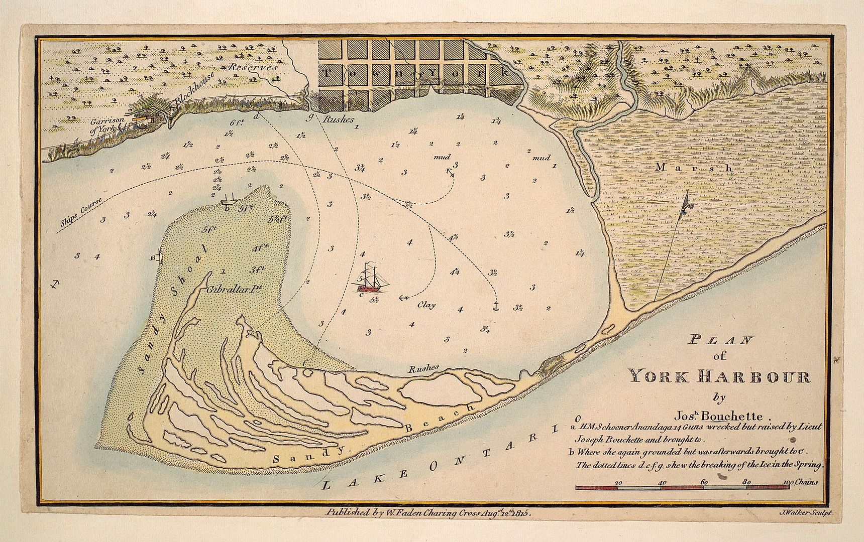
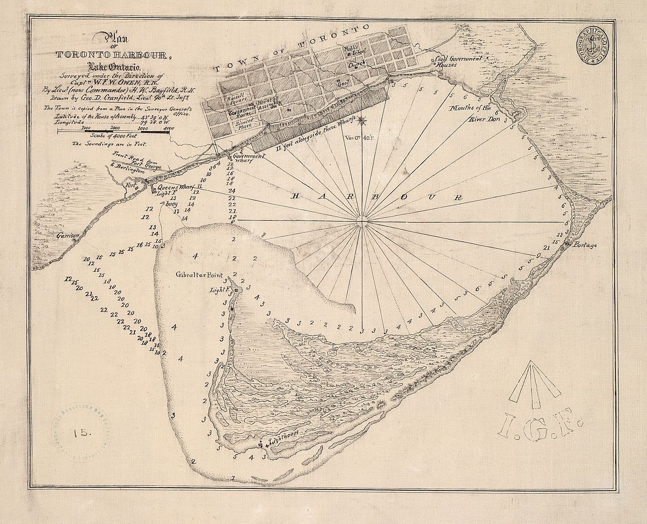
1815:
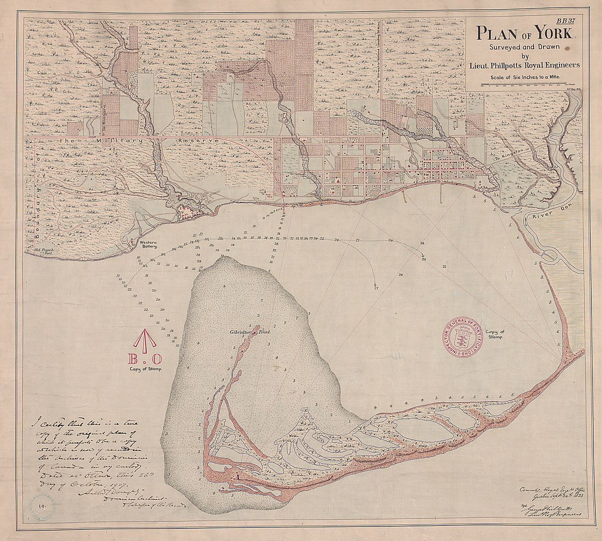
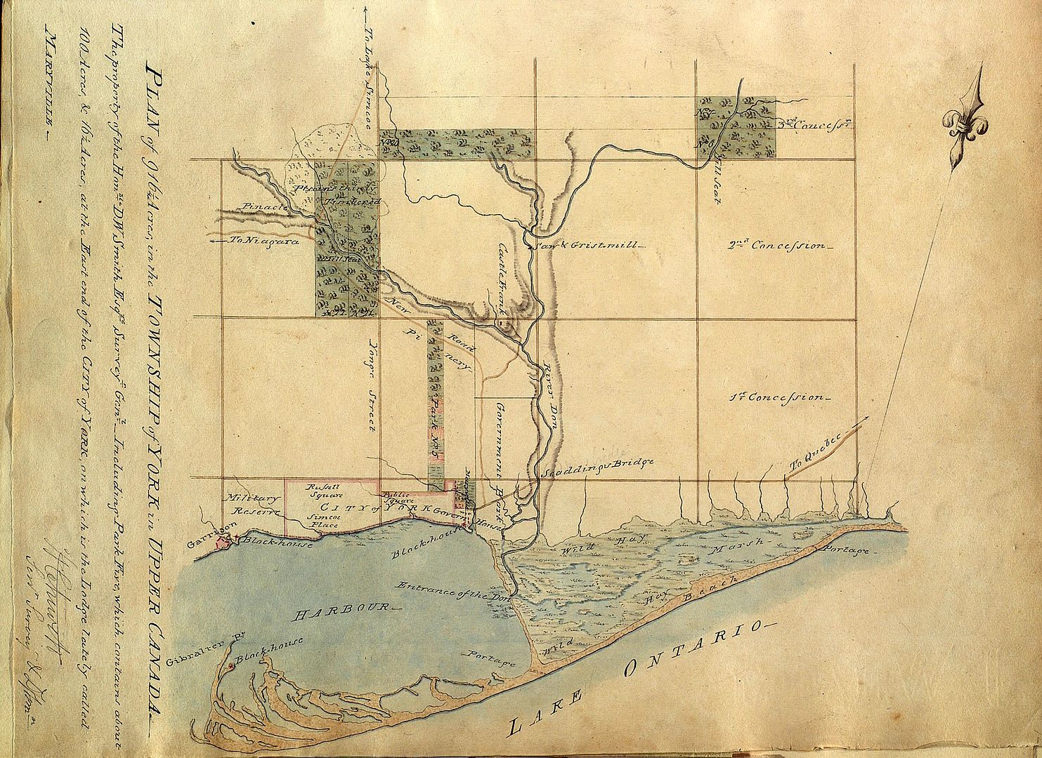
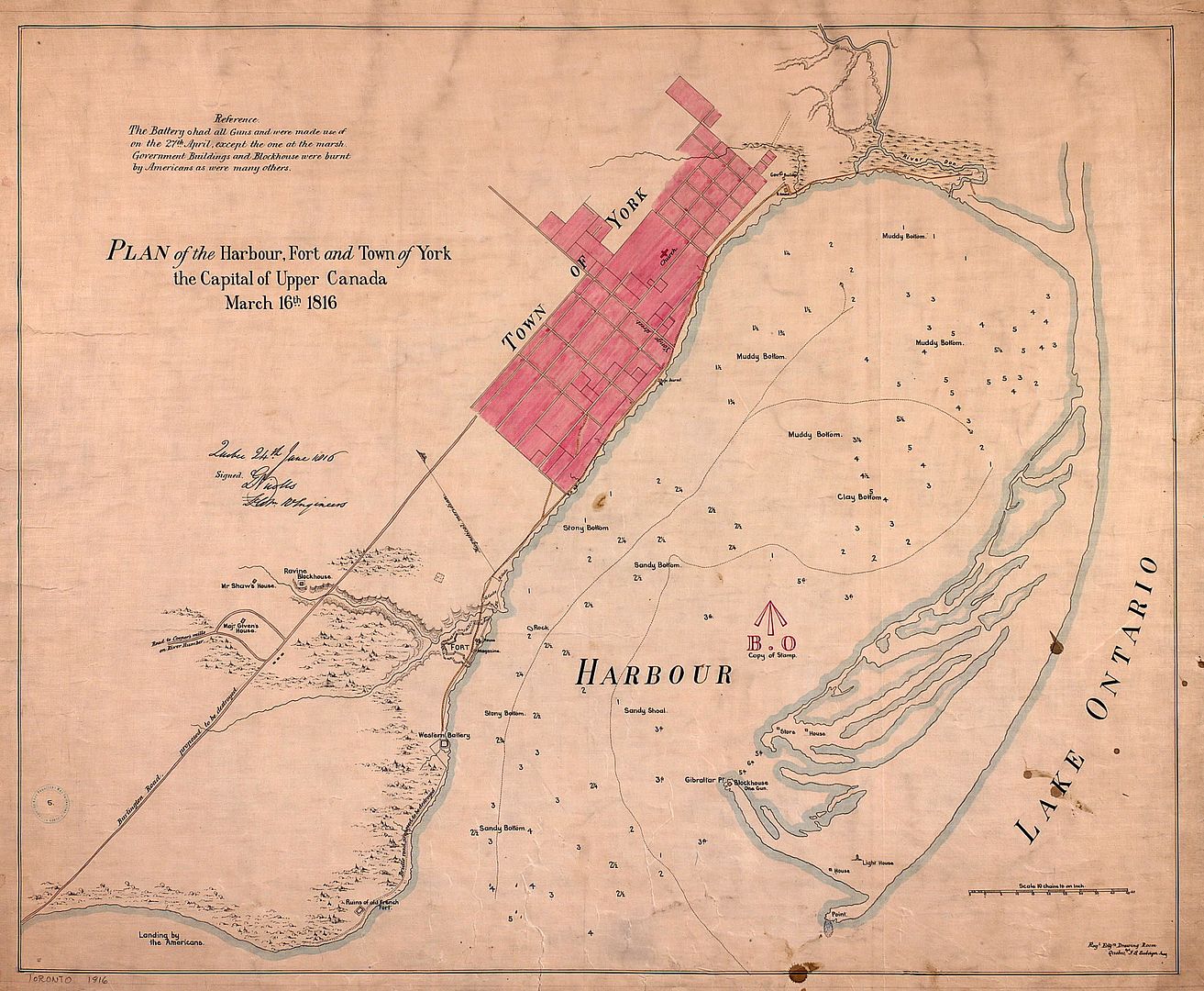
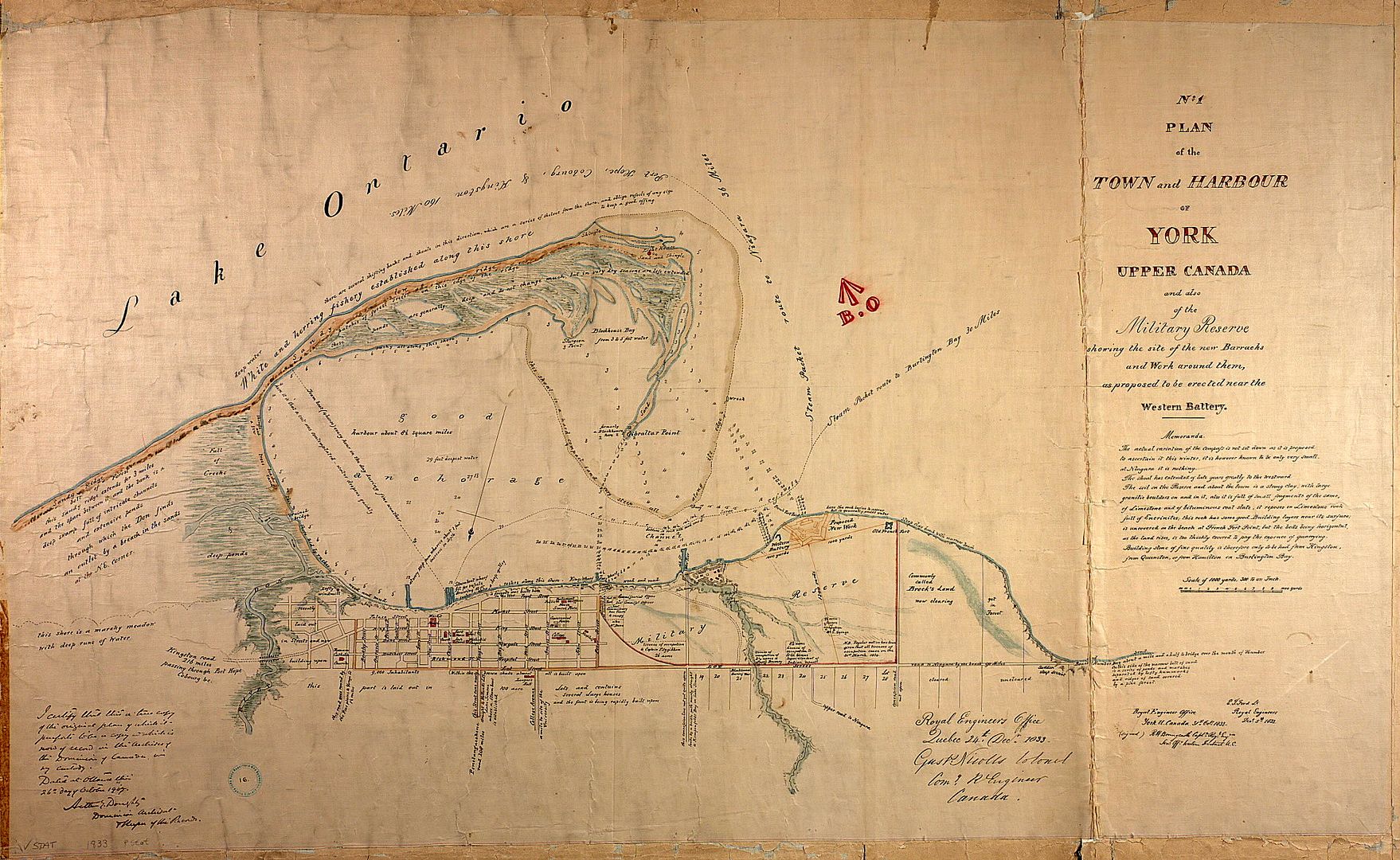
1816:
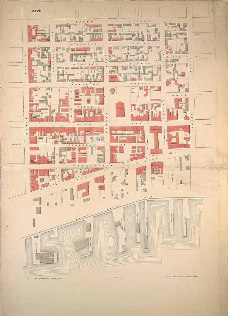
1833: A different way of looking at the City:
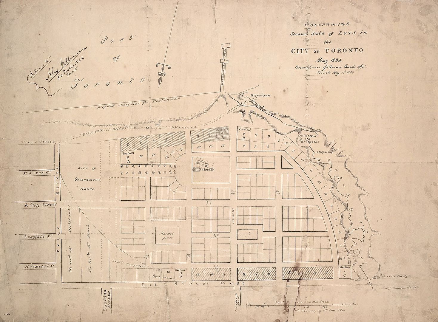
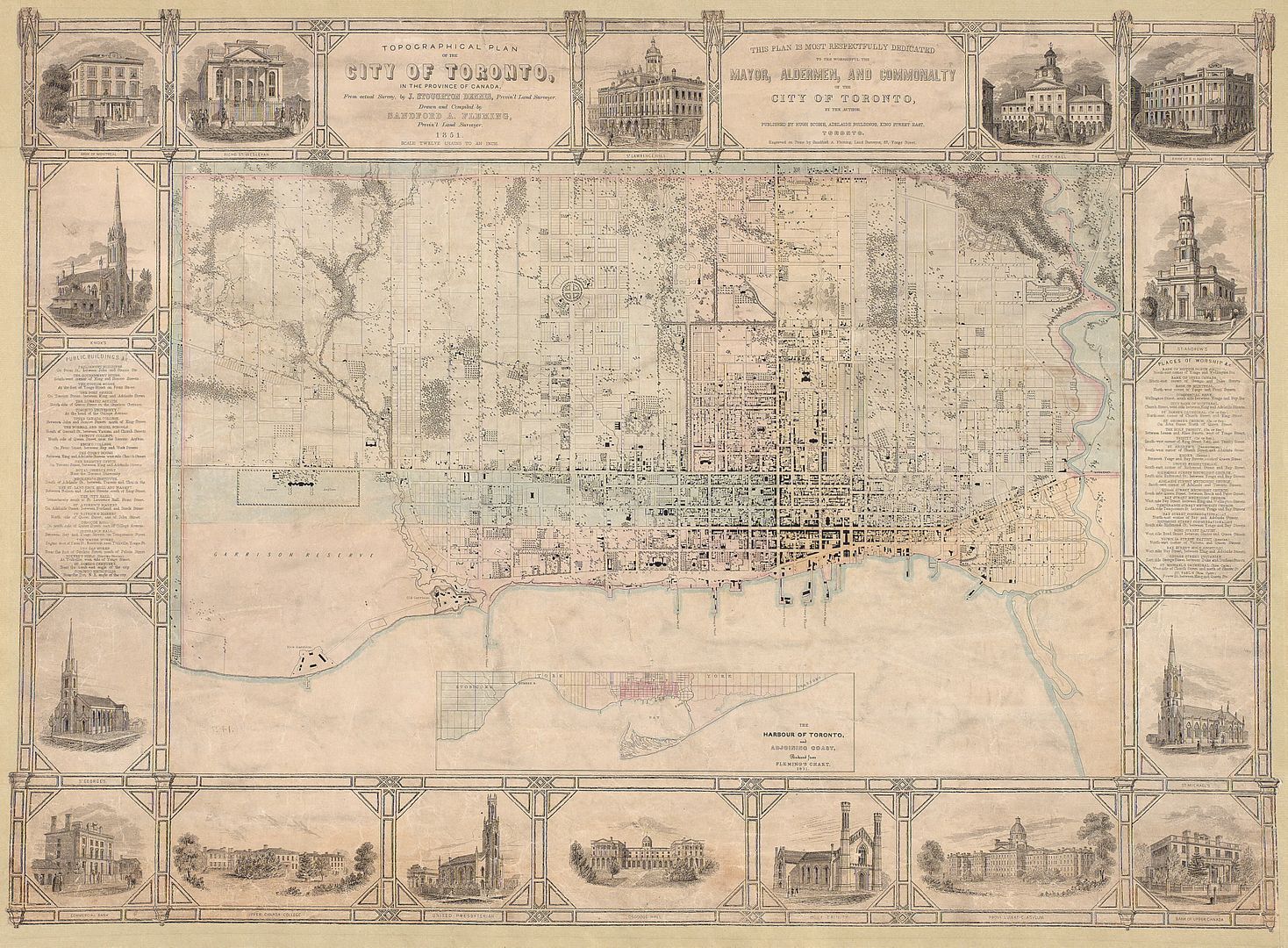
1848:
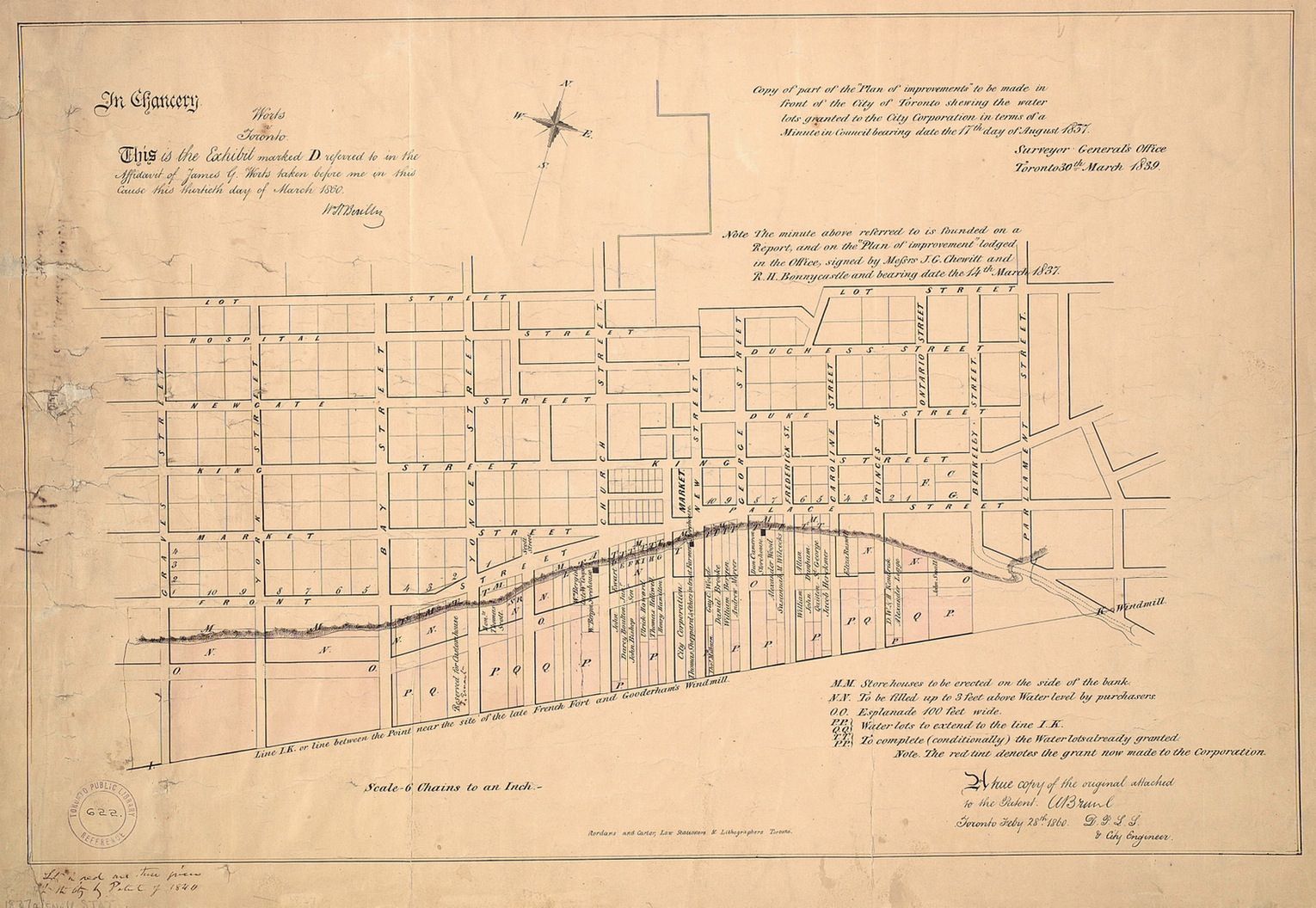
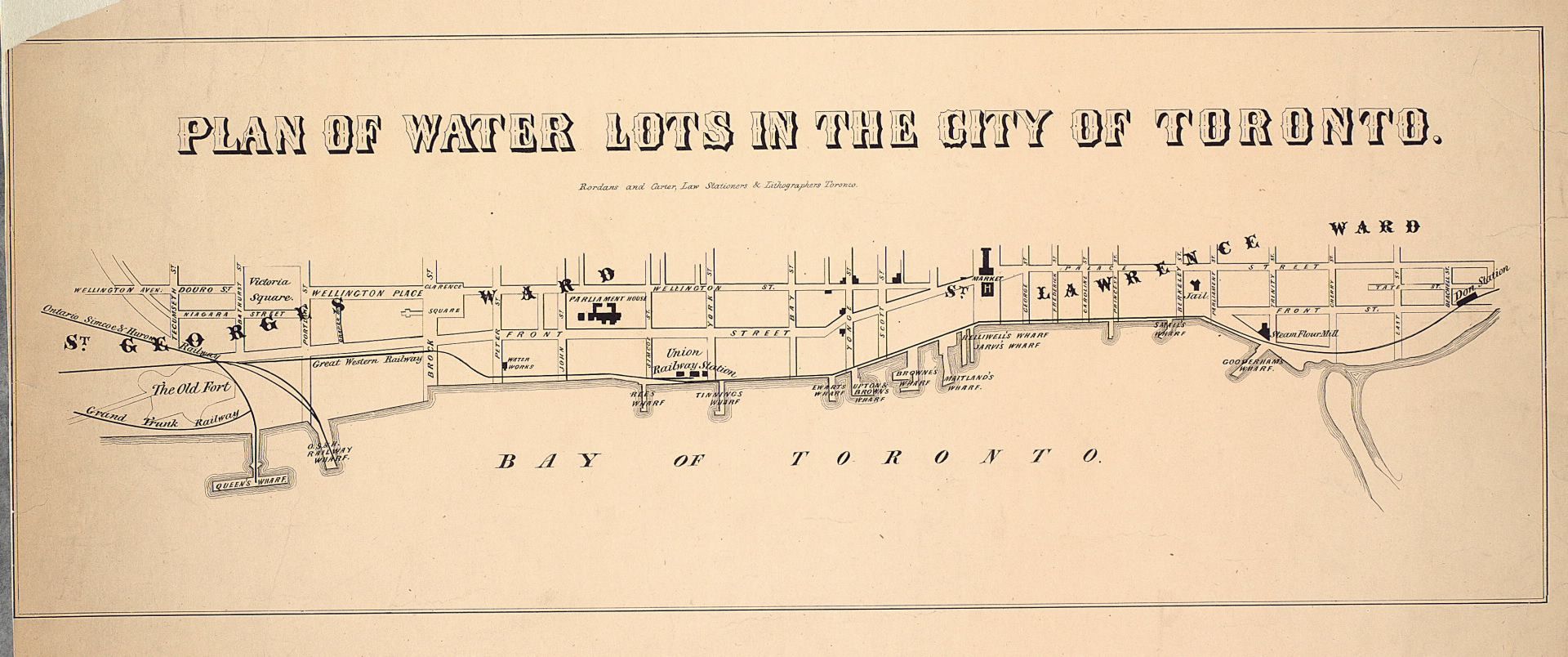
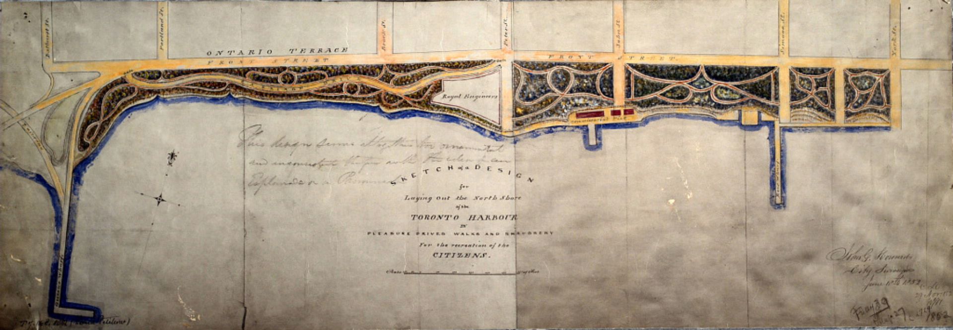
1852: Early version of Harbourfront:
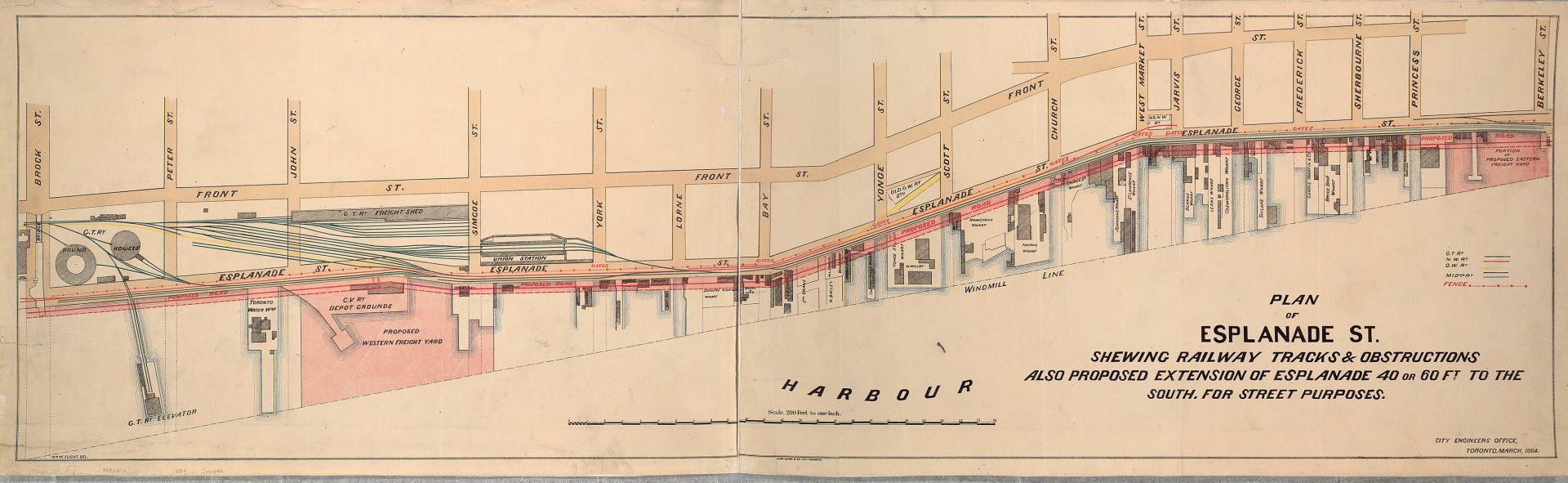
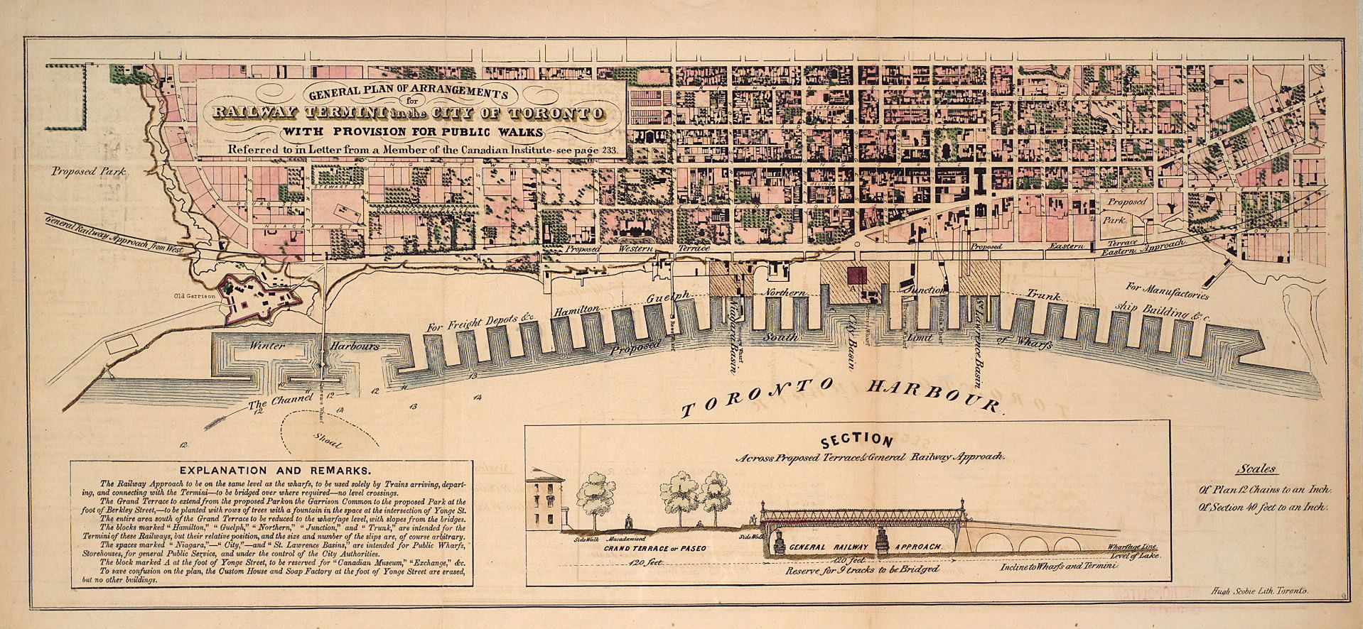
1853: Proposal for "undergrounding" the railroads:
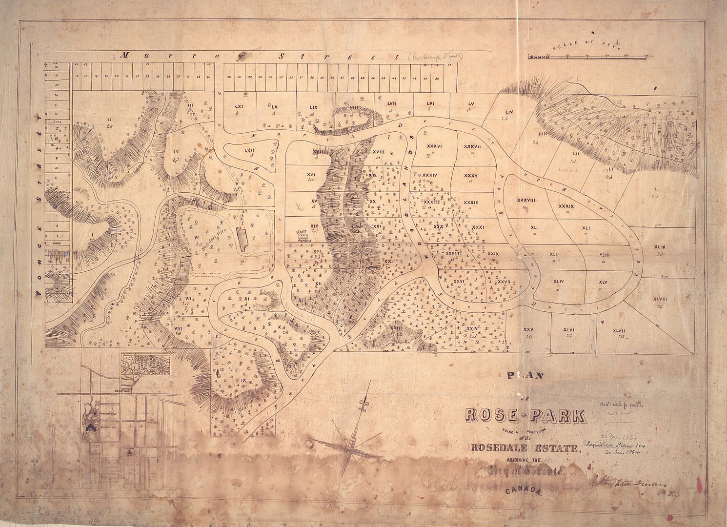
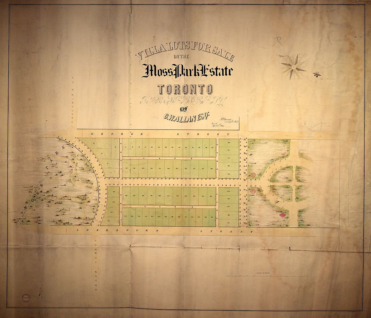
1854: Plan of subdivision for the Allan estate:
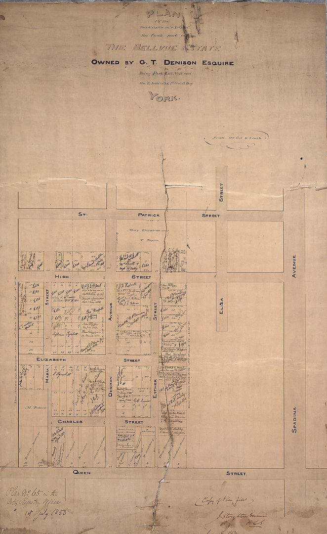
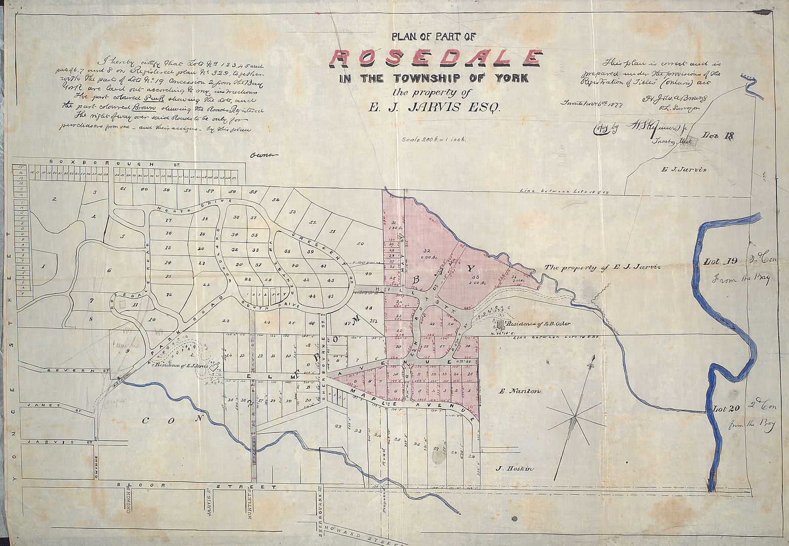
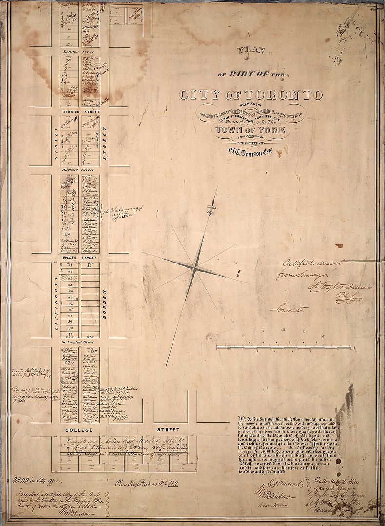
1855: Plan of subdivision for part of the Denison estate:
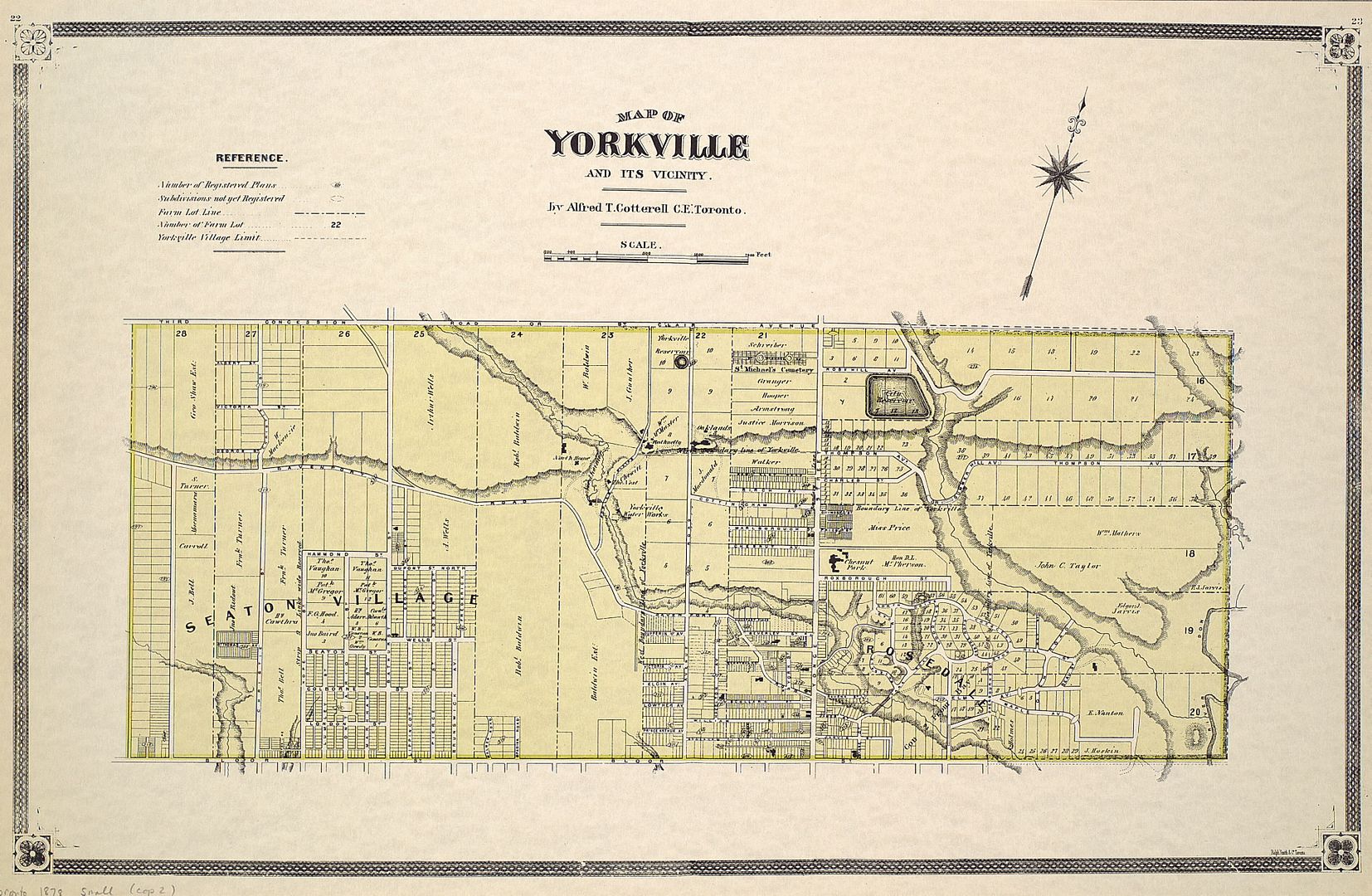
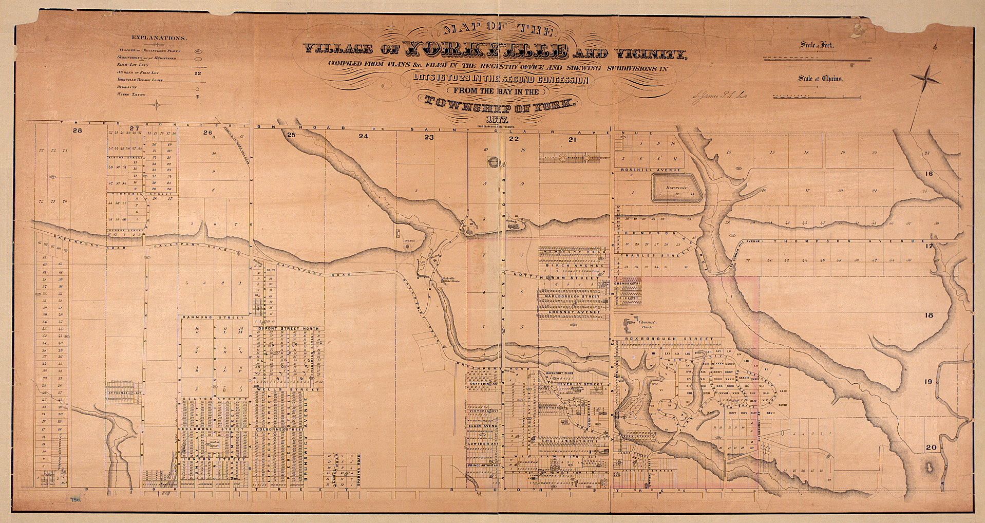
1877: Plan of Yorkville:
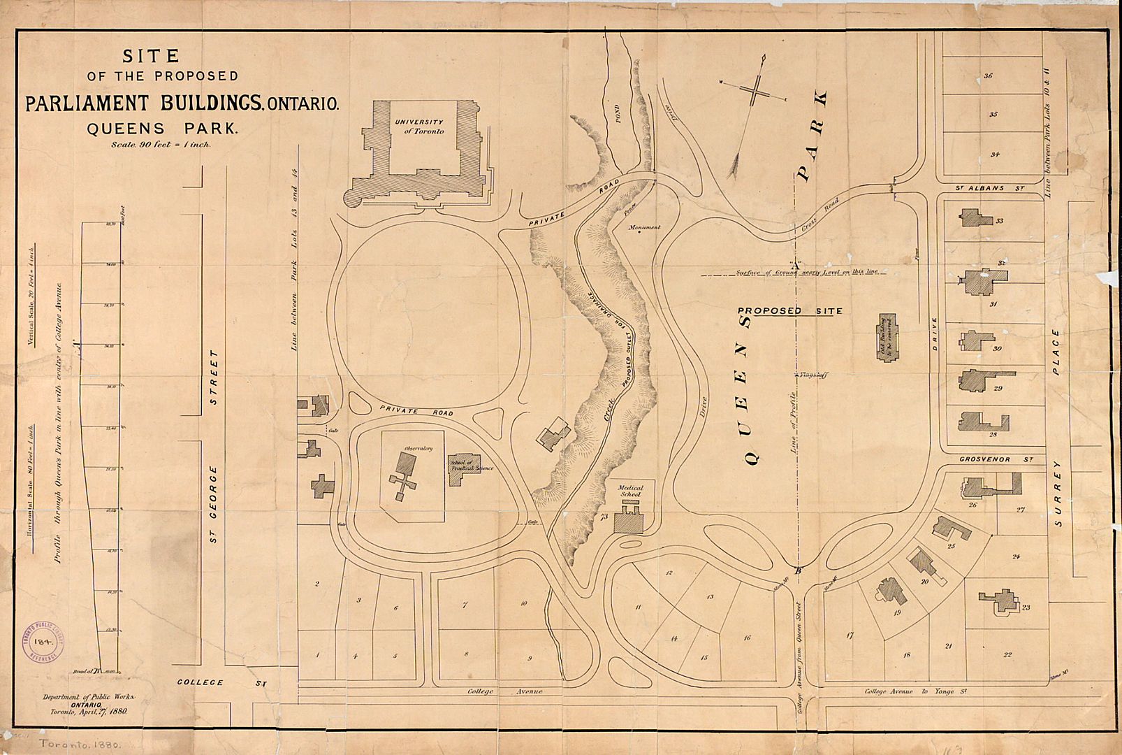
1880: Plan of the location for the new Provincial Parliament:
Here are a few:
1792:
1797:
1802:
1802: An elegant survey of the property known as Berkeley House, now part of 333 King Street East:
1810, the Don River:
1815:
1816:
1833: A different way of looking at the City:
1848:
1852: Early version of Harbourfront:
1853: Proposal for "undergrounding" the railroads:
1854: Plan of subdivision for the Allan estate:
1855: Plan of subdivision for part of the Denison estate:
1877: Plan of Yorkville:
1880: Plan of the location for the new Provincial Parliament:
Last edited: