WislaHD
Superstar
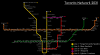
@reaperexpress You are sending the DRL to Union Station?
I think that the DRL would flood Union Station with a lot more passengers than the RER lines.
I think that the DRL would flood Union Station with a lot more passengers than the RER lines.
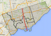
 That, as well as Yonge North Extension could be added in further update.