Rarely does a relative newcomer to Toronto's development scene make so large a splash as Republic Developments is with their proposal to redevelop an expansive parcel in the Scarborough Junction neighbourhood. Founded in 2019 by Matt Young, an 11-year development industry veteran with past experience at Lifetime Developments and Capital Developments, Republic is catapulting themselves into the building industry with an ambitious proposal dubbed the Scarborough Junction Masterplan.
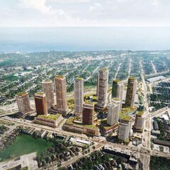
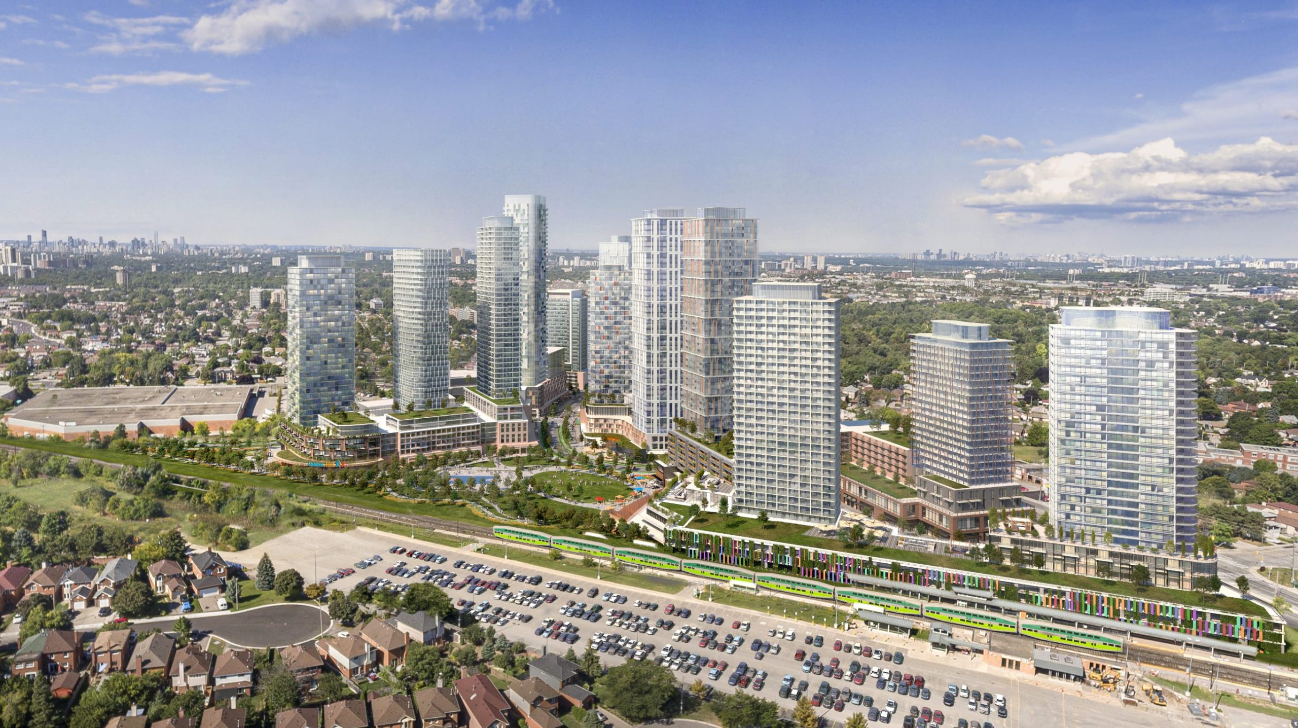 Looking northwest over Scarborough Junction Masterplan, image courtesy of Republic Developments
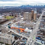
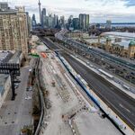
Partnering with Harlo Capital, Republic is preparing to redevelop an assemblage of two parcels of land on either side of Danforth Road south of St Clair and bordering Scarborough GO Station. The proposal will completely redefine the area in terms of land use, scale, and architecture. To the west of Danforth Road, a relatively small triangle is also bounded by Kennedy Road and St Clair Avenue East. To the east of Danforth Road is a much larger parcel, irregular in shape, its east side bounded by the Lakeshore East GO rail corridor. Together, 26 acres of land is involved.
Due to the complex nature of the site spanning multiple blocks and traversing active roads, the proposal was submitted to the City of Toronto under three separate applications, with separate Official Plan and Zoning By-law amendments proposed for 3585-3595 St Clair East and 641 Danforth Road, a Zoning By-law Amendment for the combined site of 411/415 Kennedy Road and 636 Danforth Road, and a Plan of Subdivision for 3585 St Clair East.
Currently home to a mix of commercial, warehouse, manufacturing, and sports-related uses, the Giannone Petricone Associates-designed community masterplan seeks to introduce a wide mix of uses, with a first phase concentrated in the north and east portions of the site to feature a mix of over 6,600 new residential units spread across 17 tall buildings with heights ranging from 14 storeys to as tall as 48 storeys, or roughly 150 metres in height.
This new residential density would be woven into a rebuilt urban fabric containing 165,000 ft² of retail, 4.5 acres of park space, over 50,000 ft² of community space including a child care space, and improved access to Scarborough GO station. An animated comparison below shows how the proposed land use and block configuration is a complete rethink of the low-density, pedestrian-hostile environment that exists today.
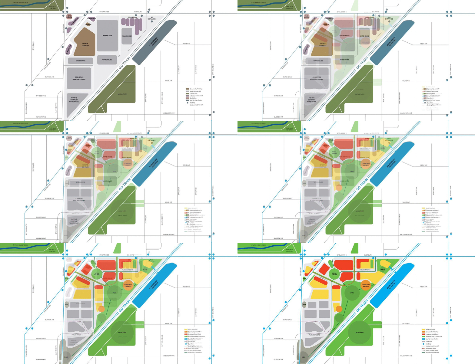 Comparing current and existing land use, road network at Scarborough Junction, images courtesy of Republic
Reworking and expanding the existing road network, new streets would create far more permeability of the site, and would include a retail lined high street heading southeast from Danforth Road and curving north to meet St Clair. Other areas would welcome only pedestrians, like a 3.416 m² 'retail square' planned with a mix of fixed and flexible seating areas, patio spaces serving retail units, and raised planters along with water and other landscaping features. The configuration and planning of the network, with retail-lined streets and ample public spaces, aims to create a destination for people from the larger area.
 Retail square at Scarborough Junction Masterplan, image courtesy of Republic Developments
While many transit trips will be best served by the TTC bus routes that serve the bounding major streets (some of which give quick access to the subway at Warden or Kennedy stations), the proposal maximizes the site's adjacency to Scarborough GO station by creating a new north entrance to it. This would serve not just those living and working in the proposed Scarborough Junction development, but the wider community, where those north and west of the rail corridor currently lack convenient pedestrian access to the GO station. A concept rendering shows how a striking building could open out onto a 705 m² public plaza featuring seating and landscaping.
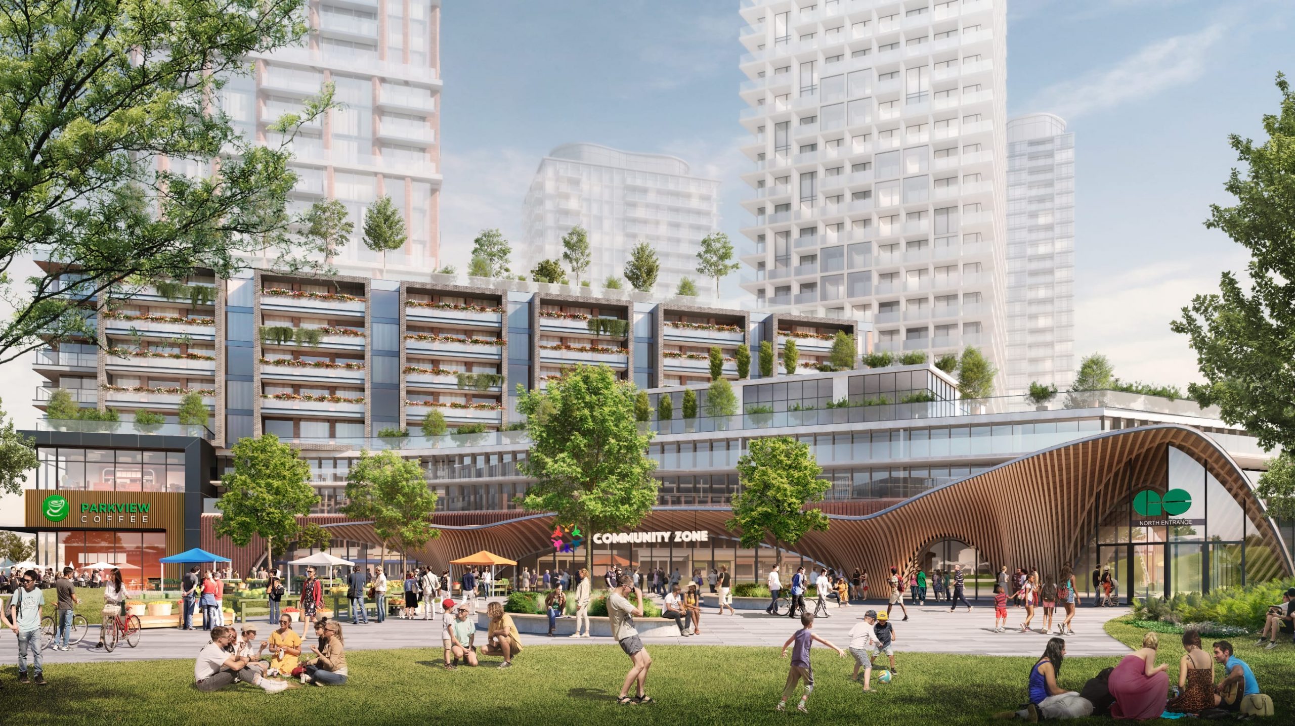 North entrance for Scarborough GO station at Scarborough Junction Masterplan, image courtesy of Republic Developments
Breaking with the convention of most new developments in Scarborough that expect many of their residents to drive, the GO station and walkable streets have factored into the plan to provide 3,666 parking spaces, the proposed ratio of units to parking spaces approaching 2:1. Along with the local and regional transit connectivity, the site is also being proposed with 7,336 bicycle parking spaces, over 6,500 of which are for residents, the remainder for visitors. At this number, the community would be built an almost 1:1 ratio of units to bike parking.
 Public realm and cyclists at Scarborough Junction Masterplan, image courtesy of Republic Developments
You can learn more from our Database file for the project, linked below. If you'd like to, you can join in on the conversation in the associated Project Forum thread, or leave a comment in the space provided on this page.
* * *
UrbanToronto has a new way you can track projects through the planning process on a daily basis. Sign up for a free trial of our New Development Insider here.

 10K
10K 


