The long-gestating redevelopment of Toronto’s Port Lands is drawing closer as work progresses on a multifaceted plan preparing the area for future investment by building flood protection and re-naturalizing the mouth of the Don River. The Waterfront Toronto project is proceeding thanks to $1.25 billion investment from all three levels of government in 2017. It will eventually unlocking 240 hectares of land in the Port Lands, including new land created by infilling areas of the harbour, while adding new infrastructure to a de-industrializing area.
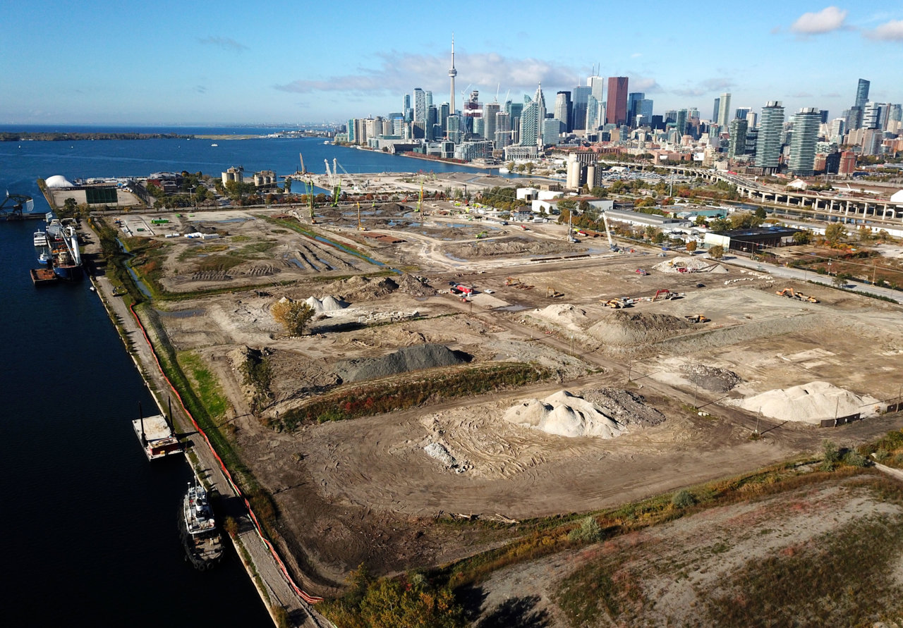 Aerial view of the Port Lands, facing northwest, image by Forum contributor skycandy
A diagram released by Waterfront Toronto outlines the work schedule from September through December, highlighting specific areas and tasks that will be carried out before the year’s end. Amongst the tasks at hand, the main road access points to the area—the north and south Cherry Street bridges—are set to be replaced by new bridges spanning the Keating Channel to the north, and a naturalized Don River mouth to the south. The north bridge will be the first to be built, as the new river valley that the south bridge will span is still being excavated. The earliest phases in this bridge replacement are now underway, and will continue with the realignment of Cherry Street, demolition, and other aspects of site preparation.
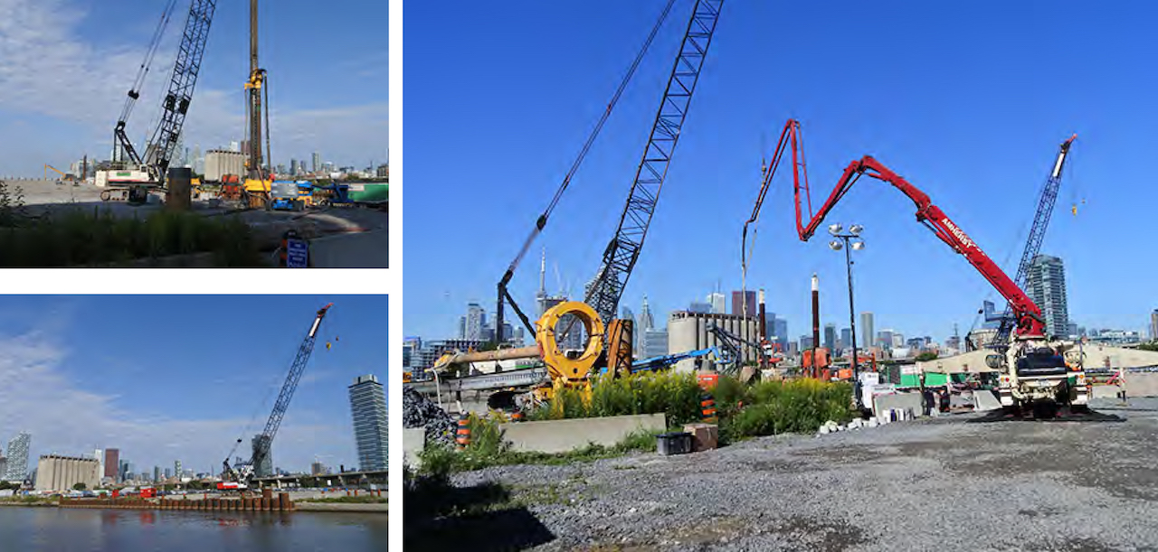 Early stages of construction for north Cherry Street bridge, image via Waterfront Toronto
One of the most watched aspects of this project is the lake filling, which is reshaping the land with a new coastline for what will be Villiers Island, and which will create a coastline that is more conducive both for the marine habitat and for the area's use as a new park and flood-protected neighbourhood behind it. Comparing two views below, captured twenty-two months apart, shows how new land has been added around Essroc Quay via lake filling.
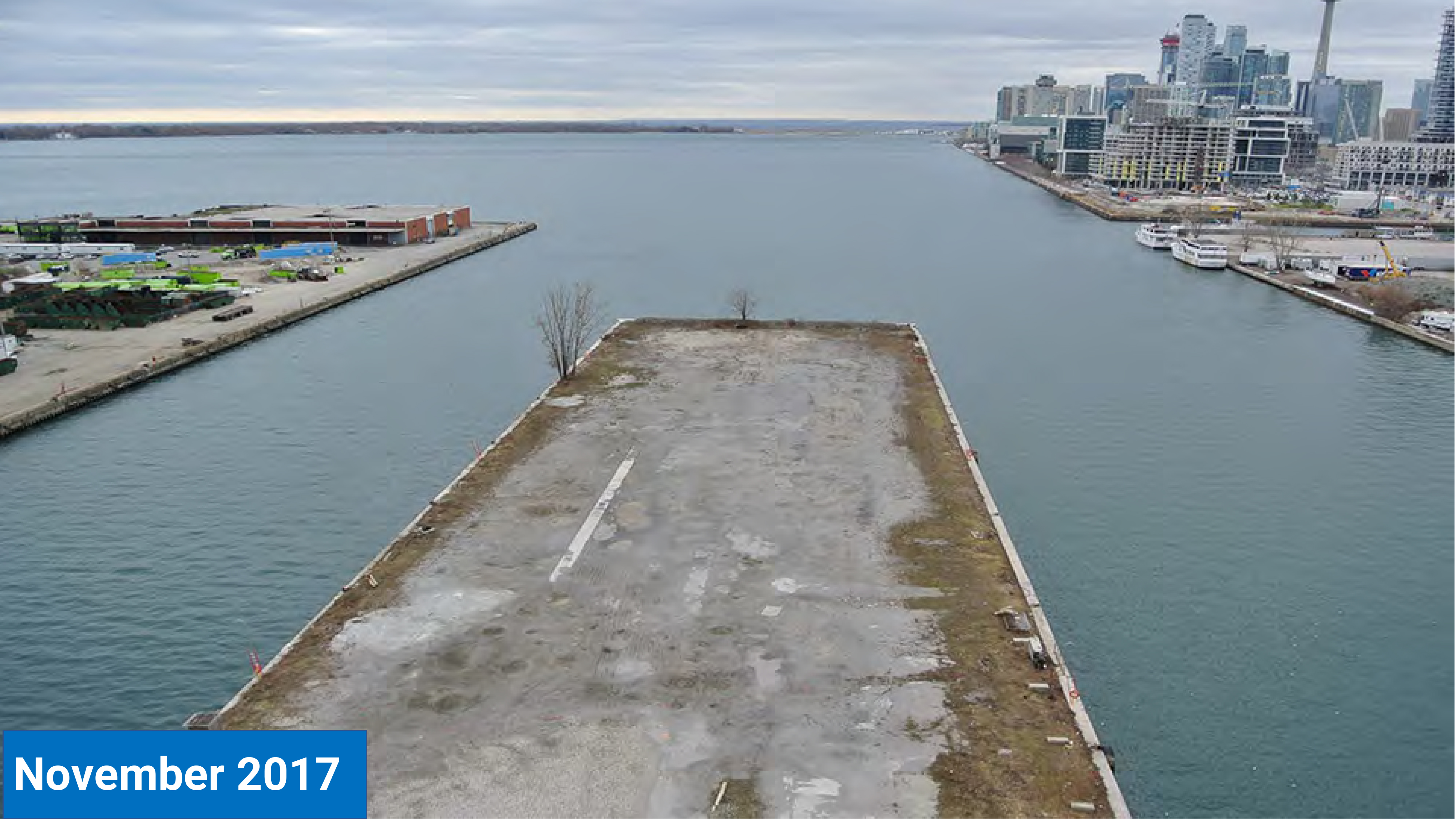
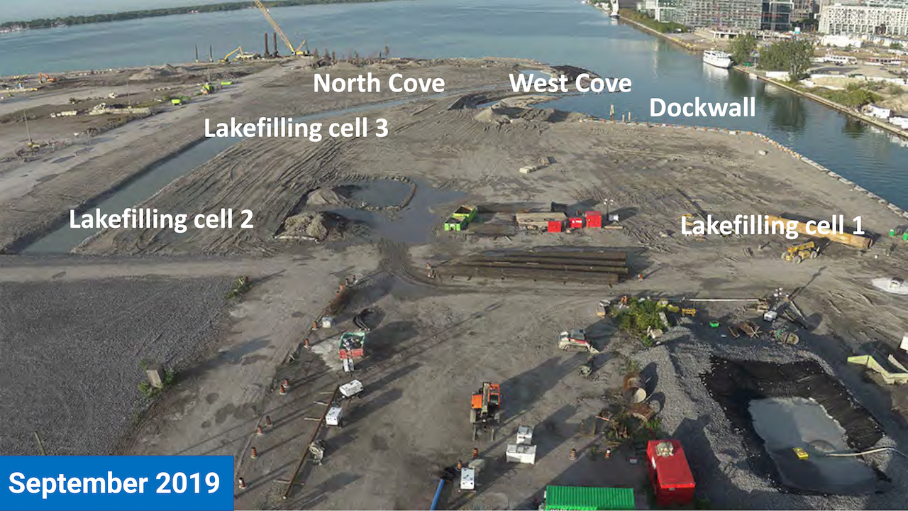 November, 2017, prior to lake filling, and September, 2019, images via Waterfront Toronto
Meanwhile, southeast of these lake fill cells, a new meandering Don River Valley is being excavated, someday set to carry the river to its new naturalized mouth. Aerial views show the new river course in early stages of excavation, with the first section being dug just east of the future mouth. Not as far along, river sections to the east and northeast are entering into site preparation in advance of excavation.
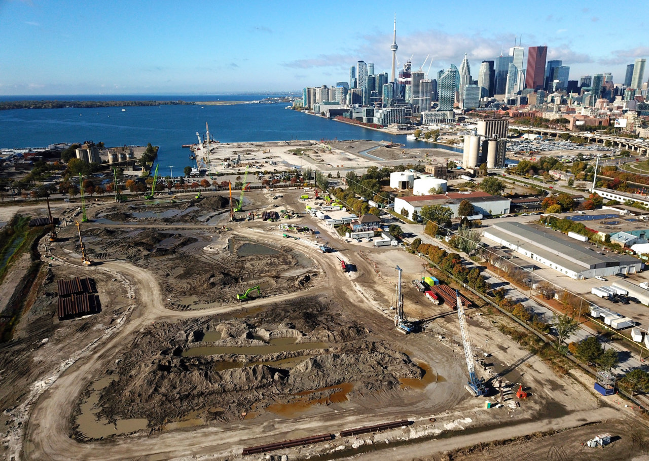 New course for the Don River, image by Forum contributor skycandy
Waterfront Toronto has produced a nearly five-minute video demystifying the project with detailed explanations and infographics breaking down the various aspects of the project and their importance to flood protection and local ecology.
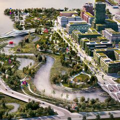
Once all work is complete, the area will be primed for the development of the Villiers neighbourhood, which will be home to roughly 25,000 residents and 30,000 jobs.
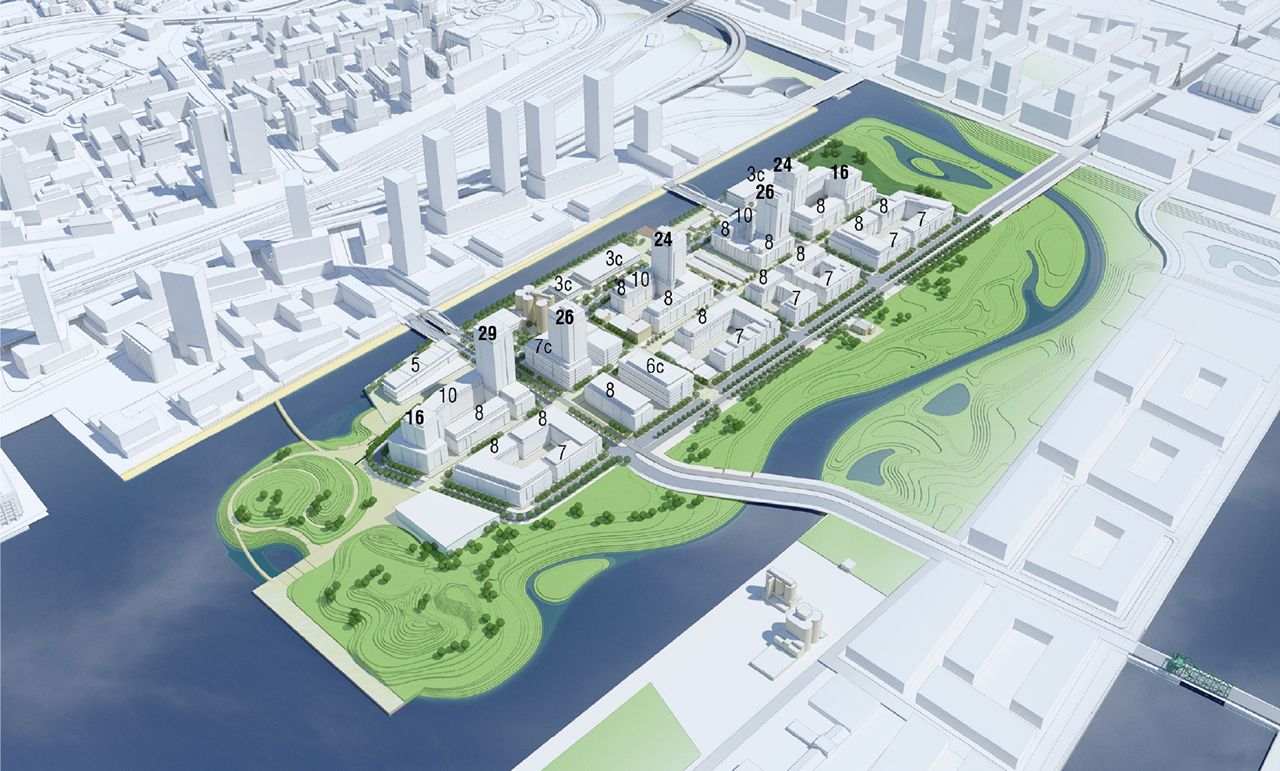 Aerial overview representing the future of Villiers Island, draft image via Waterfront Toronto
Additional information and images can be found in our Database file for the project, linked below. Want to get involved in the discussion? Check out the associated Forum thread, or leave a comment below.
* * *
UrbanToronto has a new way you can track projects through the planning process on a daily basis. Sign up for a free trial of our New Development Insider here.
| Related Companies: | GeoSolv Design + Build , LEA Consulting, Tarra Engineering & Structural Consultants Inc |

 15K
15K 


