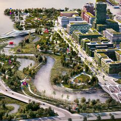
Drilling rigs and bulldozers are often the visual representation of the loss of natural lands in favour of development, but an active project on the doorstep of Downtown Toronto is instead using heavy construction equipment to reintroduce nature to the area. The once heavily industrialized Port Lands area will soon be home to a re-naturalized mouth for the Don River, repairing the current mouth which has long suffered ecologically from the effects of channelization through a hard 90° turn.
Part of a $1.2 billion regeneration initiative from Waterfront Toronto, a new, serpentine river mouth will carve through the area, giving the river a naturalized course to the lake in place of the current turn into the Keating Channel, which restricts flow and requires regular dredging. The river's new mouth, combined with the retained Keating Channel, will create a new island. Villiers Island will be connected to both the mainland and surrounding Port Lands via new bridges.
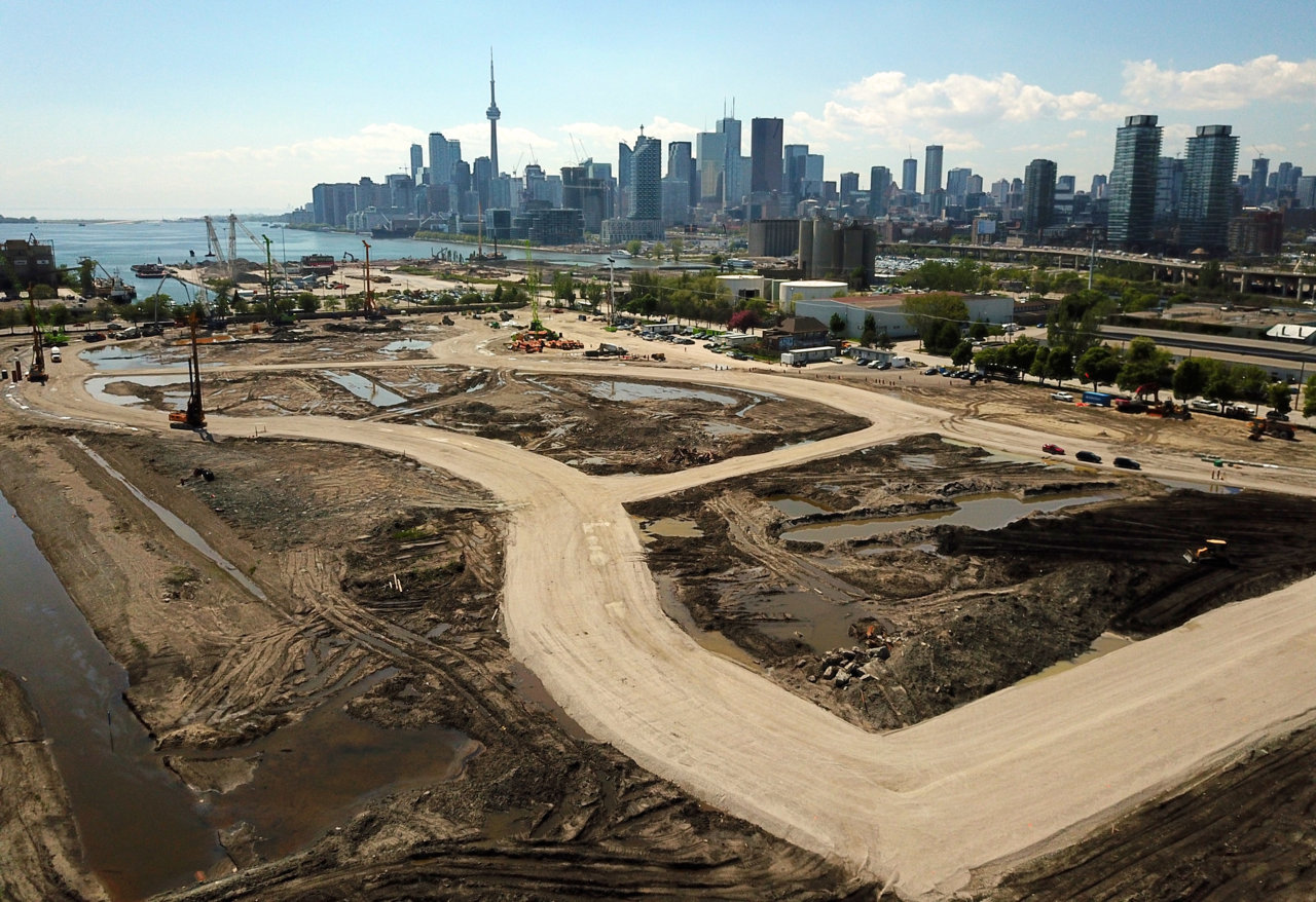 Looking northwest across the new river valley, image by Forum contributor skycandy
We last provided an update only a couple of weeks ago in late May when shoring rigs had begun drilling around the perimeter of the river's future path and excavating out the new valley. In the time since, the course of the new river mouth has become quite apparent in aerial views, with a pair of wide of temporary gravel roadways for construction equipment marking the extremities of the valley walls. The darker soil between these wide roadways marks the area being excavated, while the smaller connecting roads between the sides will also be excavated.
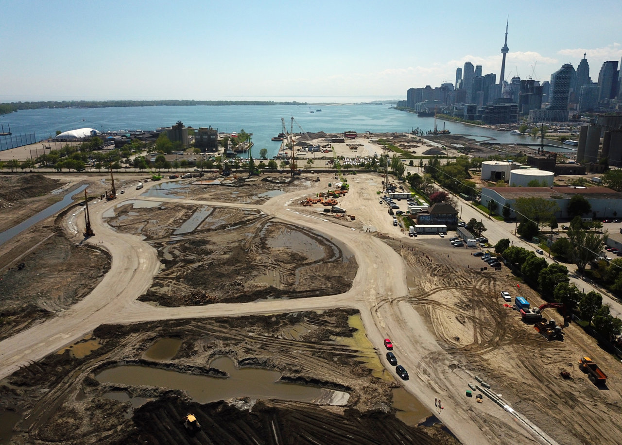 Looking west across the new river valley, image by Forum contributor skycandy
Meanwhile, northwest of the new river mouth excavation area, work is making visible progress for the Cherry Street Lakefilling project, another important element in the wider Lower Don Lands project. The latest photos show a new concrete dock wall extending the Keating Channel, with one of the last "lakefill cells" in the process of having water being pumped out and new fill being brought in.
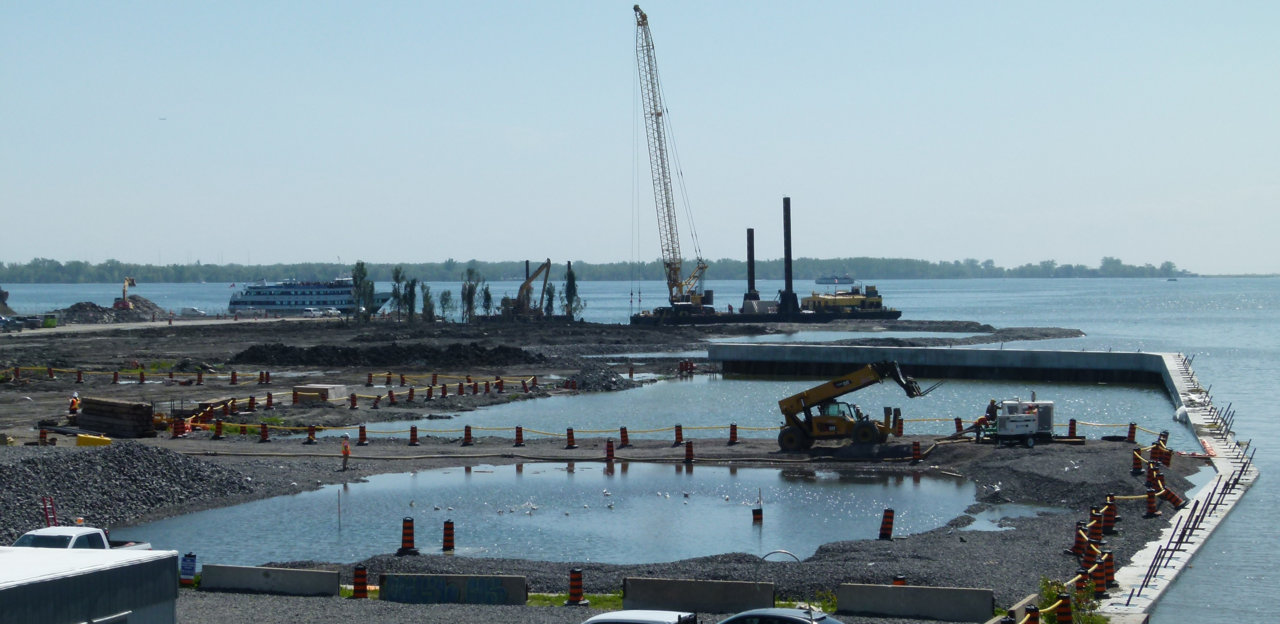 Facing west to the new dock wall, image by Forum contributor skycandy
As of one month ago, approximately 230,000 cubic metres of locally sourced clean fill had been added to form what will eventually become the northwest edge of the new Villiers Island. This area will be home to the new Promontory Park, as well as wildlife habitats that will spring up around salvaged trees that have been planted in protective "habitat coves" around Essroc Quay.
We’ll provide regular updates as this massive construction project progresses over the next five years. To learn more about the project, check out our database file, linked below, where you'll find additional renderings, or the associated forum thread with construction photos and finer details about what's coming to the Port Lands.
* * *
UrbanToronto has a new way you can track projects through the planning process on a daily basis. Sign up for a free trial of our New Development Insider here.
| Related Companies: | GeoSolv Design + Build , LEA Consulting, Tarra Engineering & Structural Consultants Inc |

 9K
9K 


