
 3.2K
3.2K 


Toronto is at a crossroads when it comes to street design. Major projects across the city have been slowly transforming our streets over the past decade, and everyone seems to have an opinion on the matter. From Rob Ford's crusade against cyclists, culminating in the removal of the Jarvis Street bike lanes, to the debate over the future of the Gardiner Expressway, to recent pilot projects on King and Bloor Streets, the tug of war over the future of our roads has see-sawed between the status quo and a complete redefinition of Toronto's road network.
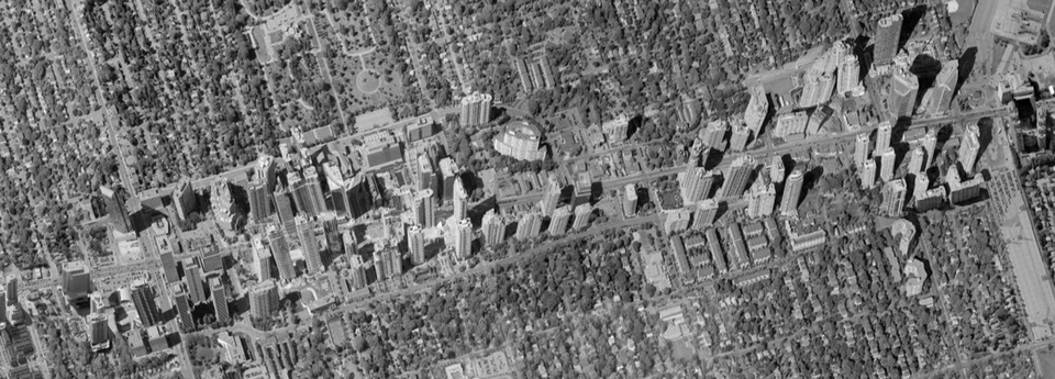
Hot off the heals of the emphatic win for the Bloor Street makeover, the battle over the use of our streets is once again being waged, this time in a locale far removed from Toronto's dense urban core. The stretch of Yonge Street between Sheppard Avenue and the hydro corridor north of Finch Avenue in North York Centre is due for reconstruction, and the City has taken this opportunity to rethink how the street might be designed.
An Environmental Assessment Study was completed in 2016, which concluded that an option entitled 'Transform Yonge' was preferred: a radical proposal (well, radical in a suburban context) that would reduce the width of the road from six to four vehicular lanes for most of the stretch, relocate street parking to side roads, install bike lanes on either side of the street, and increase the sidewalk width while adding a landscaped median. More details of the Transform Yonge design can be found here.
The Transform Yonge initiative received the support of a majority of local Yonge Street residents, and was fully endorsed by local Ward 23 Councillor John Filion, who has been vocally supportive of it. The project, however, hit a major speed bump earlier this year when Ward 24 Councillor David Shiner put forward a motion at Council to pull funding for the next stage of the project, which was subsequently supported by Mayor John Tory and passed by a 24-20 vote.
This, however, was not the end of the Reimagining Yonge study. In May 2017, the Public Works and Infrastructure Committee directed City staff to study an alternative solution of installing bike lanes on either Beecroft Road or Doris Avenue (which run parallel to Yonge) while maintaining six lanes of traffic on Yonge Street, and compare this alternative to the Transform Yonge proposal. Through the study process, City staff determined that Beecroft was a better option than Doris for bike lanes, and so put together an Enhance Yonge/Transform Beecroft proposal to compare to Transform Yonge.
At an open house last week, the City presented the findings of its comparison and has opted for the original Transform Yonge proposal as the preferred solution. It was determined that the benefits of the Transform Yonge proposal far outweighed the benefits of the Enhance Yonge/Transform Beecroft option, though the City did state that both options would be viable and would meet the objectives of the project. Interestingly enough, it was found that the Beecroft option was estimated to be $21 million more expensive than Transform Yonge, and both options would have a negligible impact on traffic congestion, with average vehicular travel times estimated to increase by only one minute by 2031.
Councillor John Filion was on hand at the open house, and is enthusiastically supportive of the project. He is adamant that a remake of Yonge is vital to the area and is necessary to improve the quality of life for the tens of thousands of residents who reside on or near Yonge Street. For him, the project is more than just about improving the streetscape or accommodating greater volumes of cyclists and pedestrians—it's about creating a destination. "[North York Centre] was sort of an instant downtown, a dream of Mel Lastman to have a downtown core in North York," Fillion explained. But that translated into what he calls a "developer's playground": a collection of tall buildings "without really good planning", creating the uninviting streetscape of Yonge Street today.
Filion insists that the Transform Yonge proposal is a very logical solution to the problem of Yonge. He points out that with on-street parking, the street is already reduced to four lanes for 20 hours of the day, and even during rush hour, cars frequently stop in the curb lanes and cause backups. He also points to the fact that increased road widths do not in fact ease traffic congestion, and that it has been proven that traffic will fill whatever road is provided, regardless of the number of lanes. This portion of Yonge also benefits from two parallel service streets that are currently below their full traffic capacity. A future project to extend Doris Avenue south to Tradewind Avenue, which will terminate at Avondale Avenue, will also help ease congestion.
Through Transform Yonge, Filion hopes to create an inviting atmosphere that not only benefits local residents, but also attracts visitors to the area. He has met with many local groups, and always poses the question: "Would you rather live next to a highway, or next to a Main Street?". The answer has overwhelmingly been 'Main Street', with residents evoking the qualities of Queen and Bloor Streets in describing what they wish to see in their own neighbourhood. Filion states that while there is a small minority who are opposed to the changes, there has been tremendous public support for the makeover, which has only reinforced his determination that this will be beneficial for the area. He sees this project as an opportunity to complete Mel Lastman's dream and finally make North York Centre feel like a real downtown.
The next step in the process is the compilation of the final report, which will be presented to the Public Works and Infrastructure Committee in January. The public has until December 29 to provide input. Following a 30-day public review period in March 2018, the Environmental Assessment will head back to City Council for approval, and if all goes well this time around, the Detailed Design phase will begin mid-2018. As the study nears its conclusion, the stage is being set for yet another debate at Council over the future of one of the Toronto's major arterial roads.
More information about the project can be found on the City's website here, and the panels presented at the open house can be viewed here. We will keep you posted of any news as it becomes available. In the meantime, you can get in on the discussion by checking out our dedicated Forum thread, or by leaving a comment in the space provided on this page.


