


DSCToronto
Superstar
Member Bio
- Joined
- Jan 13, 2008
- Messages
- 22,422
- Reaction score
- 37,174
- Location
- St Lawrence Market Area
As this is a multi-location matter it seems best to create a general thread to discuss it!
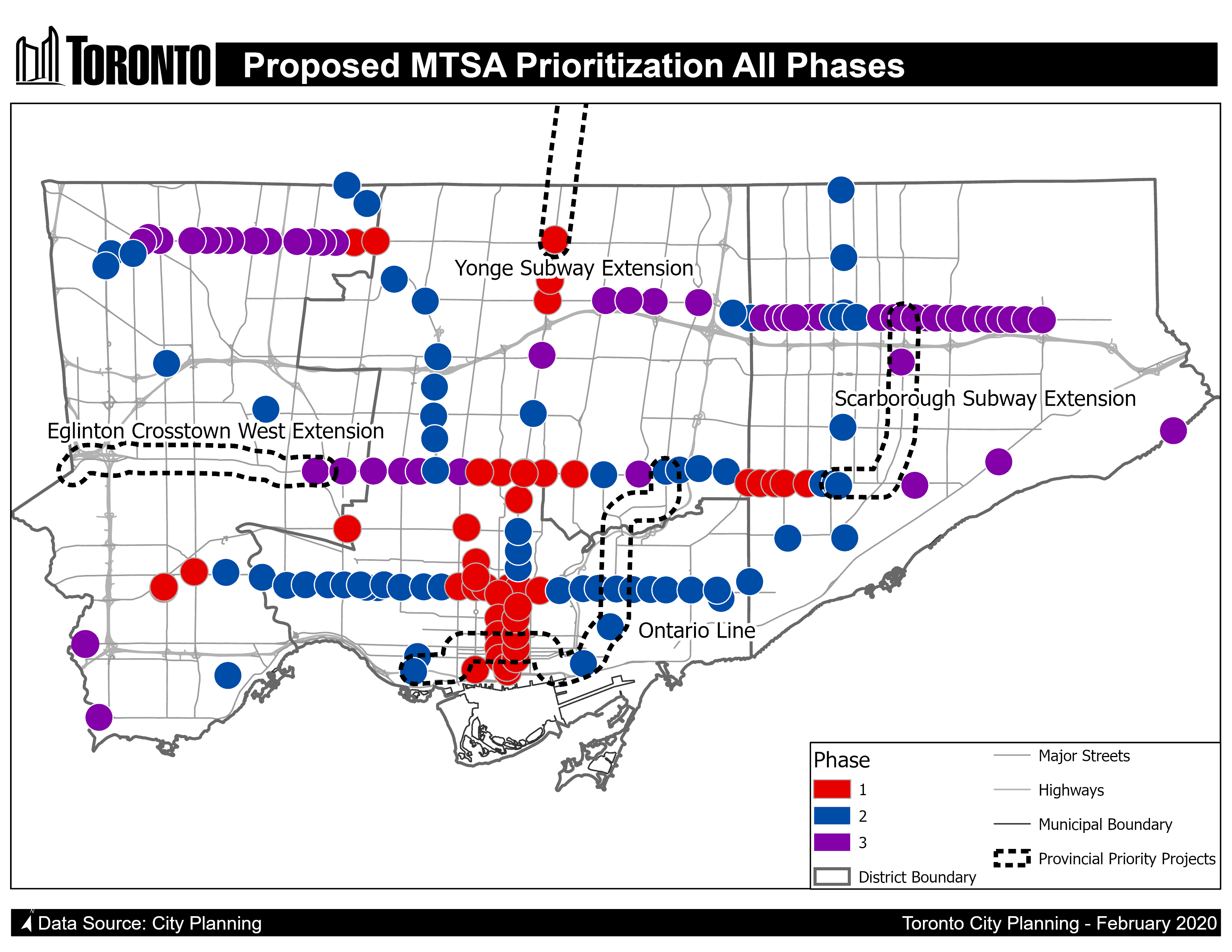
"In June 2020, City Planning initiated the Growth Plan Conformity and Municipal Comprehensive Review ("the MCR") which includes the delineation of 180+ Major Transit Station Areas (MTSAs) to meet Provincial intensification requirements by July 2022. The introduction of Protected Major Transit Station Areas (PMTSAs) is part of the MCR. An equity lens is being applied to this work program that prioritizes the delineation of PMTSAs to enable the implementation of inclusionary zoning as an affordable housing tool, where market conditions could support it."
Details are at: http://app.toronto.ca/tmmis/viewAgendaItemHistory.do?item=2021.PH22.6 and https://www.toronto.ca/legdocs/mmis/2021/ph/bgrd/backgroundfile-165469.pdf and the maps are at: https://www.toronto.ca/legdocs/mmis/2021/ph/bgrd/backgroundfile-165470.pdf
Lots to digest!