


dt_toronto_geek
Superstar
A little fluffy, but somewhat interesting. I found the map (linked below) most intriguing.
We define ourselves by our neighbourhoods
But even with the NIMBYism, no one would doubt they provide the organizational unit that has kept Toronto from spiralling out of control
Aug 30, 2009 04:30 AM
Christopher Hume
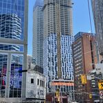
Toronto has always been a city of neighbourhoods, but who knew just how many neighbourhoods?
Until the Star set out to map all 239 of them, it was anybody's guess. Of course, everyone's heard of Cabbagetown, the Annex, Riverdale and Parkdale, Jane-Finch and Malvern. But where does one neighbourhood begin and the next begin?
Not that that's the most important thing; the fact is that it was the neighbourhoods that kept Toronto from the fate doled out in so many North American cities in the 1950s, '60s and '70s when suburban sprawl began in earnest.
In a city obsessed with real estate and the price of housing, the neighbourhood sits at the heart of what it means to be a Torontonian. It's not that neighbourhoods don't change; they do. Think of Cabbagetown, which until 35 or 40 years ago was not the kind of place that attracted nice middle-class families. Today, only the rich need apply. Even Riverdale, once a blue-collar bastion, is now too expensive for many. The same process is unfolding in Parkdale.
But for all the problems of the NIMBY hordes, no one would doubt that the neighbourhood provides the basic organizational unit that has kept Toronto from spiralling out of control. When urban theorist Jane Jacobs moved here in the 1960s from New York, where she had taken on and beaten uber-builder Robert Moses, she immediately found herself embroiled in the fight to stop the Spadina Expressway. It was the residents in her adopted neighbourhood, the Annex, and others who coalesced into the group that succeeded in killing the urban highway.
As Bill Davis, then premier of Ontario, so eloquently put it: "If we are building a transportation system to serve the automobile, the Spadina Expressway would be a good place to start. But if we are building a transportation system to serve people, the Spadina Expressway is a good place to stop."
Almost four decades later, however, we hear the residents of North Toronto complaining about a proposal to shut the fifth, reversible, lane on Jarvis St., which has become a convenient route into the downtown core for those in the area.
In the zero-sum game that is the city, one neighbourhood's loss is another's gain. Except, of course, that the city isn't a zero-sum game. In fact, though some might find themselves inconvenienced, we're all in the same urban boat.
If nothing else, the Star's neighbourhood map makes it clear that we are all connected; one neighbourhood leads into the next, as often as not seamlessly, even imperceptibly. The divisions, though sometimes hard and fast, can also be psychological and emotional.
Neighbourhoods can be established and stable and still be in a constant state of change. Like the city of which they are a part, neighbourhoods are always in transition.
Though we find change threatening, it cannot be stopped. Indeed, the names of so many Toronto neighbourhoods are little more than memories, all that remains of towns, villages, boroughs, train stops that long ago disappeared.
Yorkville, for example, was once a place apart from Toronto. So were Forest Hill, Swansea and Davisville. The list goes on.
If the names of some neighbourhoods are a record of history, others reflect changes that have occurred in modern times. Some neighbourhoods are defined by their physical boundaries, others by the communities that inhabit them. In a few cases – South Riverdale and Chinatown East come to mind – the two overlap.
But in the end the most important thing about any of these neighbourhoods is that they are part of something much larger – Toronto. Ultimately, it is the city that gives them life, meaning and relevance, and that makes them places we choose (or not) to live. It is the city that makes them possible.
Source
Map of Toronto neighbourhoods (zoomable)
http://www3.thestar.com/static/googlemaps/starmaps.html?xml=090120_shapetool_neigbourhoods.xml
We define ourselves by our neighbourhoods
But even with the NIMBYism, no one would doubt they provide the organizational unit that has kept Toronto from spiralling out of control
Aug 30, 2009 04:30 AM
Christopher Hume
Toronto has always been a city of neighbourhoods, but who knew just how many neighbourhoods?
Until the Star set out to map all 239 of them, it was anybody's guess. Of course, everyone's heard of Cabbagetown, the Annex, Riverdale and Parkdale, Jane-Finch and Malvern. But where does one neighbourhood begin and the next begin?
Not that that's the most important thing; the fact is that it was the neighbourhoods that kept Toronto from the fate doled out in so many North American cities in the 1950s, '60s and '70s when suburban sprawl began in earnest.
In a city obsessed with real estate and the price of housing, the neighbourhood sits at the heart of what it means to be a Torontonian. It's not that neighbourhoods don't change; they do. Think of Cabbagetown, which until 35 or 40 years ago was not the kind of place that attracted nice middle-class families. Today, only the rich need apply. Even Riverdale, once a blue-collar bastion, is now too expensive for many. The same process is unfolding in Parkdale.
But for all the problems of the NIMBY hordes, no one would doubt that the neighbourhood provides the basic organizational unit that has kept Toronto from spiralling out of control. When urban theorist Jane Jacobs moved here in the 1960s from New York, where she had taken on and beaten uber-builder Robert Moses, she immediately found herself embroiled in the fight to stop the Spadina Expressway. It was the residents in her adopted neighbourhood, the Annex, and others who coalesced into the group that succeeded in killing the urban highway.
As Bill Davis, then premier of Ontario, so eloquently put it: "If we are building a transportation system to serve the automobile, the Spadina Expressway would be a good place to start. But if we are building a transportation system to serve people, the Spadina Expressway is a good place to stop."
Almost four decades later, however, we hear the residents of North Toronto complaining about a proposal to shut the fifth, reversible, lane on Jarvis St., which has become a convenient route into the downtown core for those in the area.
In the zero-sum game that is the city, one neighbourhood's loss is another's gain. Except, of course, that the city isn't a zero-sum game. In fact, though some might find themselves inconvenienced, we're all in the same urban boat.
If nothing else, the Star's neighbourhood map makes it clear that we are all connected; one neighbourhood leads into the next, as often as not seamlessly, even imperceptibly. The divisions, though sometimes hard and fast, can also be psychological and emotional.
Neighbourhoods can be established and stable and still be in a constant state of change. Like the city of which they are a part, neighbourhoods are always in transition.
Though we find change threatening, it cannot be stopped. Indeed, the names of so many Toronto neighbourhoods are little more than memories, all that remains of towns, villages, boroughs, train stops that long ago disappeared.
Yorkville, for example, was once a place apart from Toronto. So were Forest Hill, Swansea and Davisville. The list goes on.
If the names of some neighbourhoods are a record of history, others reflect changes that have occurred in modern times. Some neighbourhoods are defined by their physical boundaries, others by the communities that inhabit them. In a few cases – South Riverdale and Chinatown East come to mind – the two overlap.
But in the end the most important thing about any of these neighbourhoods is that they are part of something much larger – Toronto. Ultimately, it is the city that gives them life, meaning and relevance, and that makes them places we choose (or not) to live. It is the city that makes them possible.
Source
Map of Toronto neighbourhoods (zoomable)
http://www3.thestar.com/static/googlemaps/starmaps.html?xml=090120_shapetool_neigbourhoods.xml