News   Apr 25, 2024
 56     0 
News   Apr 24, 2024
 1K     1 
News   Apr 24, 2024
 1.6K     1 

miWay Transit

I made a presentation before the City Council budget committee on Jan 12 requesting that MT budget be increase from 3% to 5% to cover 10 artic expansion buses for this year considering none on order until 2017 considering MT need 12 buses now; 8 expansion buses yearly until the LRT is built yearly, max 30 minutes headway 7 days a week, install route eliminated on Sunday that run 6 days a week with a few exception; 7x24 service to start in Sept, starting route 100 in the fall, not 2017, starting service city wide at 7-8 am on Sunday, not the current method; move toward a grid system; a few new routes with one replacing route 6 & 34 to Sq One; $50-$75 million transit hub to house both MT, GO, future non Hurontario LRT's & subway connection along with a GO Rex line; scrap the 2nd transit terminal plans; max 10 minutes service on all trunk lines.

We have a 10-11% model split and need to move to 35%, let alone a 50% and this means putting more service on the road if it means higher taxes and a lower cost ratio if we want to offer an option to the car as well lowering parking requirements.

MT calling for TVM to be install in all malls as well community centres and libraries. MT is call for 2017 to be paperless with Presto replacing the current fare media. 38% of riders use the Presto system today.

As for diesel fuel, MT is seeing no decrease until the summer in the way of cost.

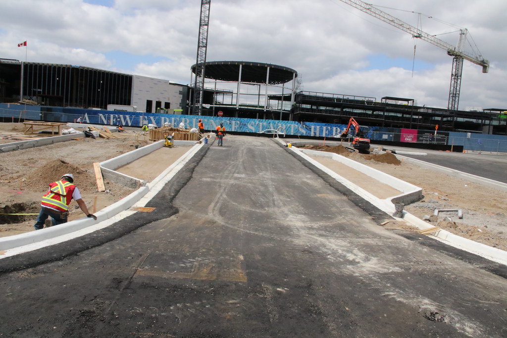
A new bus bay is plan for both direction on Sq One Dr, west of the current crossing from the terminal. The roadway will be narrow with a shorter walking distance for the crosswalk that there today.

Staff been asked to look at having washrooms build for various terminals that don't have any today. There is only 2 terminals that have washroom as well 2 GO station now.

MT is getting $275,000 to run shuttle buses from Islington and Port Credit GO Station to the Hersey Centre for the Pan Am games with service running when events are taking place.

Staff and City working on how the new Transportation Committee will be setup, its powers and duties, and how to go about filling 10 position by residents of the city as well 2 councilors. The mayor wants this committee setup ASP.

Cost of the Transitway is $479 Million and way higher than what was call for in 2004 considering how much was removed from the original plan. Very close to what I call for in 2004 as my cost would still be higher to cover the inflation between 2004 and now.
 
Posted this in the wrong thread, but now in proper thread.

Routes 1C, 44, 101, 101A, and 110 are officially on diversion until further notice due to the CUPE 3902 strike occurring at all UT campuses, including UTM.

See here.
 
New service changes on April 27
MiWay News
Weekday Map
Saturday Map
Sunday Map
Express Map

Not yet officially announced/released. Some guy on CPTDB found these.

Summary of changes
- realignment of 4 Sherway Gardens and 38 Creditview; Sunday service for route 4
- 29B Park Royal-Homelands replacing route 29 and 31 service on Saturdays
- new rush hour route 37 along Creditview from Bancroft to Erindale GO with 22 minute frequency
- 42 Derry rush hour frequency increased from 13 minutes to 10 minutes, midday increased from 24 minutes to 20 minutes, Saturday from 35 minutes to 36 minutes.
- various schedule adjustments and seasonal changes

The ridership is 42 Derry seems to be increasing a lot. First it was 5 Dixie and now 42 Derry with 20 minute off-peak frequency. Are there any oher places in the world that have busy industrial bus routes like this? I wouldn't be surprised if was just a GTA thing.
 
MT has release that info for the next board change.

The May changes will see a few big change with more service for 100's.

If headways were less than they are now, more people would use transit. Anything over 30 minutes is a killer as well no weekend service.

May will see another Open House for the Transitway.
 
I noticed a few days ago that they have build a new entrance off City Centre into the rebuilt parking lot for Sq One with layover bays. I wondering if they plan to use this layover bay for Route 8 who would then use the new layover bays on Sq One Dr by the terminal. If this happens, then 8 will not be using Living Arts Dr anymore.
17473869648_d7eb94fcd4_b.jpg
 
These guys are out to lunch on a number of the routes as it going to force some riders to transfer 3 times to get where they want to go to. Route 20 is one example of that right now.

More importance is the 2049 time frame, as that is waaaaay tooo long.

Having a 102 on the QEW is a waste of resources.

Kipling is supposed to be in operation 2019/20.

Port Credit best choice for 8 and that going too screw a lot of riders from the west including me when I have to use it.

Unless service is down to 10 minutes on most routes, longer travel time and lets look at getting a car.

I see my handy work on a few routes being change as I have call for all or some of it over the years.

As for 14 going to Sherway, I only saw it going to Dixie Mall and will carry less riders than the 4 to Sherway.

103 will disappear around 2022.

Sever is slow pulling this up

http://www7.mississauga.ca/Document...y_5_PIC_Display_Boards_5_FINAL_2015-05-22.pdf
 
Wow so they want to make it even less convenient to get to Square One? Neither the 38 nor 54 nor 10 would go there. OK then. Good thing I don't take Mississauga Transit, nor would I with these changes.
 
Wow so they want to make it even less convenient to get to Square One? Neither the 38 nor 54 nor 10 would go there. OK then. Good thing I don't take Mississauga Transit, nor would I with these changes.
Add the 8 and 90 as well. 38 never went there in the first place and been cut shorter than exist with the new cut in the routing that just took place.

If you live on Rathburn and go to the subway, you either walk to Burnhamthorpe to get the 26 or catch an 38, 8, 5 or 57 to do it as the 20 will only be an e-w route on Rathburn only. A 10+ minute walk depending where you live on Rathburn and the stop on Burnhamthorpe Rd

They will only have the 61 that will replace the 61A and you will have to catch a 42 to go west of Mavis. Long over due for service north of Derry 7 days a week all day.

As far as I am concern, Sq One is not the centre of the university for the city, but a problem how to get to other parts of the city by having to travel there in the first place. It will never be an downtown as they think since it exist at Dundas and Hurontario today.

Need a grid system along with other routing since the city has very few e-w, n-s continue roads in the first place

You can change the model split faster than 2049 time frame, but it involves investing heavily in funding transit to do it. You need 7x24 service on trunk lines with max 30 minutes at night or less. All trunk lines need to be 10 minutes or less at peak time and 10-15 or less off peak. Other lines to be 15-30 minutes off peak with the odd one seeing more than 30 since there is next to no growth on them now or the future.
 
I think there is way too much removal of hub-and-spoke routes, yet at the same time they did not stengthen the grid in any significant way:

- still no dedicate route for the entire Mavis corridor; removal of all service along Mavis south of Rathburn
- still no dedicate route for Central Parkway; Central Parkway will have even less converage with these changes
- route 20 taken off Rathburn east of Fieldgate AND no more Islington service
- still no unified Confederation/McLaughlin service (28+66), mandatory for a grid system!
- elimination of continuous service along Eglinton: 35 will no longer go west of Winston Churchill, and yet no service to Islington either
- elimination of continuous service along Matheson: cancellation of 43 Matheson-Argentia (but kind of cancelled out by extension of 39)
- no more continuous service along Aquitaine
- still no Mississauga Road service north of Turner Valley, and route 44 will no longer connect to route 4
- no more continuous/dedicated route for Tenth Line West
- no more continuous/dedicated route for Erin Mills Parkway north of Burnhamthorpe (they probably should bring back the old route 48 from Meadowvale to Clarkson)
- still no connection between 45 Winston Churchill and 26 Burnhamthorpe
- still no Tomken service north of Cardiff; I think it should be extended to Bramalea, this would be better thane extension to Dixie Mall, if the grid is the concern
 
102 (currently 71) will not be paid for by City of Mississauga. That route is contracted out to the City by one of the companies at Sheridan Park.
I think its the Sun Insurance that is paying for the 1 round trip for weekday now. If 102 is to go all day, the city will be picking up that cost.

I have being calling for a 61B to run on Mavis 100% from Derry Rd to Cooksville GO station by Dundas. This allow riders to stay on the 1 or 101 past Hurontario and catch the 61B and bypassing Sq One. Also allow riders to get to/from the GO Line.

As for the 35 not going to Islington/Kipling, no room for it. Not going going to tenth line is a mistake.

As for Erin Mills, very few riders for the service. The 110 picks up less than 10 riders south of UTM in either direction. I said before service started, ridership would be non existing.

I agree on Tomken.

I will have my say on Thursday as I can't make Wed meeting now.
 
I'm not as familiar w/Mississauga transportation planning as many of you here.

As such, a question, are their any plans to stitch the road grid together?

Until looking at these maps I wasn't clear on just how wide the gaps are in some places.

At the very minimum 2 additional 'arterial' corridors need to be completed n-s; but there are certainly places the e-w grid could be more robust as well.
 
Really interesting stuff. I like a lot of the changes, but Doady points out a lot of flaws. There's a lot of awkward transfers and roundabout routes, even if most of the looping industrial routes are wiped from the map.

The Transitway service, especially between Airport Corporate Centre and Square One, had better be frequent enough to justify removing some of the routes out of the terminal, especially the 8 and the 53. I don't know why Route 26 is being moved out of there, at least before the LRT is completed. The need for a Transitway station at Creditview is ever-more apparent; too bad it was value-engineered out of existence. Why is the 100, the core Transitway Route, being sent to the Airport and not to Islington? I don't get that one.

I guess the 66 and the 28 are still separate as they both go into the nearby terminal; I don't think their through-routing is necessary for a grid-based system. I also think Route 51 needs to go into Brampton; at least to Steeles Avenue for the connections to the 11/511. Also don't like Route 20 terminating at Tahoe.

Routes 10 and 54 terminate at a very awkward location (Kennedy/Matheson); shouldn't they be sent to Square One or another Transitway Station?
 
Last edited:
I have to ask: what is the point of the 105 Dixie MiExpress ending at Dixie Outlet Mall? Sometimes, when I feel like taking the long way, I'll take the 5 all the way down to Long Branch. DOM never seems busy as a terminal. Wouldn't it be better to terminate at Long Branch or Port Credit instead even though it would lengthen the route when it would already be super long?
 
As for Erin Mills, very few riders for the service. The 110 picks up less than 10 riders south of UTM in either direction. I said before service started, ridership would be non existing.

In early 2007, before the introduction of 110 University and the subsequent truncation of 48 Erin Mills south of South Common, 48 Erin Mills had an average of 3,606 boardings per weekday while 13 Glen Erin had 4,410 boardings per weekday. That means Erin Mills and Glen Erin has over 8,000 riders combined. I think that is plenty of ridership. After the 48 was eliminated south of South Common, it lost more than half its ridership. I think MT should bring that back the old 13/31/48 configuration because it worked. The ridership was much higher than the current 13/29/110 configuration.

http://dmg.utoronto.ca/pdf/tts/2006/validation2006.pdf#40

I'm not as familiar w/Mississauga transportation planning as many of you here.

As such, a question, are their any plans to stitch the road grid together?

Until looking at these maps I wasn't clear on just how wide the gaps are in some places.

At the very minimum 2 additional 'arterial' corridors need to be completed n-s; but there are certainly places the e-w grid could be more robust as well.

They are planning to (sort of) connect the two Britannias together. Also they still need to finish Ridgeway Dr, Drew Rd and Argentia Rd. Otherwise I don't see what other gaps there are?
 

Back
Top