

Lone Primate
Active Member
Hi, everybody. I'm new here; this is my first post. You folks have got some quality work up here; a lot of it is fascinating and inspiring. I hope I can offer something of quality to you all as well.
One of the things I've always been interested in is how cities change at the street grid level. Particularly poignant is when we abandon some place and give it over to nature again. This happens quite a lot; I'm constantly surprised by the number of places that were once common to the public that get lost, and how quickly forgotten they are.
I was at the City Archives on Friday to research the bridge at Flindon Road that once crossed the Humber in the vicinity of Albion Road. In the course of that, I also decided to look up a street a friend of mind spotted on Google Maps and found interesting... a little chunk of pavement still labeled on Google as "Blondin Avenue", but which appeared to be disconnected from the grid. What I found was truly remarkable.
Blondin Avenue used to have a substantial number of homes on it. For about fifty years, dozens of families made their homes there. Equally surprising to me was the discovery that at least as many homes had once been on the south side of Walsh Avenue, which today seamlessly turns Albion Road into Wilson Avenue and vice versa. All of this seems to have changed in just the last decade or so.
Let me start you off with some of the images I got at the Archives, matched to a modern image courtesy of Google Maps.
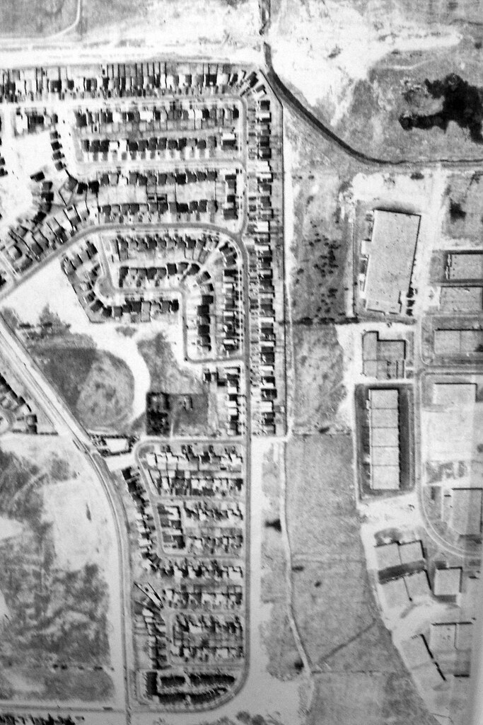
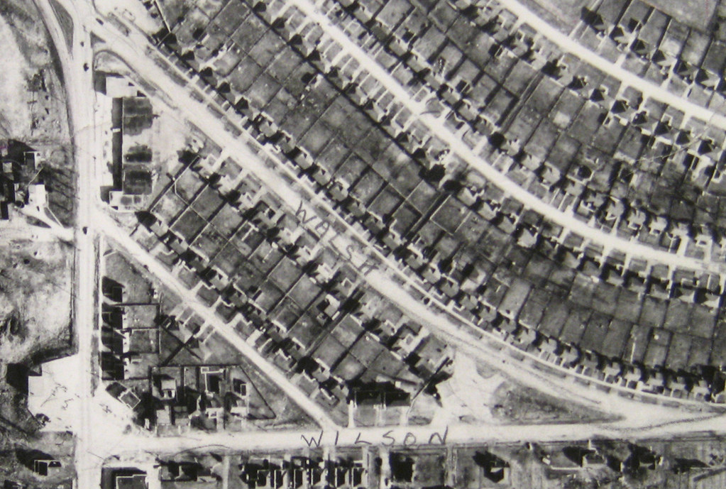
Blondin Road is the little diagonal cut at the lower left. This is how the neighbourhood appeared in 1950. At this time, the 401 had not yet been built. You can see that the handful of homes on Blondin are among the very first in the entire area.
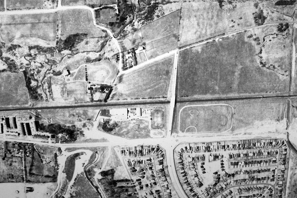
This is how it appeared in 1959. The 401 existed by then and had an pitchfork-shaped offramp at Weston Road just south of what you can see in this view.
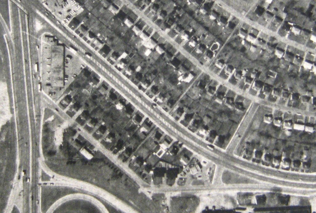
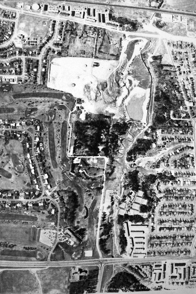
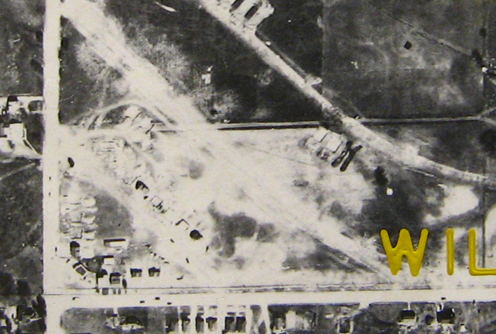
Here's how the neighbourhood looked in 1975. You can see the "new" offramp system of the 401 now, built in the mid-60s. Notice that Wilson Avenue no longer connects to Weston Road, but at the time, Blondin Avenue itself still did. That must have made for some intense moments as people barreled off the 401 into people trying to make turns at 15 mph from Blondin onto Weston. Little wonder that the shots of 1983 show Blondin ending in a cul de sac just shy of Weston. Take note, too, of the plaza at the increasingly complicated intersection of Albion and Weston at the upper left.
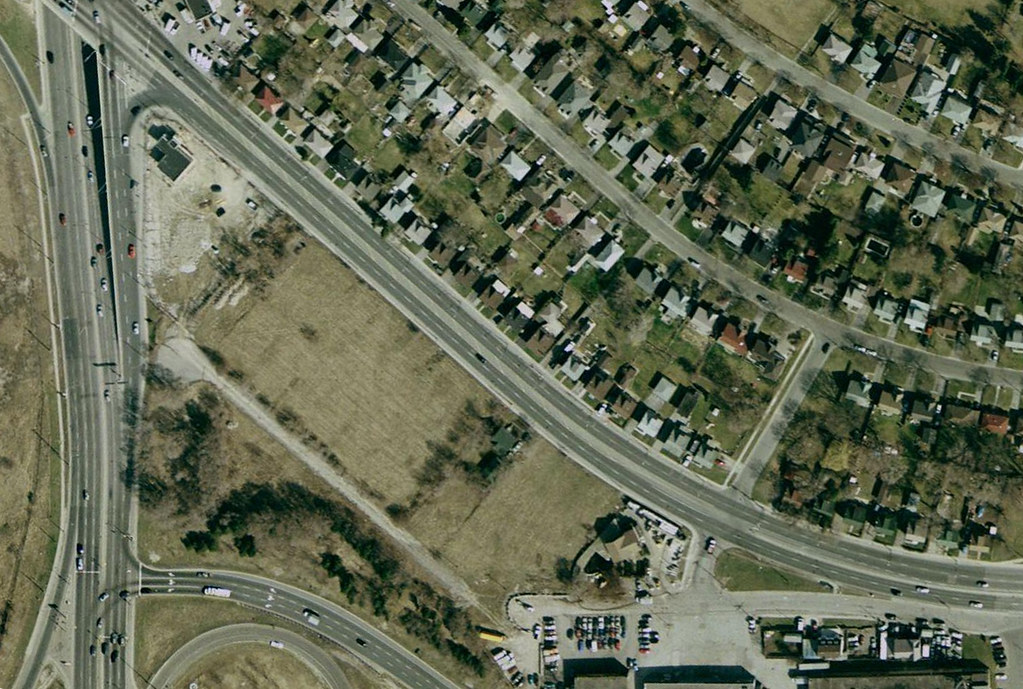
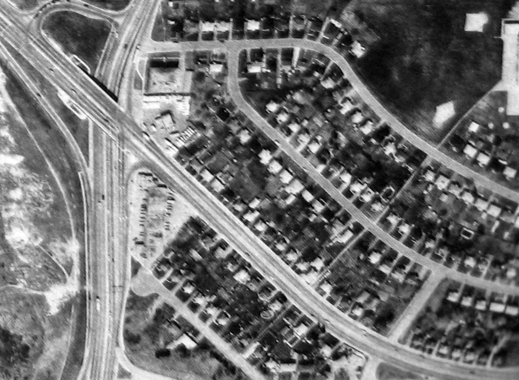
Here's how the place looks today, more or less. Blondin is cut off from the road system, and all its homes are torn down. Amazingly, and inexplicably, so are all the homes on the south side of Walsh... with the single exception of one, #35, which you can see at about the centre of the image. Even the plaza at Albion and Walsh is gone, replaced by a sales office for condos. This image is a screen cap from Google Maps.
Now here's some of what I saw when I was there yesterday (Saturday) to explore what I'd seen from "above"...
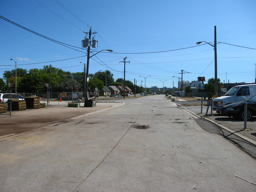
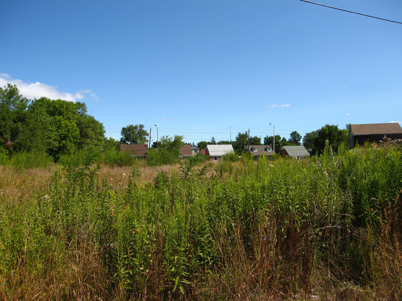
Looking down Wilson Avenue eastward. To the left is Walsh, which in modern times sweeps traffic from Albion to Wilson and Wilson to Albion. What you're seeing here is a largely forgotten, but still open-for-business (literally) butt-end of Wilson Avenue... it's still officially called Wilson Avenue, in fact.
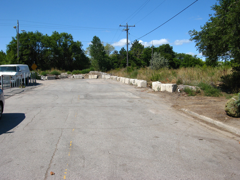
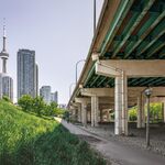
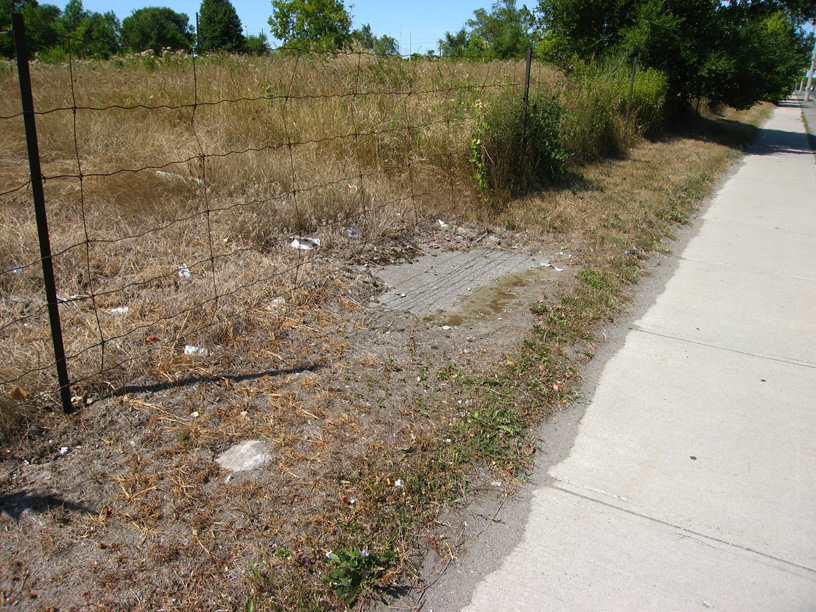
Turning around, this is the view. Until the mid-60s, what you would have seen would be Wilson Avenue straight to Weston Road. When the 401 was expanded from four lanes to the current express-collector system in about 1965, Wilson was cut off from Weston by the land requirements of the new interchange of the 401 at Weston Road. But the intersection of Wilson and Blondin, just the other side of the heap of rubble, was still open. Until fairly recently (and I'm not sure exactly HOW recent; I'm hoping some of you might know), there would have been houses on the right beyond the foreground tree.
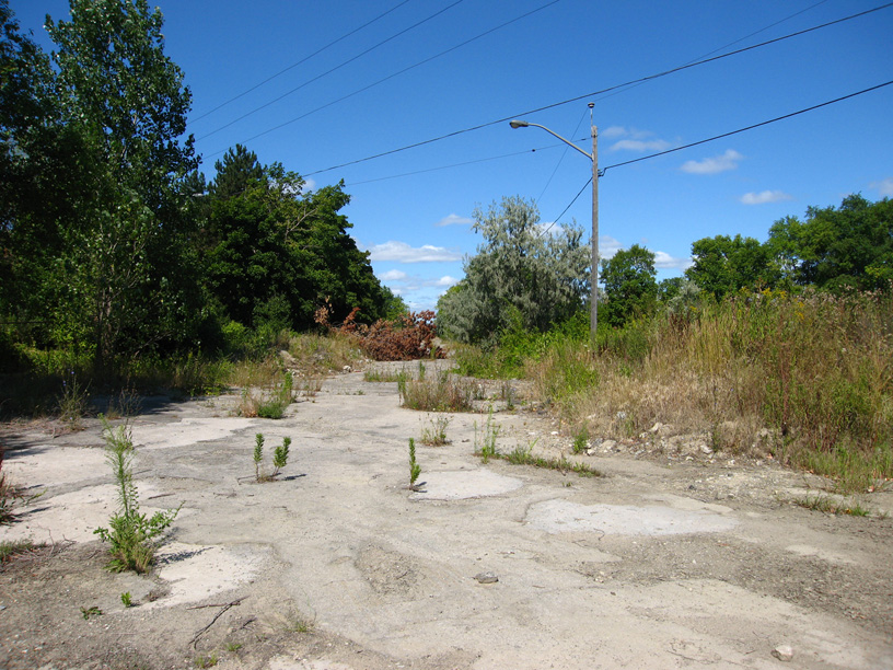
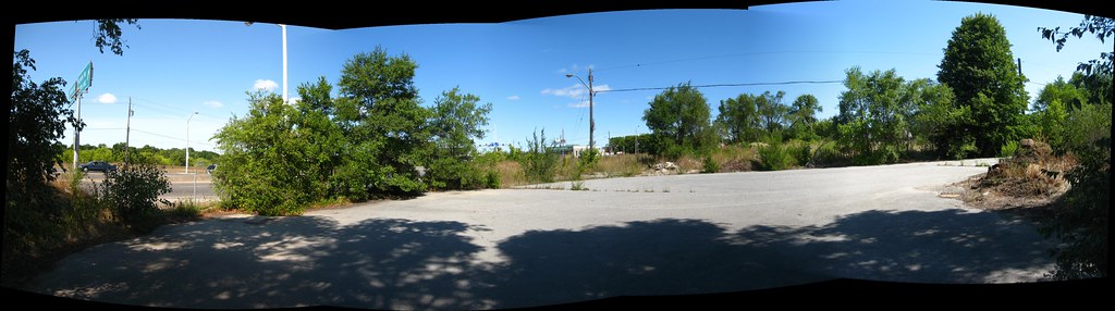
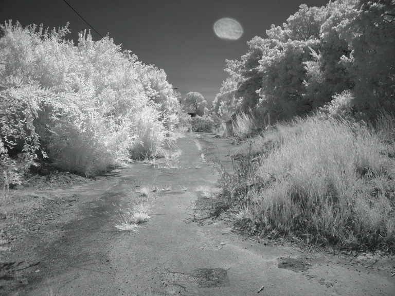
Climbing the rubble that segregates Blondin from the street grid, this was my first view of what was once a tidy residential street. This is Blondin Avenue as it looks today. Jaw-dropping. It looks like something out of the Love Canal Photo Album. I think this scene would be heartbreaking for anyone who once lived there, especially if you grew up on this street. I'm no expert but the rate of decay here suggests to me that the neighbourhood was torn down 10-15 years ago. Does anyone know for sure?
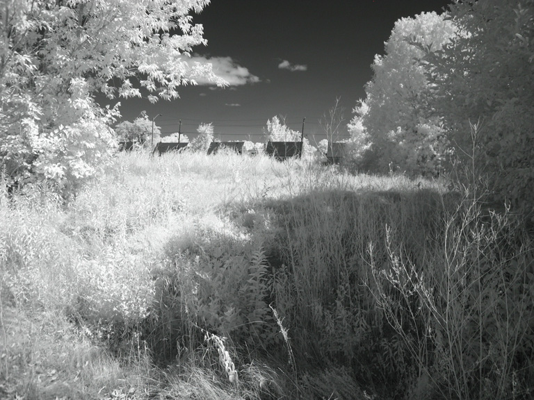
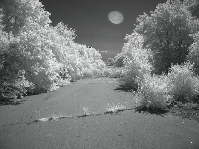
This is an infrared shot of Blondin Road as I moved past the fallen tree above and headed towards a rubble field that seems to have been dumped in the mid-point of Blondin Avenue.
A couple of views across the field that was once two rows of houses and their adjacent backyards. The second, infrared, shot is probably the remains of someone's driveway.

Humanity has a knack for making lemonade from lemons. Here, in the debris field in the middle of a one-time residential street, someone is growing vine vegetables. Looked like plum tomatoes.
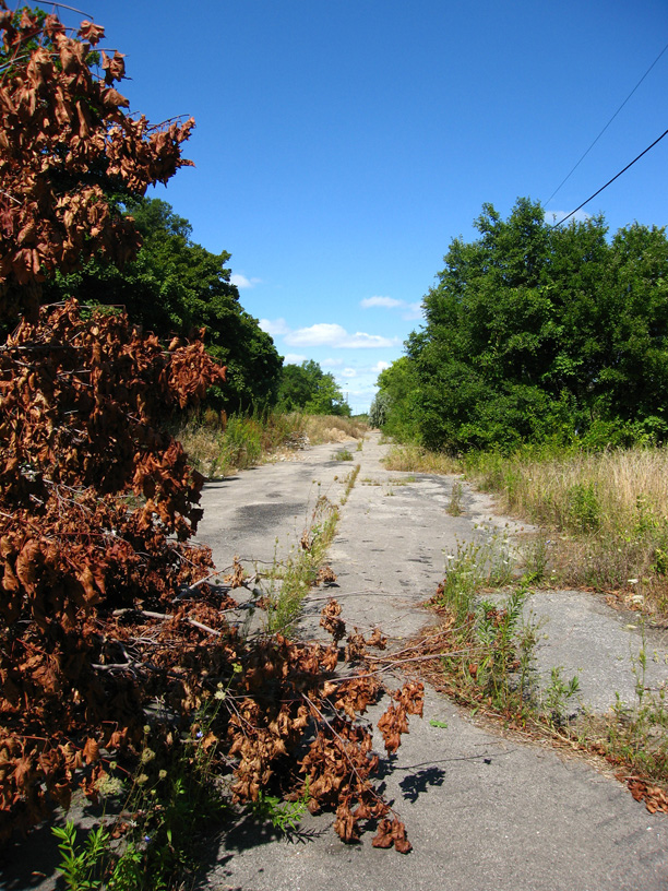
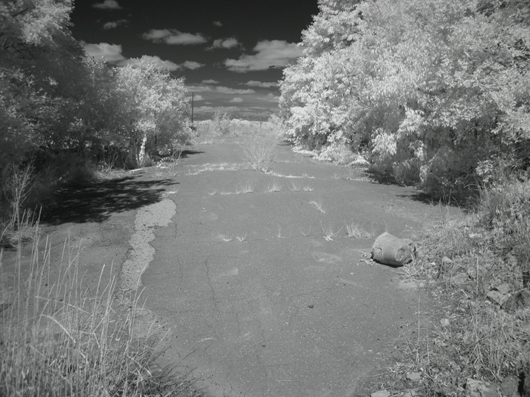
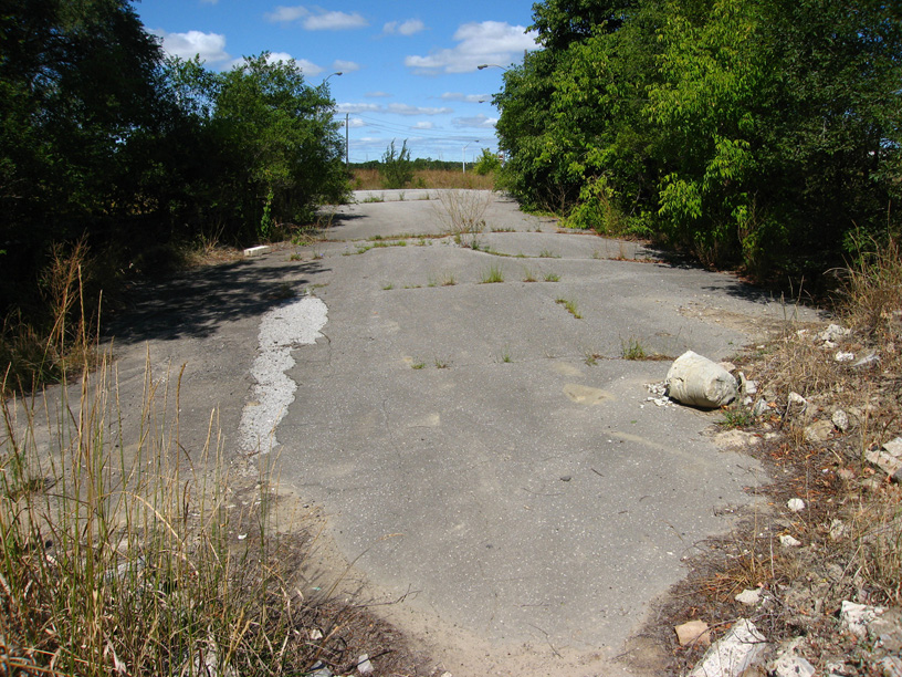
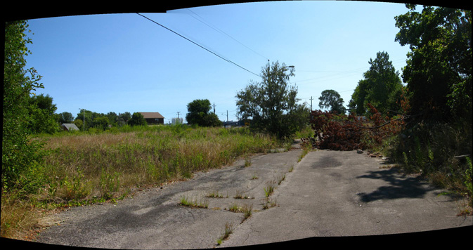
Clearing the debris field and catching an unhindered glimpse of the remainder of the road towards Weston.
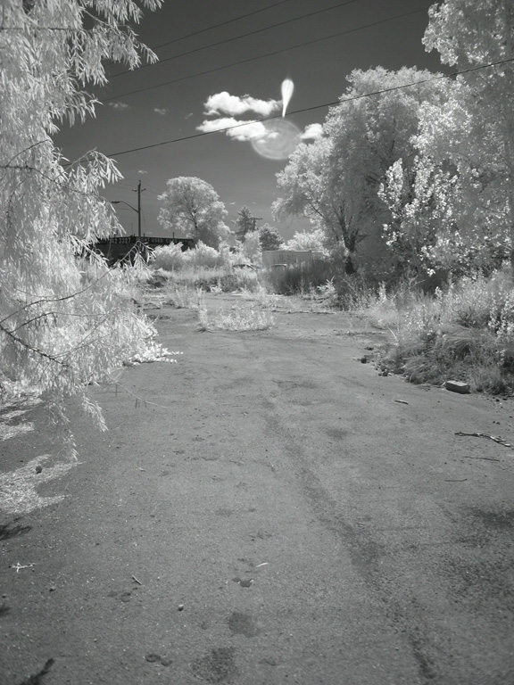
A couple of shots approaching the end of Blondin Avenue, where it once met Weston Road.
Here's the cookie. Today, and for over 20 years now, Blondin Avenue ends in a cul de sac at the very edge of Weston Road, which you can glimpse through the gap in the trees at the left. Beyond the trees on the right, you would have been able to see a plaza at one time. Until sometime around 1980 or so, this would actually have been an intersection exchanging traffic between Blondin Avenue and the northbound lanes of Weston Road. Immediately to my right once stood what appear to be a couple of large multi-unit low-rises, and across the street on the right, there were bungalows... single-unit homes.
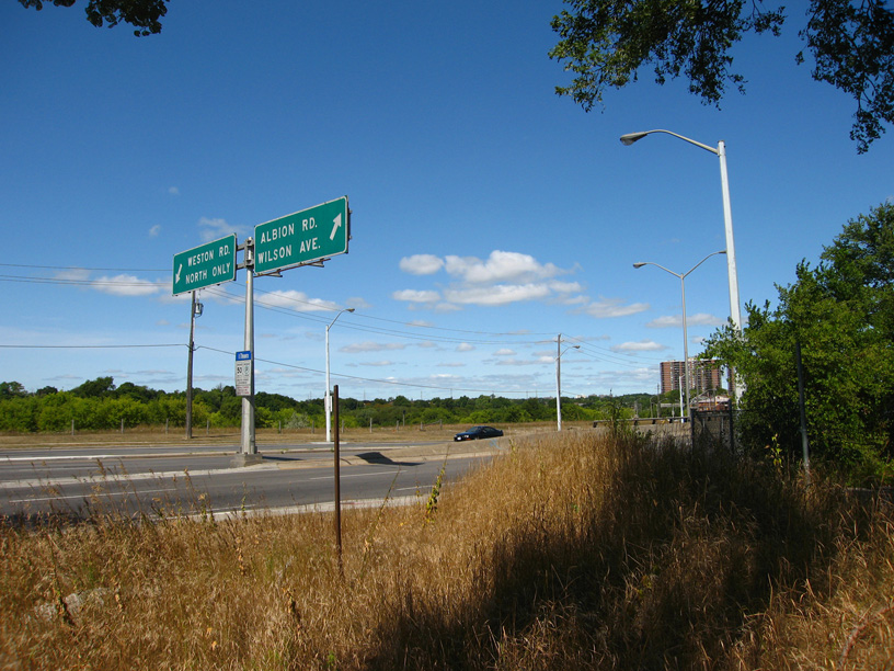
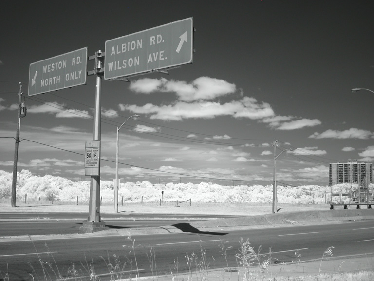
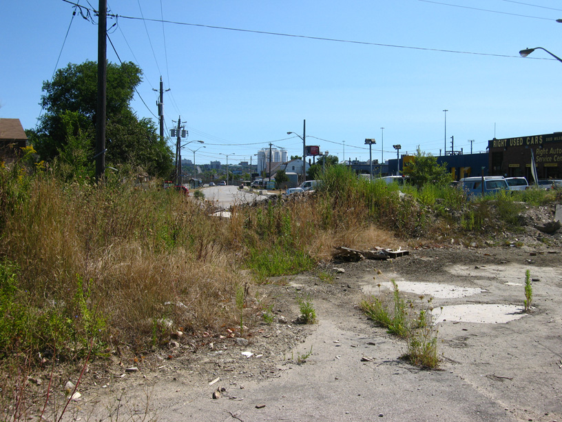
These signs are visible from the field just south of Blondin Avenue and a bit north of the 401 offramp to northbound Weston Road.
At this point, I headed back. Blondin road takes about ten minutes to walk, but part of that is getting over the three or four dunes of sandy debris dumped midway. Anyway, the shots from here on in are the return trip away from Weston and towards Wilson again.
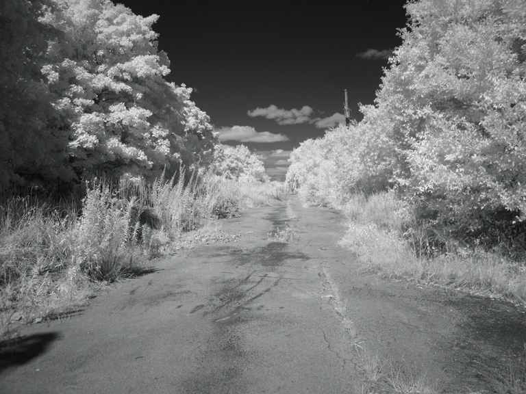
Heading east in infrared, just before the resumption of the debris field in the road.
Views of Blondin heading towards Wilson after clearing the debris field.
This once would have been the view of anyone heading off the work, turning onto Wilson from Blondin... before all the crap was dumped here, of course.")
Having cursorily explored Blondin, I decided to walk up Walsh, the other half of this devastation. I was particularly interested in the state of the one, solitary survivor of all this...
Somebody's driveway once, fronting onto Walsh Avenue.
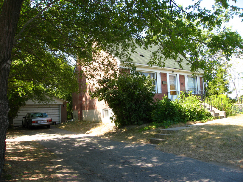
This is the only house still remaining on the south side of Walsh, #35. As you can see by the car and the state of the place, someone still lives here. This is a great mystery. Why only this place? Did everyone else sell except them? Why didn't they sell, then? What's to become of this one, single remainder of that lost neighbourhood?
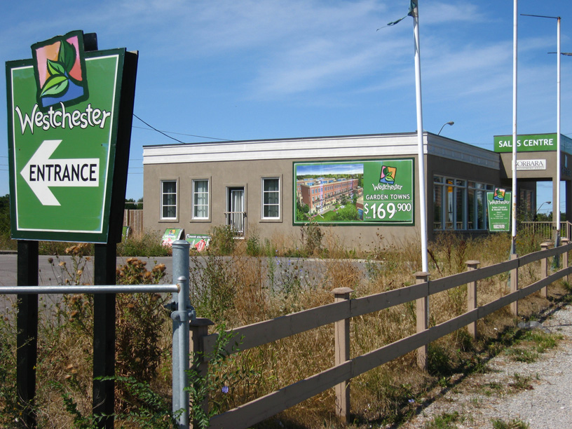
And here it is... looks like it could be the reason for it all. At the corner of Walsh/Albion and Weston Road, where the plaza used to be, is now this small sales office for this development. I wonder how long they've been sitting on the land? Have they owned it all along, or did they just buy it up once the homes were torn down... and if so, why were they torn down in the first place? Are these guys waiting for the moment they can clear #35 off the block as well?
Well, that's the trip. I hope it peaked your interest. If any of you knows something more about the neighbourhood and how and why and especially when it was lost, I've love to learn more.
One of the things I've always been interested in is how cities change at the street grid level. Particularly poignant is when we abandon some place and give it over to nature again. This happens quite a lot; I'm constantly surprised by the number of places that were once common to the public that get lost, and how quickly forgotten they are.
I was at the City Archives on Friday to research the bridge at Flindon Road that once crossed the Humber in the vicinity of Albion Road. In the course of that, I also decided to look up a street a friend of mind spotted on Google Maps and found interesting... a little chunk of pavement still labeled on Google as "Blondin Avenue", but which appeared to be disconnected from the grid. What I found was truly remarkable.
Blondin Avenue used to have a substantial number of homes on it. For about fifty years, dozens of families made their homes there. Equally surprising to me was the discovery that at least as many homes had once been on the south side of Walsh Avenue, which today seamlessly turns Albion Road into Wilson Avenue and vice versa. All of this seems to have changed in just the last decade or so.
Let me start you off with some of the images I got at the Archives, matched to a modern image courtesy of Google Maps.
Blondin Road is the little diagonal cut at the lower left. This is how the neighbourhood appeared in 1950. At this time, the 401 had not yet been built. You can see that the handful of homes on Blondin are among the very first in the entire area.
This is how it appeared in 1959. The 401 existed by then and had an pitchfork-shaped offramp at Weston Road just south of what you can see in this view.
Here's how the neighbourhood looked in 1975. You can see the "new" offramp system of the 401 now, built in the mid-60s. Notice that Wilson Avenue no longer connects to Weston Road, but at the time, Blondin Avenue itself still did. That must have made for some intense moments as people barreled off the 401 into people trying to make turns at 15 mph from Blondin onto Weston. Little wonder that the shots of 1983 show Blondin ending in a cul de sac just shy of Weston. Take note, too, of the plaza at the increasingly complicated intersection of Albion and Weston at the upper left.
Here's how the place looks today, more or less. Blondin is cut off from the road system, and all its homes are torn down. Amazingly, and inexplicably, so are all the homes on the south side of Walsh... with the single exception of one, #35, which you can see at about the centre of the image. Even the plaza at Albion and Walsh is gone, replaced by a sales office for condos. This image is a screen cap from Google Maps.
Now here's some of what I saw when I was there yesterday (Saturday) to explore what I'd seen from "above"...
Looking down Wilson Avenue eastward. To the left is Walsh, which in modern times sweeps traffic from Albion to Wilson and Wilson to Albion. What you're seeing here is a largely forgotten, but still open-for-business (literally) butt-end of Wilson Avenue... it's still officially called Wilson Avenue, in fact.
Turning around, this is the view. Until the mid-60s, what you would have seen would be Wilson Avenue straight to Weston Road. When the 401 was expanded from four lanes to the current express-collector system in about 1965, Wilson was cut off from Weston by the land requirements of the new interchange of the 401 at Weston Road. But the intersection of Wilson and Blondin, just the other side of the heap of rubble, was still open. Until fairly recently (and I'm not sure exactly HOW recent; I'm hoping some of you might know), there would have been houses on the right beyond the foreground tree.
Climbing the rubble that segregates Blondin from the street grid, this was my first view of what was once a tidy residential street. This is Blondin Avenue as it looks today. Jaw-dropping. It looks like something out of the Love Canal Photo Album. I think this scene would be heartbreaking for anyone who once lived there, especially if you grew up on this street. I'm no expert but the rate of decay here suggests to me that the neighbourhood was torn down 10-15 years ago. Does anyone know for sure?
This is an infrared shot of Blondin Road as I moved past the fallen tree above and headed towards a rubble field that seems to have been dumped in the mid-point of Blondin Avenue.
A couple of views across the field that was once two rows of houses and their adjacent backyards. The second, infrared, shot is probably the remains of someone's driveway.
Humanity has a knack for making lemonade from lemons. Here, in the debris field in the middle of a one-time residential street, someone is growing vine vegetables. Looked like plum tomatoes.
Clearing the debris field and catching an unhindered glimpse of the remainder of the road towards Weston.
A couple of shots approaching the end of Blondin Avenue, where it once met Weston Road.
Here's the cookie. Today, and for over 20 years now, Blondin Avenue ends in a cul de sac at the very edge of Weston Road, which you can glimpse through the gap in the trees at the left. Beyond the trees on the right, you would have been able to see a plaza at one time. Until sometime around 1980 or so, this would actually have been an intersection exchanging traffic between Blondin Avenue and the northbound lanes of Weston Road. Immediately to my right once stood what appear to be a couple of large multi-unit low-rises, and across the street on the right, there were bungalows... single-unit homes.
These signs are visible from the field just south of Blondin Avenue and a bit north of the 401 offramp to northbound Weston Road.
At this point, I headed back. Blondin road takes about ten minutes to walk, but part of that is getting over the three or four dunes of sandy debris dumped midway. Anyway, the shots from here on in are the return trip away from Weston and towards Wilson again.
Heading east in infrared, just before the resumption of the debris field in the road.
Views of Blondin heading towards Wilson after clearing the debris field.
This once would have been the view of anyone heading off the work, turning onto Wilson from Blondin... before all the crap was dumped here, of course.
Having cursorily explored Blondin, I decided to walk up Walsh, the other half of this devastation. I was particularly interested in the state of the one, solitary survivor of all this...
Somebody's driveway once, fronting onto Walsh Avenue.
This is the only house still remaining on the south side of Walsh, #35. As you can see by the car and the state of the place, someone still lives here. This is a great mystery. Why only this place? Did everyone else sell except them? Why didn't they sell, then? What's to become of this one, single remainder of that lost neighbourhood?
And here it is... looks like it could be the reason for it all. At the corner of Walsh/Albion and Weston Road, where the plaza used to be, is now this small sales office for this development. I wonder how long they've been sitting on the land? Have they owned it all along, or did they just buy it up once the homes were torn down... and if so, why were they torn down in the first place? Are these guys waiting for the moment they can clear #35 off the block as well?
Well, that's the trip. I hope it peaked your interest. If any of you knows something more about the neighbourhood and how and why and especially when it was lost, I've love to learn more.