


kali
Active Member
^
|
|
|
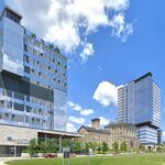
Bike lanes appearing on Ellis btw Queensway and Lake Shore:
View attachment 260828
'
View attachment 260829
Side note here, both the highway and the rail bridges here look beyond rough.
Bike lanes appearing on Ellis btw Queensway and Lake Shore:
View attachment 260828
'
View attachment 260829
Side note here, both the highway and the rail bridges here look beyond rough.
If I was the cycling dictator, I would have used pedestrian and bicycle tunnels next to the existing railway & Gardiner Expressway underpasses at Colborne Lodge Drive, Ellis Avenue and Windermere Avenue, (maybe even under The Queensway at Parkside Drive). Maybe will have to wait for whichever century they have to rebuild the underpasses to include a widening.
As it is, the existing automobile dictators at City Hall would forbid it.
That reminds me - is there a reason why Queensway and Parkside are grade separated?
Seems like they grade separated it from the start when the Queensway was built in the 50s. This picture is from 1956 and you can see the bridge getting built.That reminds me - is there a reason why Queensway and Parkside are grade separated?
In that 1956 photo looking west from Parkside, it looks like they're already building up the grade for The Queensway. Maybe there was a temporary road before moving it up onto the berm?
Interesting tidbits of history, but I still don't see any justification for the intersection to be grade separated. It's annoyed me forever.
I agree.
Did a quick look at the gradient, very rough calculation, looks like the grade from Claude Avenue to Parkside would be ~4% That's very do-able, the streetcars have it much worse climbing Bathurst.
I would love to see Queensway cut back here to one lane each way (which it functionally is after the Queen/King/Roncy intersection.
That way more land could be returned to High Park.
On the other hand, there is one thing to consider, the TTC/City have had issues w/Queensway over the former swampy bit (high water table, settling issues).
That section of Queensway might need to go up in height a bit so that Grenadier Swamp could be reborn around and under it.
To build the Parkside Drive to Ellis Drive section (for the Queen Street West extension, later renamed The Queensway), the Metro government bought 18 acres (7.3 ha) of High Park from the city. This was in contravention of stipulations by original High Park owner John Howard that the lands be used for parkland only. Metro officials searched for descendants of Howard to obtain their consent.
I agree.
Did a quick look at the gradient, very rough calculation, looks like the grade from Claude Avenue to Parkside would be ~4% That's very do-able, the streetcars have it much worse climbing Bathurst.
I would love to see Queensway cut back here to one lane each way (which it functionally is after the Queen/King/Roncy intersection.
That way more land could be returned to High Park.
On the other hand, there is one thing to consider, the TTC/City have had issues w/Queensway over the former swampy bit (high water table, settling issues).
That section of Queensway might need to go up in height a bit so that Grenadier Swamp could be reborn around and under it.