


afransen
Senior Member
I'd like to see more cycling friendly, but it's good.
It's also not just about leafy streets, but having amenities, jobs and regional transit within walking/cycling distance
|
|
|
I'd like to see more cycling friendly, but it's good.
I think we need to move away from the concession model (plowing the grid roads through ravines/river valleys like they aren't there) and build a road network and communities that work with the natural landscape. That would ameliorate the walkability impact of natural landscapes if we are leaving them as boundaries between communities. And the idea that all the density goes on the arterial is kind of a crazy model we have developed in North America. Arterials are roads designed to optimize for flow, and they serve a role in the urban fabric. A road designed for flow cannot also be a street designed for place-making/community. So, let arterials optimize for flow, and don't put dense housing/uses along it. And have streets and paths for place-making and active transportation, with retail, housing, and commercial uses away from roaring traffic. Our cities are built so completely ass-backward it boggles my mind. Nodes of density should be in the centre of blocks of arterials, focused on major transit stations, and not focused on the intersections of arterials, which are highly unlivable.excessive natural heritage policies are also a major issue if you ask me (though I'm sure Northern Light would disagree).
Many newer areas like Seaton are approaching almost 50% of the land area dedicated to natural heritage preservation. It creates instead of a cohesive, walkable residential area, a series of islands connected by arterial roads.
I'm not saying eliminate natural heritage preservation obviously, I don't really know the answer to what's an appropriate level either, it just seems too much as it is now. Reduced buffers from features and a lower standard of what constitutes a feature is likely required.
Each resident has good access to parks, schools, and perhaps some local service retail (barber, convenience store, dentist, etc.) within walking distance, but employment and commercial is still far away for most and requires a vehicle to access reasonably.
I think we need to move away from the concession model (plowing the grid roads through ravines/river valleys like they aren't there) and build a road network and communities that work with the natural landscape. That would ameliorate the walkability impact of natural landscapes if we are leaving them as boundaries between communities. And the idea that all the density goes on the arterial is kind of a crazy model we have developed in North America. Arterials are roads designed to optimize for flow, and they serve a role in the urban fabric. A road designed for flow cannot also be a street designed for place-making/community. So, let arterials optimize for flow, and don't put dense housing/uses along it. And have streets and paths for place-making and active transportation, with retail, housing, and commercial uses away from roaring traffic. Our cities are built so completely ass-backward it boggles my mind. Nodes of density should be in the centre of blocks of arterials, focused on major transit stations, and not focused on the intersections of arterials, which are highly unlivable.
I think we need to move away from the concession model (plowing the grid roads through ravines/river valleys like they aren't there) and build a road network and communities that work with the natural landscape. That would ameliorate the walkability impact of natural landscapes if we are leaving them as boundaries between communities. And the idea that all the density goes on the arterial is kind of a crazy model we have developed in North America. Arterials are roads designed to optimize for flow, and they serve a role in the urban fabric. A road designed for flow cannot also be a street designed for place-making/community. So, let arterials optimize for flow, and don't put dense housing/uses along it. And have streets and paths for place-making and active transportation, with retail, housing, and commercial uses away from roaring traffic. Our cities are built so completely ass-backward it boggles my mind. Nodes of density should be in the centre of blocks of arterials, focused on major transit stations, and not focused on the intersections of arterials, which are highly unlivable.
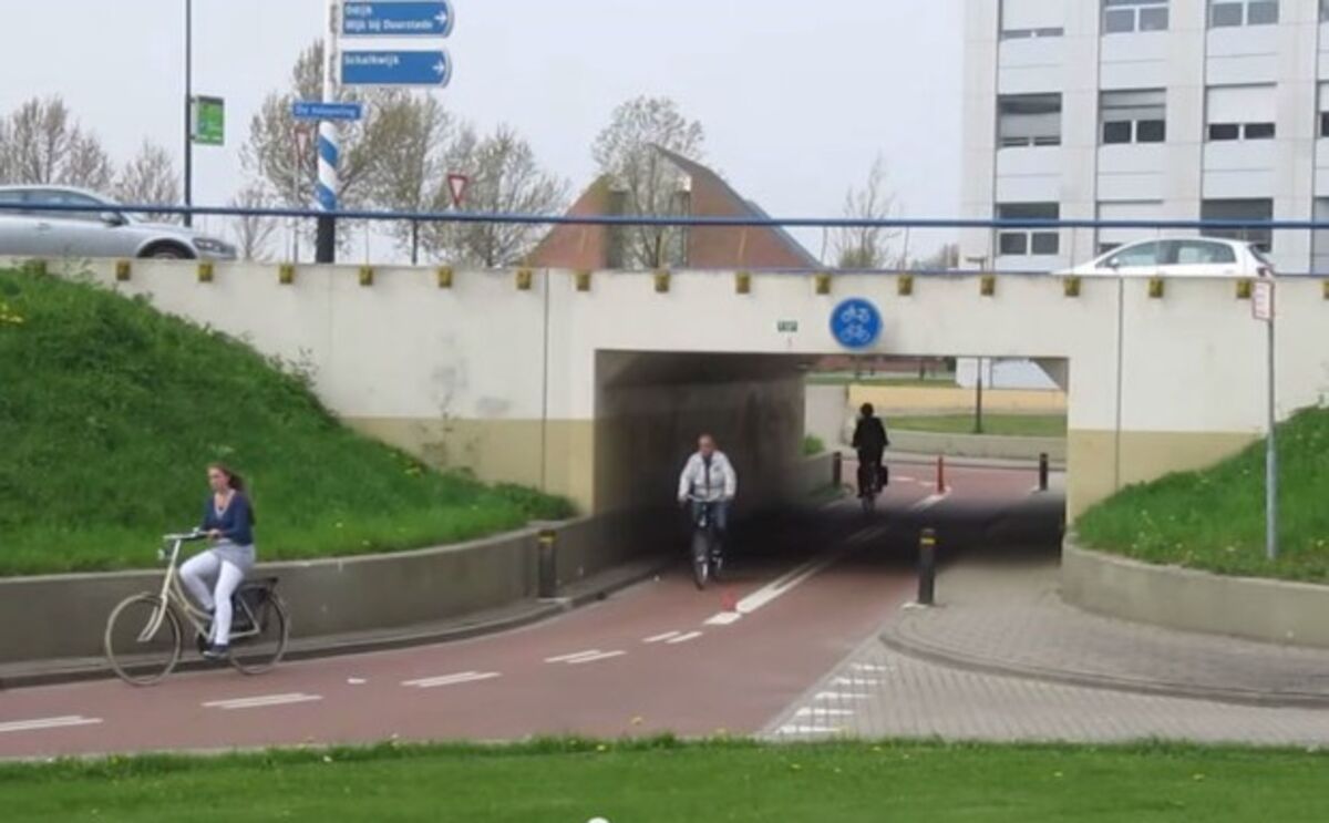
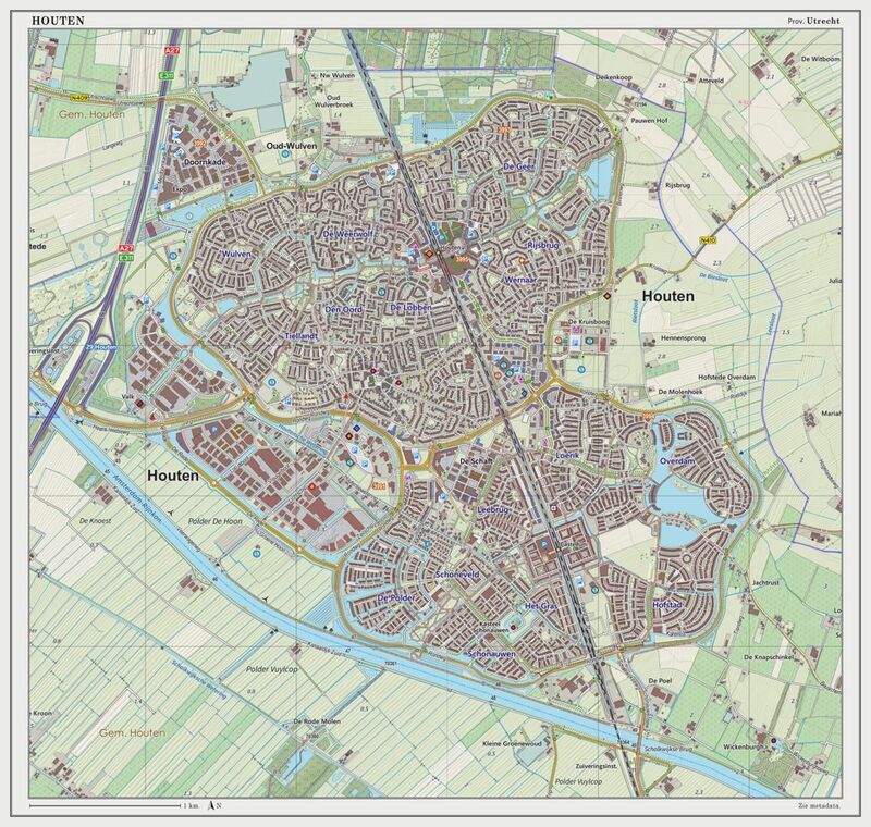
There are different ways to approach it. One is that used in Houten, a suburb of Utrecht in the Netherlands.This criticism stems from the idea that concession roads should prioritize traffic flow. The fact is that we don't need to designate EVERY concession road as a higher order road/proto highway.
Furthermore, what would be the alternative to density along major corridors? Density further away from from the major corridor???
It's also a question of development. Developers do not want to build intermediate roads into their developments and so it's back on the city to demand certain road hierarchies.
 www.bloomberg.com

 on it, here you go!
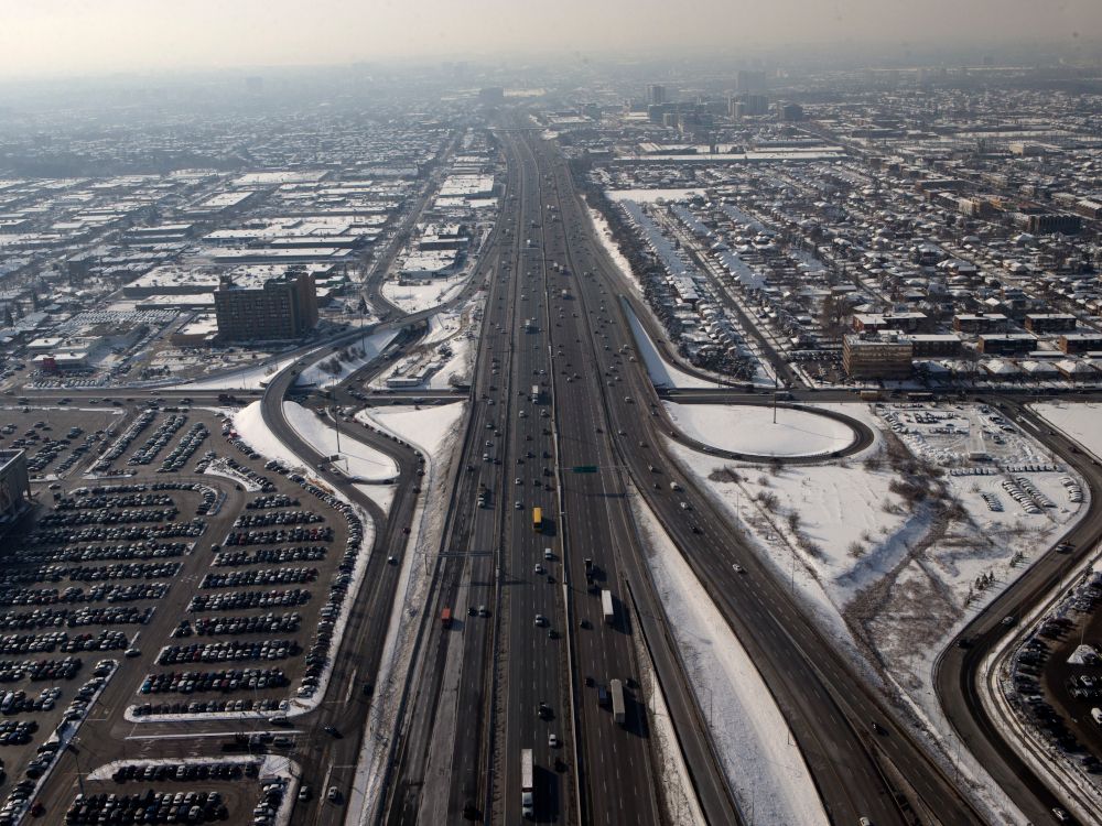
 nationalpost.com
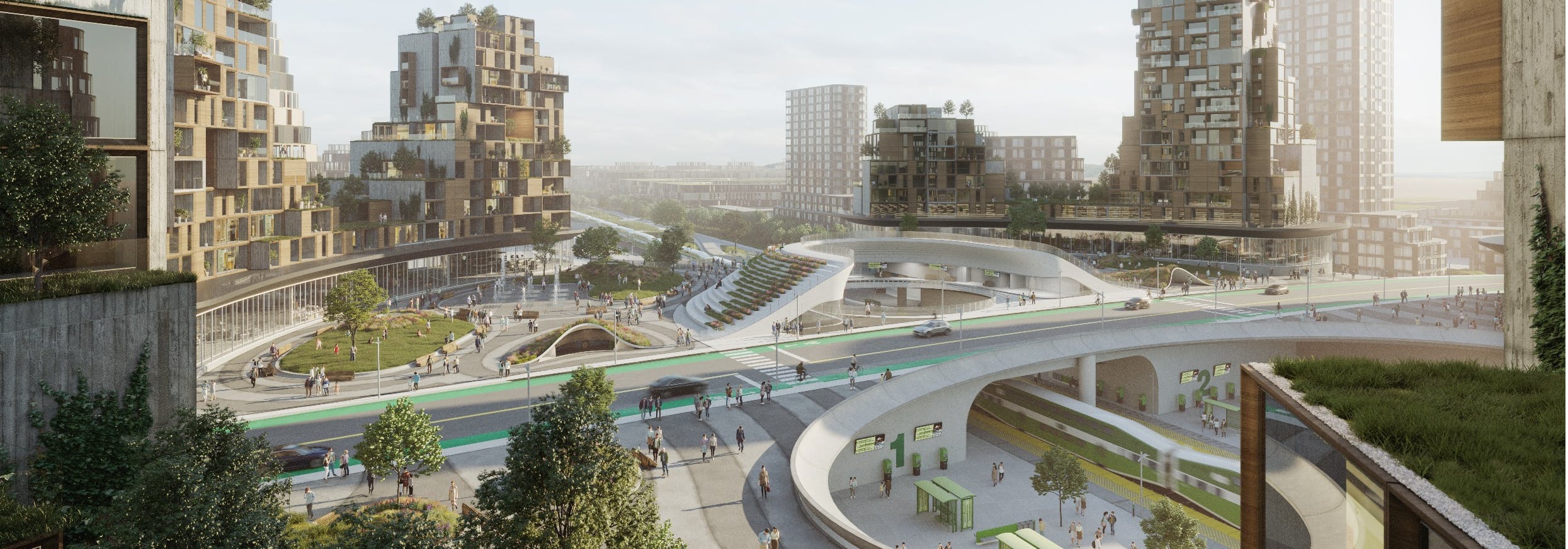
As a surprise to probably no one, I liked this article and thought it made more good points in favour of this highway.Per above, thanks for posting those Innisfil renderings. I love them every time I see them. They're kind of crazy, obviously, but you have to admire the ambition!
Also, this National Post article (supporting the highway, obviously) is pretty terrible and I'm not going to waste time disassembling its logic, line by line, but the mere fact it doesn't even mention the Greenbelt shows you much understanding McParland actually has of the issues at hand. If anyone wants to
Kelly McParland: Sprawl or no, you can't end a housing shortage without building homes
The blame for out-of-control housing prices has been largely placed on the shortage of supply. The answer is to build more homes. But they’ve got to go…
As a surprise to probably no one, I liked this article and thought it made more good points in favour of this highway.
And hey, the author effectually gave a shout out to some of you lol
")
I was pointing it out as an example of wrong-headed, if ambitious, transit oriented development. Particularly the desire to have an arterial road run over the train station at the centre of the community. Just why?Per above, thanks for posting those Innisfil renderings. I love them every time I see them. They're kind of crazy, obviously, but you have to admire the ambition!
Also, this National Post article (supporting the highway, obviously) is pretty terrible and I'm not going to waste time disassembling its logic, line by line, but the mere fact it doesn't even mention the Greenbelt shows you much understanding McParland actually has of the issues at hand. If anyone wants to
Kelly McParland: Sprawl or no, you can't end a housing shortage without building homes
The blame for out-of-control housing prices has been largely placed on the shortage of supply. The answer is to build more homes. But they’ve got to go…
I was pointing it out as an example of wrong-headed, if ambitious, transit oriented development. Particularly the desire to have an arterial road run over the train station at the centre of the community. Just why?