News   Apr 16, 2024
 600     3 
News   Apr 16, 2024
 448     3 
News   Apr 16, 2024
 809     0 

TTC: Streetcar Network

If the Eglinton Crosstown LRT (and Jane LRT) had been designed with the TTC gauge (1,495 mm) instead of standard gauge (1,435 mm), the St. Clair streetcars (and Junction streetcar) could have used the Mt. Dennis facility.

Too bad the Wychwood barns couldn't be reused. In its heyday, it could have handled 160 PCC streetcars (equal to 80 Flexity Outlooks), served mostly Weston, St. Clair, Rogers, Oakwood, and Bathurst streetcar routes.

streetcar-4303-05.gif

From link.

Wychwood would have been problematic for flexities given it's age and capabilities. For new cars you need new facilities.
 
If the Eglinton Crosstown LRT (and Jane LRT) had been designed with the TTC gauge (1,495 mm) instead of standard gauge (1,435 mm), the St. Clair streetcars (and Junction streetcar) could have used the Mt. Dennis facility.

Too bad the Wychwood barns couldn't be reused. In its heyday, it could have handled 160 PCC streetcars (equal to 80 Flexity Outlooks), served mostly Weston, St. Clair, Rogers, Oakwood, and Bathurst streetcar routes.

streetcar-4303-05.gif

From link.

I have to say, I rather like what's been done w/Wychwood.

The farmer's market there is great.

Nice to have that space for the community.

Though I also think it would have made sense to maintain either a portion of the facility as storage/wash only (no maintenance to speak of) or, alternatively, find another location to serve St. Clair at the top of the hill, if only to avoid the deadhead time.

Hillcrest will serve that purpose it seems, and that works.

Though there was likely an opportunity (20 years ago) when the land was being repurposed, to consider moving the yard to somewhere near Gunn's loop (the old stockyards lands).

*****

In terms of Wychwood's ongoing usability, its important to note the site was in disrepair prior to its adaptive reuse.

It certainly was restorable.

I'm not certain about holding 80 Flexities, at first blush, I got a number closer to 60, but I probably left a bit of slack to assume not fully nose-to-tail and ensure they weren't sticking out into the roadway.

The facility certainly wasn't designed with maintenance from the top in mind.

I'm sure a retrofit would have been possible; though I don't know how practical.
 
  • Like
Reactions: syn
...

Though there was likely an opportunity (20 years ago) when the land was being repurposed, to consider moving the yard to somewhere near Gunn's loop (the old stockyards lands).

...

There's all that empty parking lot space next to the Home Depot at Gunn's Loop that could be converted to streetcar storage.

From link.
1602980176170.png
 
I wonder if Metrolinx/TTC will have to construct some new streetcar trackage as part of the Ontario Line - it remains to be seen how disruptive the construction will be, and whether they'll run any Queen service at all, or just divert it temporarily as and when required. Vancouver have wired up alternative routes for their trolleybuses as part of the Broadway Subway project.

Where would "diversionary" trackage, additional loops, reconfigured intersections be useful?

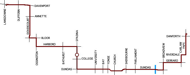
They should extend the 505 DUNDAS streetcar tracks eastward from Broadview Avenue over to, at least, Carlaw Avenue. Making the GERRARD STATION the east-end terminal for the 505.

They could use Gerrard Street (reminiscent of the old HARBORD streetcar), but since they extended Dundas Street East back in the 1950's, they forgot to install streetcar tracks when they did.

harbord15.gif

From link.
Will require an EA, has to be tunnel and not sure if Pape Station can handle a loop and buses. Don't forget the Ontario Line as it will kill that idea.

You could extend 505 on Dundas to Carlaw that would require and EA and run in mix traffic, but expect an uprising from the NIMBY's.
 
I wonder if Metrolinx/TTC will have to construct some new streetcar trackage as part of the Ontario Line - it remains to be seen how disruptive the construction will be, and whether they'll run any Queen service at all, or just divert it temporarily as and when required. Vancouver have wired up alternative routes for their trolleybuses as part of the Broadway Subway project.

Where would "diversionary" trackage, additional loops, reconfigured intersections be useful?
Given Moss Park station is now being built under the park, they can probably run the 501 until Church St before having to divert it down to probably King (or potentially they could use Richmond and Adelaide). The area where we could see a big issue for streetcars is Queen and Spadina, depending on the construction method, as that could disrupt the 501 and 510. But if they can avoid that problem, then the 501 could use Spadina to return to Queen St.

We also could see some impacts on the 504 and 511 depending on how they build King/Bathurst Station.
 
Will require an EA, has to be tunnel and not sure if Pape Station can handle a loop and buses. Don't forget the Ontario Line as it will kill that idea.

You could extend 505 on Dundas to Carlaw that would require and EA and run in mix traffic, but expect an uprising from the NIMBY's.
Question drum - when would an EA be required? Would a new block of streetcar trackage require one?
 
Question drum - when would an EA be required? Would a new block of streetcar trackage require one?
It depends on a number of things as well what type of EA. If tackage exist on the surface or cover over with asphalt and depending what been asked for, you may or may not need an EA. St Clair required an EA since it was being converted into an ROW.

If no track exist you will need an EA for that one block or X blocks.

Again, the type of EA can be 6 months to an year plus depending what is been requested.

There was talk about putting Dundas tracks back into service from Dundas West Station to Runnymede and then connecting it to St Clair before Dundas Road was rebuilt. Since the tracks exist under the asphalt, there would be no need for an EA on Dundas and TTC could tear the existing tracks up and rebuilt them. An EA would be require to take the tracks from Dundas to St Clair since no tracks were every place for that area. You would be looking a 6-12 months time frame for the EA. It also if there is strong NIMBY's, it could/will be longer.

The St. Clair Avenue to Dundas Street via Runnymede Road connection probably wouldn't a need EA. Using Jane Street and/or Scarlett Road would need one.

From link.

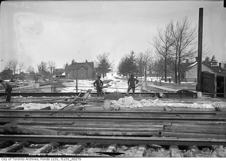
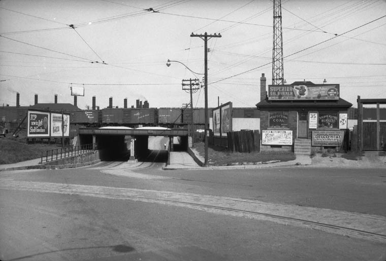
runnymede_1912.jpg

Runnymede Road subway under construction. Looking north towards St.Clair Avenue.
Large house at left sits where Lambton roundhouse would be built. March 23, 1912

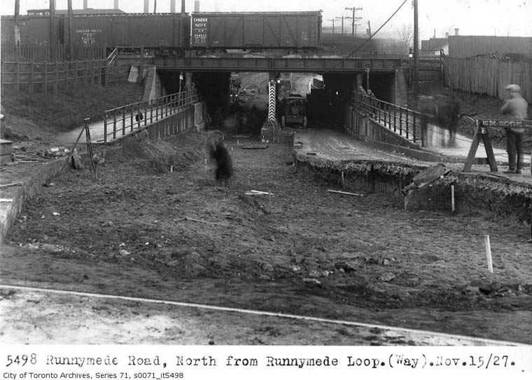
runnymede_1927n.jpg

runnymede_1927s.jpg

runnymede_tracks2.jpg

runnymede_tracks1.jpg

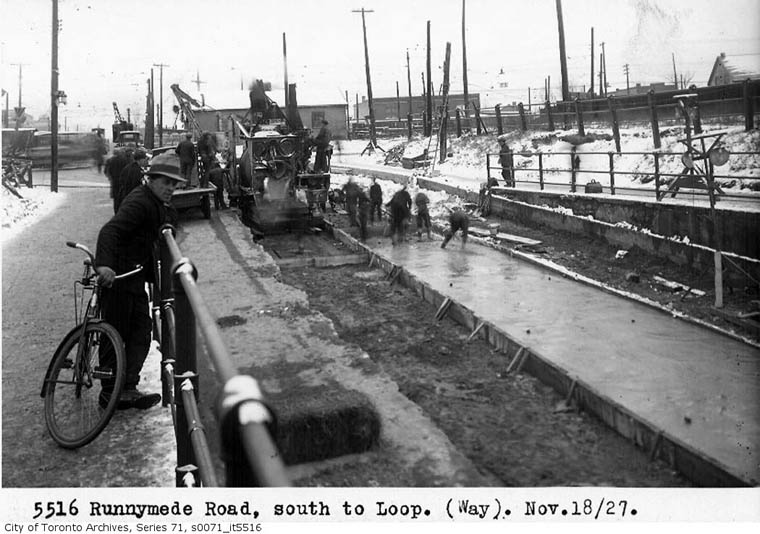
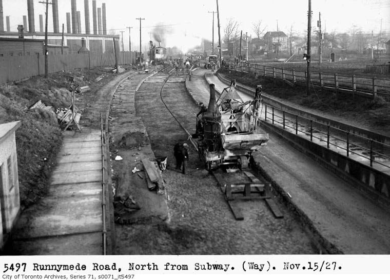
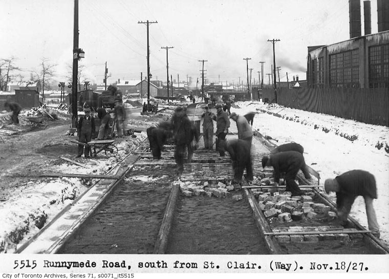
Laying streetcar tracks on Runnymede Road (looking south from St.Clair) to reach the planned Britannia Division car barn north of St.Clair Avenue West, mostly east of Runnymede.

runnymede_1957.jpg

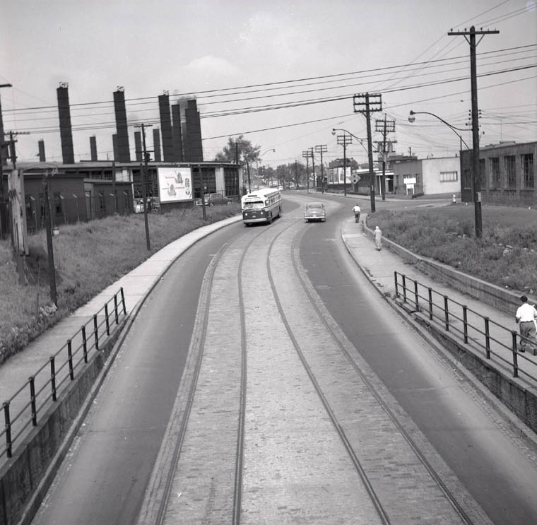
Looking north from the Runnymede bridge showing never-used TTC tracks. Note the TTC Runnymede bus and the jog to bring street into York Township since the City of Toronto would not pay for it! August 31,1957.
runnymede_1954.jpg

Looking north on Runnymede, showing TTC track curving into the loop and unconnected tracks going under subway towards St.Clair to reach a planned car barn off Britannia Avenue which was never built. These tracks were visible for decades, then paved over and finally removed during construction of the new underpass in 1982.
Yes it does require an EA as not only the tracks don't exist, but there never been a 512 line this far west. The idea was to shorten 512 travel route to/from the yard.

If Hillcrest becomes the yard for 512, then no need for what was proposed for Dundas. Then 512 was to go west a lot further than Runnymede.

Should the Jane LRT be built south of Eglinton Avenue towards Line 2, it would make sense to extend the 512 to Jane/Scarlett. As a bus route, the 35 Jane and 935 Jane are already one of the busiest bus routes for the TTC.

Maybe that is why they don't want to extend the 512 to Jane/Scarlett because it would make the 35/935 THE busiest bus route.

How would they do that when the LRT is standard gauge?
 
Should the Jane LRT be built south of Eglinton Avenue towards Line 2, it would make sense to extend the 512 to Jane/Scarlett. As a bus route, the 35 Jane and 935 Jane are already one of the busiest bus routes for the TTC.

Maybe that is why they don't want to extend the 512 to Jane/Scarlett because it would make the 35/935 THE busiest bus route.
Jane LRT needs to go south of Eglinton and has to be underground just like Eglinton for narrow road. You don't stop there, but continue south to the Lake Shore.

Taking it one step further, you replace the LRT with the Ontario Line to form a U. The idea of a U goes back as far as 2006 when I drew a Master GTA Transit Plan for the Transit Summit and had never seen any of the transit plan for Toronto.
25511786271_4080e4b79a_b.jpg
 

Back
Top