We've come a long way from the days a hundred years ago when new neighbourhoods were built by cutting down all the trees, flattening the hills, using their dirt to fill in river valleys, and putting the rivers into sewers. The current plan for the new town of Seaton in north Pickering is a perfect example. River valleys and natural corridors traverse the new community, ensuring that no neighbourhood is far from a forest or stream. The plan is progressive when it comes to preserving natural areas, but when it comes to the actual layout of the community and its transit accessibility, it's no better and perhaps even worse than the sprawl that has been built for decades. The problem is that these purportedly highly progressive and sustainable plans nevertheless betray antiquated thinking on transportation and land use.
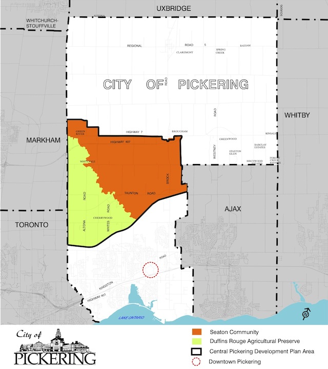 Seaton in Context, from the Central Pickering Development Plan
The plan for Seaton was completed less than a decade ago in 2006, but does the model hold up today? Rather than locating employment areas around a rail transit hub at the heart of the community, they are relegated to a sprawling strip at the far north end along Highway 407 not even centred on the planned transitway stops. Meanwhile, the rail corridor that is marked for passenger service is at the far southern edge surrounded by low-density housing and woodlands. The otherwise admirable inclusion of natural corridors only serves to further divide the residential neighbourhoods from commercial areas and make the community even less walkable. It's clear that, like most suburban GTA communities, most people will drive to shops and businesses along the highway or Taunton Road to work or do their shopping. The siting of rail stations on the edge will do nothing to encourage intensification and walkable communities.
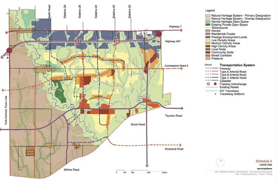 Seaton Land Use Map, from the Central Pickering Development Plan
The same problem is apparent in the 2009-completed plan for the new town of Queensville, north of Newmarket in York Region. It doesn't have any provision at all for rail service. All of the employment areas and even a proposed post-secondary education institution are centred on the interchanges of the new Highway 404 extension. That's not transit-oriented planning. If a university or college ends up being built, GO will undoubtedly have to provide dozens or even hundreds of expensive bus trips per day like it's doing at UOIT. It's far better to build a university or college at a transit hub, which lowers the cost of transit provision and makes it much more convenient for the majority of students who don't own cars.
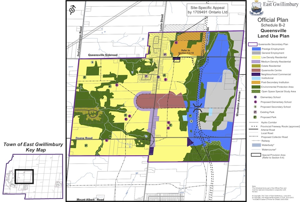 Queensville Map from the East Gwillimbury Official Plan
A better approach would be to take advantage of areas that are still farmland to preserve a corridor for rail service through the heart of the development either as a spur or a diversion from the existing line. A rail station with frequent service could serve as a centrepiece of the community that would encourage the development of both high-density residential and walkable commercial areas. These cities built from scratch provide the opportunity to create, for the first time, a 905 community truly built around the transit station and not the highway interchange.
Jonathan English is a doctoral student in Urban Planning at Columbia University. His blog is Transit Futures.

 2.4K
2.4K 


