News   Apr 19, 2024
 1.3K     0 
News   Apr 19, 2024
 750     2 
News   Apr 19, 2024
 1.2K     3 

Toronto Urban Sprawl Compared to Other Cities

The transit ridership and transit mode share of the NYC urban area is about the same as the Toronto urban area. So I don't understand why you are arguing for weighted density on that basis.

Manhattan comprises less than 10% of the population of the NYC urban area. Your hypothetical urban area of 90% the population living at Manhattan-level densities would be a ridiculously, insanely dense urban area - far denser than your hypothetical 100% Brampton urban area, by any measure.
Nope, the 90% Manhattan-like city would be a similar density to the 100% Brampton-like city if it's surrounded by ultra-low density sprawl.

10 million people at 28000 pop/km2 = 357 km2
11 million people at 2800 pop/km2 = 3571 km2 (approximate density of built up part of Brampton)

That means that for the remaining 1 million people to take up 3214 km2, the density would have to be 311/km2, which is about the density of the ultra low density sprawl that takes up a large part of New York's urban area.
https://www.google.ca/maps/place/Ro...2dd5ccb02e4bfa!8m2!3d40.6300586!4d-74.5473329

The reason why I brought up weighted density is because I feel it should in theory more closely reflect the potential for transit mode share. The truth is Canadian cities seem to do better for transit use regardless of which method of density measurement you use. If you were to add the Bay Area, Montreal, Edmonton and Ottawa to your graph, that would be clear. Or maybe San Diego or Las Vegas - reasonably dense cities with pretty damn low transit mode share.
 
Almost every resident of the Milton urban area works in Mississauga or Oakville, in the Toronto urban area. But most residents of the Oshawa urban area work in the Oshawa urban area.
ok... So for the east end, Ajax-Pickering would be like the equivalent of Oakville and southern York would be equivalent to Mississauga.

56.4% of Milton residents work in Toronto, Oakville or Mississauga
58.8% of Whitby residents work in Toronto, Ajax-Pickering or Vaughan/Richmond Hill/Markham

When you consider that Whitby already has a higher percentage working in Toronto proper than Milton, and then combine that with the fact Ajax-Pickering and Southern York have stronger commuting ties to Toronto than Mississauga or Oakville do (even Whitby itself has higher commuting rates into Toronto than Mississauga and Oakville), then that shows that Whitby has significantly stronger ties to Toronto than Milton does. Oshawa and Clarington are more independent, so it evens out to the Oshawa CMA being comparably closely tied to Toronto as Milton.

And it's only 51.0% of the Oshawa area (Oshawa, Whitby, Clarington) that works in the Oshawa area. That's not super high when you consider it's 52.1% for Mississauga, so Mississauga is more "self sufficient" than the Oshawa area.
 
NEWS RELEASE

ONTARIO FARMLAND TRUST

*************************
Farming groups unite to call on province to freeze urban boundaries now

Guelph, ON – For the first time, all of Ontario’s major farm organizations, representing some 52,000 farms and 78,000 farmers, have come together to present a strong, united message to the province: freeze urban boundaries now to stop urban sprawl and protect farming in the Greater Golden Horseshoe (GGH).

“The province needs to impose real boundaries on urban expansion, not more restrictions on farming,” says Keith Currie, President of the Ontario Federation of Agriculture (OFA). “Hard municipal growth boundaries must be part of the solution to supporting agriculture in the GGH so we don’t pave over the region’s farmland and displace more farm families and farming communities.”

OFA is joined by fifteen other agriculture organizations that are calling for stronger provincial leadership on farmland preservation, including the Ontario Farmland Trust (OFT), Christian Farmers Federation of Ontario (CCFO), National Farmers Union-Ontario, and the Golden Horseshoe Food & Farming Alliance.

The agriculture groups say that the province’s recently proposed changes to the Growth Plan for the Greater Golden Horseshoe and Greenbelt Plan fail to protect the majority of farmers and farmlands in the region from ongoing and poorly-planned urban sprawl. They are concerned that the proposed new policy reinforces and enables status quo sprawl, making it difficult to see a future for local food and farming in the region.

“Nothing is more fundamental to protecting farmland and achieving the goals of the Growth Plan than freezing urban and rural settlement boundaries,” explains CFFO President Clarence Nywening. “This holds municipalities accountable to meeting their growth targets by using urban lands more efficiently and supporting denser, transit-oriented developments rather than allowing councils to be passive and complacent about sprawl.”

The province’s population growth projection of 4.5 million new residents by 2041 is being used by developers to argue that more farmland should be designated for urban uses in the GGH.

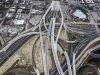
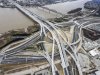
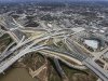
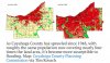
However, independent research by the Neptis Foundation and others shows that more land for urban development in the region is not needed, with an excess of 25 years’ worth of farmland already designated by municipalities to accommodate growth in both urban and rural settlement areas. An area of prime farmland 1.5 times the size of the City of Toronto is in the process of being converted to housing subdivisions, warehouses and strip malls.

Not just home to the best farmland in Canada, the Greater Golden Horseshoe is home to one of North America’s largest agricultural and agri-food industry clusters, with a unique diversity of primary farm production, food processing, food service, food distribution and retail that represents the fastest growing employment sector in Ontario and generates $12.3 billion in annual economic activity.

Citing the outpouring of public support for a larger provincial role in establishing firm urban boundaries and protecting agricultural land during the Coordinated Land Use Planning Review, Norm Ragetlie, Chair of the Ontario Farmland Trust, says that “We are at a unique moment in history where there is an opportunity for the province to demonstrate real leadership in growth planning by enacting meaningful limits on urban expansion. Everyone wins when we design better planned, healthier urban and rural communities, while also creating an environment for farming and the agri-food economy to remain prosperous, and working together to protect farmland forever.”

All groups calling for a freeze on urban boundary expansion include: the Ontario Farmland Trust, Ontario Federation of Agriculture, Christian Farmers Federation of Ontario, National Farmers Union – Ontario, Golden Horseshoe Food & Farming Alliance, Sustain Ontario, Ecological Farmers Association of Ontario, Preservation of Agricultural Lands Society, Food & Water First, Farms at Work, FarmStart, Land Over Landings, Langford Conservancy, Sustainable Brant, and the Simcoe County Greenbelt Coalition.
https://www.guelphtoday.com/local-n...s-have-had-enough-of-your-urban-sprawl-477429
 
Louisville’s “Spaghetti Junction” is a testament to how cars degrade cities
Doubling down on auto infrastructure, Kentucky-style.

See link.

Dwight D. Eisenhower’s grand scheme to connect US cities to one another with interstates was a great idea. It enhanced trade, economic development, and mobility.

By contrast, jamming interstates and freeways through cities — something Eisenhower never envisioned — was a terrible idea. The power of cities is in the connections that form among people and institutions in close proximity. Intra-urban freeways destroy that connectivity. They chop cities into pieces, creating disconnected zones, isolating people from business districts and often from urban waterfronts. They occupy enormous swaths of valuable land but produce no tax revenue; they only absorb revenue in maintenance costs.

What’s more, the impact of urban freeways is not evenly distributed. It is most often poor communities and communities of color that are displaced to build freeways, and it is most often those communities that get herded into low-value zones adjacent to freeways.

Some cities have made the bold choice to remove freeways altogether. The evidence from those experiments is overwhelmingly positive — see this post, or this one, for some examples (and great before-and-after pics); see here for a more formal list of case studies. I am not aware of a single example of a city that removed an urban freeway and later decided that doing so was a mistake.

However, the notion that you can rip out a freeway, traffic will simple disperse, and the reclaimed land will produce more value than what it replaced is highly counterintuitive to most people, including most city officials. Despite copious empirical evidence to the contrary, they simply cannot shake the notion that traffic is a static quantity that will flood onto urban surface streets if freeways are gone.

We know why freeway closures don’t cause traffic problems, at least at a general level: Commuting drivers choose other regional routes, local drivers choose other forms of transport, and thanks to the new land uses and connections freed up by freeway removal, fewer people need to travel long distances. At this point, we probably shouldn’t be surprised anymore.

Nonetheless, people still don’t believe it, so many cities, stuck with urban interstates and freeways, see no choice but to double down, chasing the “sunk costs” of all that asphalt with more spending and more building.

Cities need to start thinking about themselves as cities, as places to be, to live and work, not as bits of infrastructure designed to move goods and people around. Louisville has bet big on auto infrastructure, and it will be paying the price for a century.
 

As annoyed as I was that Toronto chose not to tear down the Gardiner, I'm just glad we have nothing like this in our downtown:


636178220532488699-SpaghettiJunction06.jpg


636178221234814205-SpaghettiJunction11.jpg


636178221866938361-SpaghettiJunction17.jpg


Furthermore, the tolling system they put in place rewards people who drive more often.

http://cityobservatory.org/for-whom-the-bridge-tolls/
 

Attachments

  • 636178220532488699-SpaghettiJunction06.jpg
    636178220532488699-SpaghettiJunction06.jpg
    114.6 KB · Views: 992
  • 636178221234814205-SpaghettiJunction11.jpg
    636178221234814205-SpaghettiJunction11.jpg
    104.9 KB · Views: 887
  • 636178221866938361-SpaghettiJunction17.jpg
    636178221866938361-SpaghettiJunction17.jpg
    115.7 KB · Views: 1,011
We may not have these junctions downtown but we certainly have them in Toronto. Look at Yorkdale junction at Allen/401 or the spaghetti of roads and highways around Pearson.
 
We may not have these junctions downtown but we certainly have them in Toronto. Look at Yorkdale junction at Allen/401 or the spaghetti of roads and highways around Pearson.

I agree but at least it was in greenfield land at the time they were built. Neighbourhoods were not destroyed to build it, and they don't wall off the city from the waterfront. That's why urbanists in Louisville are upset about this.
 
As annoyed as I was that Toronto chose not to tear down the Gardiner, I'm just glad we have nothing like this in our downtown:


View attachment 95278

View attachment 95279

View attachment 95280


Furthermore, the tolling system they put in place rewards people who drive more often.

http://cityobservatory.org/for-whom-the-bridge-tolls/

Do the people who love those highway intersections, the same ones who complain about the real estate used by the new Line 1 subway extension stations?

14766-41093.jpeg
 
Cleveland, 1948 vs 2002. Same amount of people, 100s of miles of extra roads & pipes to pay for.
Screen Shot 2017-03-01 at 3.59.16 AM copy.jpg


Cleveland in 1920: 796,841 people, 56.4 sq. mi., 14,128 per sq. mi.
Cleveland in 2010: 396,815 people, 77.7 sq. mi., 5,107 per sq. mi.

Akron in 1920: 208,435 people, 22.7 sq. mi. - 9,182 per sq. mi.
Akron in 2010: 199,110 people, 62.4 sq. mi. - 3,210 per sq. mi.

Meanwhile Paris is 40.7 sq. mi., with 2,230,000 people.
 

Attachments

  • Screen Shot 2017-03-01 at 3.59.16 AM copy.jpg
    Screen Shot 2017-03-01 at 3.59.16 AM copy.jpg
    134.1 KB · Views: 648
The last remaining gas station in downtown Vancouver has been put up for sale. If it sells, this would make Vancouver the first big city in Canada to lack gas pumps in its downtown core.

Meanwhile here's a quick google search of Toronto's downtown gas stations, which may not be entirely accurate but it gives you an idea. Do you think one day they will all be redeveloped?


Screen Shot 2017-04-16 at 5.46.29 PM.png
 

Attachments

  • Screen Shot 2017-04-16 at 5.46.29 PM.png
    Screen Shot 2017-04-16 at 5.46.29 PM.png
    562 KB · Views: 654
An older article, but offers some perspective:

Essentially developers are holding off on developing already serviced lands in order to pressure the opening of the Greenbelt.

Oakville Mayor says developing greenbelt won't cool housing market

http://www.cbc.ca/news/canada/toron...reenbelt-housing-market-development-1.4049190

Indeed!
[...]
In Toronto, that number jumps to over 100,000, according to Toronto's chief planner Jennifer Keesmaat. When Burton took to Twitter to discuss his frustration with developers, Keesmaat responded saying 118,610 housing units have been approved and not yet built in Toronto.

Developers run 'cartel economy,' Burton says
"Builders control supply in this region," said Keesmat, and Burton agrees.

"We live in a cartel economy," he said.

Burton says as long as developers don't feel the pressure to develop within existing boundaries, the greenbelt will remain threatened in Ontario.[...]
Of course, reading the Stun or the Pest, we get a completely different story...
 
Wow that's quite an allegation. Wonder what the deeper story is to this. What are the developers reasons for not building on land they hold? Buyer demand? Rehabilitation costs?
 

Back
Top