Mississauga Mississauga Transitway | ?m | ?s | Metrolinx | IBI Group

Regretting about "what should have been" is an emotionally required exercise but not to be dwelled upon for too long :)

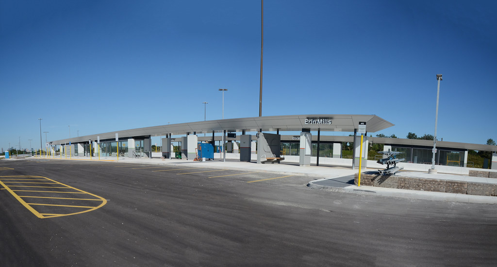
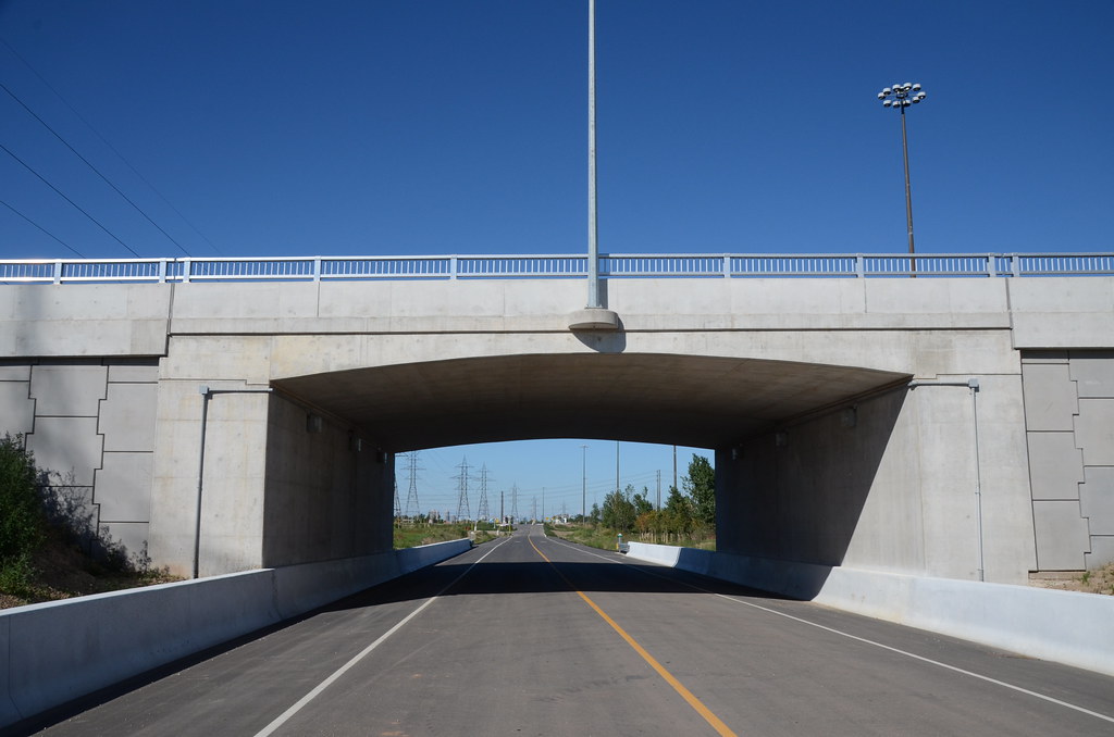
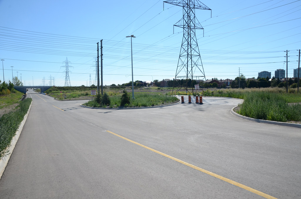
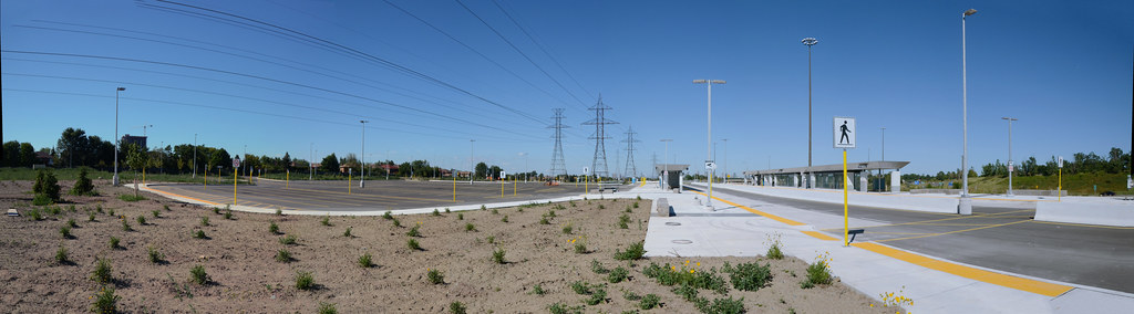
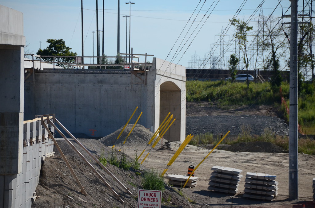
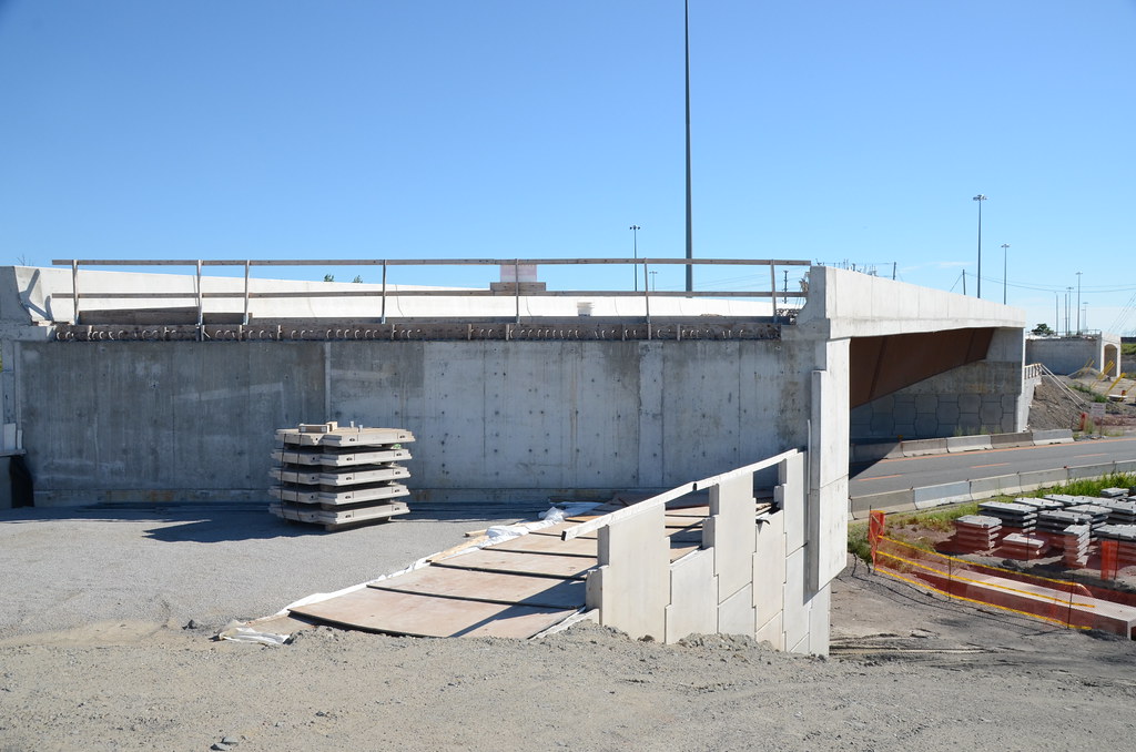
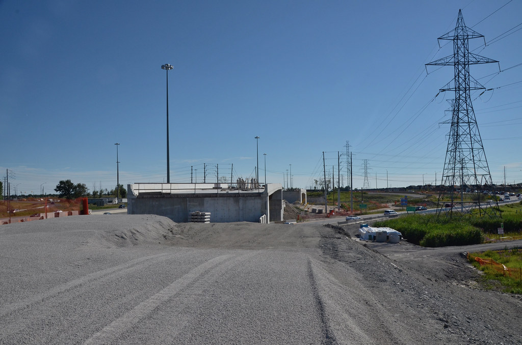
We have the transitway here and now, let's work with and make the best of it. The LRTs are still on the books anyways.

I like to think of this as organic growth: the city makes mistakes, works around them imperfectly, then corrects them when they become critical... and the cycle repeats itself but the city accumulates more wisdom. This is how we mature, I think.

On a deeper level and much like a patient and foresighted father who deals with his child, this is good. This is how we should treat our city, with tolerance and clemency.
 
Last edited:
Aug 9 and a 100+ up on site

99% complete for Erin Mills Station with only wiring to be finish off. There is a turning loop for westbound buses as well a road to get to Erin Mills Parkway Road at both ends.

No washroom with brick seating area. Don't park your bike at the east storage area as you will find it under water after a rain or snow storm as it at the bottom of a slop area with not drain.

Can open in Jan/Feb when the next phase open then, but GO will have to use Erin Mills interchange until spring/summer when Winston Churchill road is completed. Both bridges are built and require relocating traffic 403 on ramp. Them the back filling can take place to build the Transitway road.
19847920583_a471203976_b.jpg

20442657706_f76267aa97_b.jpg

20468886645_43cd30d1d4_b.jpg

20468890105_a0be5c895d_b.jpg

20460178222_1170479ea5_b.jpg

20475235681_7e40f4ffee_b.jpg

20442728726_891239fb3f_b.jpg

20475239601_1958a23dc6_b.jpg

20468836185_6fcbf4a973_b.jpg
20280857170_269fa4c87b_b.jpg
20442793396_c6d2ea0d2d_b.jpg
 
They really seem to have put a lot of thought into the Transitway and it shows. This is first class rapid transit.
 
They really seem to have put a lot of thought into the Transitway and it shows. This is first class rapid transit.
This is totally different from the eastern stations and less costly at that. Cawthra Station come close to this and it has an underpass for riders where there are only walkways at each end of the station as well bing shorter.

The way Winston Churchill interchange is taking place, one would assumed the plan Ridgeway Station is dead now and would be very costly to rebuild it with a underpass for Winston Churchill to get to it as well any connection to 407 at some future date.
 
The way Winston Churchill interchange is taking place, one would assumed the plan Ridgeway Station is dead now and would be very costly to rebuild it with a underpass for Winston Churchill to get to it as well any connection to 407 at some future date.
I suppose you would be correct if the transitway was abruptly ending at Winston Churchill, sans station. You've been around long enough to know better, or at least to be able to do proper research. The rendering in the header of this thread shows the Winston Churchill Station on the west side of the boulevard for crying out loud, along with every other document regarding this project.

I think a ramp to Glen Erin (rather foolishly cut out from the original plan) and a transitway extension to Ridgeway (perhaps just the roadway as an interim solution) would add quite a bit of use to this otherwise stub of a transitway. For example, under the MiWay five plan those using the 13 will have to either transfer twice to use the transitway to shorten their trip to the subway; or if they simply need to get to another station along the transitway they can ride down to South Common and transfer to the 100 which will then backtrack them up to the transitway. In either scenario, valuable time is lost in needless connections and/or backtracking to an investment that exists to reduce that time lost in commute.

Fortunately Metrolinx seems to be open to ideas to enhance the transitway and I will be writing to them on the subject.
 
One thing I think they did wrong was the map of the system.

He shows the line and stations but when taking the 407 uses a different font............it breaks up the system and makes it look like they are 2 different systems or fares or aren't even connected at all. Who cares if it's on it's own Transitway or HOV, it's the same system so it should be just one solid line. All that does is confuse newcomers to the system.

Whether part is underground, elevated, at grade, uses transit -only ways, HOV, or flies there, who cares?.............just make it one simple route line like Ottawa's Transitway part of which is just Bus-only, Transitway, and freeway HOV.
 
Mavis is not a big problem since 61 Mavis goes to CCTT. There are probably engineering problems because the westbound ramp to 403 is huge and the station is not even shown in long-term plans. Maybe they decide it is not possible.

So if they build transitway Erin Mills to CCTT, it would be just be for Creditview. 6km of transitway just for one station.

This transitway should not be the focus in the first place. It should have been Hurontario-Main and Dundas East LRT all along. The transitway is nice opportunity as a component of GO's regional BRT plans (including 407 Transitway), but imo it is not important for MiWay.

Look at the busiest Express route: 110 University, and that's using the bus-bypass lanes, no transitway at all. Although 107 and 110 probably should be combined, you can see, the lack of transitway doesn't seem to be a major factor for 110.

The real problem of the lack of transitway along Rathburn. No City Centre and Hurontario Stations. How they will connect the LRT to transitway? If they are stupid enough to build LRT along Rathburn, they will get in the way of the buses and there are A LOT of buses along Rathburn, including BRT buses.

A full transitway would mean taking buses off Rathburn and also a Hurontario station, which means the LRT can be straight, no diversion onto Rathburn needed. A full transitway alogn Rathburn and LRT straight up Hurontario would also free up space at CCTT which is operating more than twice the capacity it was originally designed for.

Which map are you referring to?

I don't see what you are talking about on MiWay's map, or on GO's map.
 
One thing I think they did wrong was the map of the system.

He shows the line and stations but when taking the 407 uses a different font............it breaks up the system and makes it look like they are 2 different systems or fares or aren't even connected at all. Who cares if it's on it's own Transitway or HOV, it's the same system so it should be just one solid line. All that does is confuse newcomers to the system.

Whether part is underground, elevated, at grade, uses transit -only ways, HOV, or flies there, who cares?.............just make it one simple route line like Ottawa's Transitway part of which is just Bus-only, Transitway, and freeway HOV.

Meant to quote this. Not sure why Doady's message ended up in there instead... o_O
 
He's probably referring to the dashed line used as a symbol for the Express routes on the transitway on the MiWay maps. He is probably right it would probably look better and be less confusing if it was jsut a solid line. They show the transitway stations and that is enough to tell the user for the average user how to use the system.

The legend is not correct either. It says peak-only express routes are dashed line (like peak-only local routes) but 108 is not represented with a dashed line... But transitway is also dashed line. It's just more confusion.
 
Exactly. Not a huge deal but just show the Transitway as one solid line.

Even so, this is the best rapid transit corridor the GTA has opened in a long time and will serve the region very well. It's a shame that once you transfer from the fast, reliable Transitway onto the TTC Eglinton bus you go from high speed transit to the slow boat to China.
 
So the finishing touches to the first phase of the transitway are now underway. A contract was awarded to Buttcon in the amount of 3.5 million to finish what B. Gottardo left off.
 
Last edited:
So the finishing touches to the first phase of the transitway is now underway. A contract was awarded to Buttcon in the amount of 3.5 million to finish what B. Gottardo left off.

Buttcon? Lol are they in the toilet paper business?
 
Buttcon? Lol are they in the toilet paper business?
I always get a chuckle when I see their job-sites. They are actually a fairly large construction company. Definitely not on the upper tier of >$3bn companies, which would include PCL, Kiewit, Ellisdon, Ledcor and Aecon. I think they are in the $100m-250m revenue range, which includes general contractors like Eastern, Carillion, Walsh, Melloul-Blamey and Dufferin and developers like Tridel and ConDrain
 
Photo Opportunity: Ride the Mississauga Transitway on Two Wheels at Tour de Mississauga

Sep 16, 2015

This year’s 8th annual Tour de Mississauga will be a photo you don’t want to miss. Each of the five routes will travel on the Mississauga Transitway – the City’s new dedicated bus corridor.

More than 3,500 riders in brightly coloured Tour de Mississauga T-shirts and cycling jerseys will leave Mississauga Celebration Square this Sunday morning to hit the pavement of the Mississauga Transitway. On this one day only, bicycles will be able to ride on the transitway without any bus traffic.

The Mississauga Cycling Advisory Committee promises a range of ages from young children in trailers to older adults, enjoying our city on two wheels.

Photo Opportunity

What: Tour de Mississauga - Beginning and ending at Mississauga Celebration Square. The event has five different routes and all will travel on the Mississauga Transitway.

Who: Mayor Bonnie Crombie
Ward 3 Councillor Chris Fonseca, City Council representative on the Mississauga Cycling Advisory Committee (MCAC)
Members of MCAC
Participants on their bikes

When: Sunday, September 20, 2015
7 a.m. 120 km City Classic Ride departs
7:45 a.m. Opening Remarks/Photo opportunity with Mayor Bonnie Crombie
8 a.m. 100 km Challenge Road Ride departs
8:30 a.m. 60 km Signature Sixty departs
9:30 a.m. 30 km Leisure Ride departs
10:30 a.m. 15 km Family Ride departs

When: Sunday, September 20, 2015

Where: Mississauga Celebration Square
300 City Centre Dr. (Duke of York Blvd. and Burnhamthorpe Rd. W.)

For more information, visit mississaugacycling.ca/tour.
 

Back
Top