News   Apr 18, 2024
 589     0 
News   Apr 18, 2024
 5K     1 
News   Apr 18, 2024
 2.3K     4 

Toronto Infrastructure Mysteries - what is this?

TransitBart

Senior Member
Member Bio
Joined
Mar 26, 2016
Messages
2,379
Reaction score
1,722
Location
Leslieville
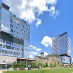
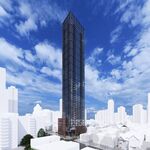
This thread is for those who have a question about something you have seen in the city. I suggest you take a picture of the building, structure or monument that you are curious about and post it here. Tell the forum where you took the picture and ask them your question.

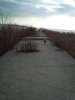
For example. I get to Cherry Beach with my pooch often. Right at the point where the eastern gap ends and you can practically spit across to Ward's Island, is the slab of concrete pictured below. I know that the Leslie spit has had fill dumped and formed, but this looks like it was cast in place. What was this? A road? A dock? Does anyone know? Also what was this before it was Cherry Beach Park?

The picture below is at the point looking south-west of Toronto Islands.

Mystery Cherry Beach Slab.jpg
 

Attachments

  • Mystery Cherry Beach Slab.jpg
    Mystery Cherry Beach Slab.jpg
    627.5 KB · Views: 207
Last edited:
the islands have a similar thing sticking out into the water along the eastern gap, and I know that one was used to dock industrial boats at a time. Long abandoned and half collapsed into the lake, though.
 
the islands have a similar thing sticking out into the water along the eastern gap, and I know that one was used to dock industrial boats at a time. Long abandoned and half collapsed into the lake, though.
That one is a continuation of the dock wall that runs on the eastern edge of Ward`s Island - I think it extended into the inner harbour so it could accommodate more (or longer) ships waiting for a dockside mooring. It does not look very good and it would be great if Ports Toronto could remove it - assuming it's theirs!
 
What was this? A road? A dock?
As a youth (late 50's and pre Leslie St. spit) I worked as a lifeguard for the Toronto Harbour Commission. One of the guard towers was on a pier parallel to the eastern gap. The seat looked out into the lake. At the end of the pier was a fog horn which drove the guards crazy on foggy days. The Google satellite image shows no remnant of this significant feature. The remaining portion of the area north of the beach had a heavy undergrowth and was sort of a lovers lane.
 
Not just the wrong end of the law from my understanding, but also the "wrong" side of sexuality.

TPS has a lot of very dirty history a lot of people like to sweep under the rug.
 

Back
Top