News   Apr 26, 2024
 2.4K     4 
News   Apr 26, 2024
 579     0 
News   Apr 26, 2024
 1.2K     1 

Toronto Crosstown LRT | ?m | ?s | Metrolinx | Arcadis

No offense but until Steve Munro tells me that I remain sceptical that is a fact.. It might be but I dont know... Has steve commented on this issue? If it isnt possible why were so many counsellors trying to suggest that it could be repurposed.

Steve has talked about the Weston corridor many times. His stance is that a converted UPX would be the most logical place to put the western leg of the Downtown Relief Line. This doesn't mean literally converting the line to subway technology (that is definitely impossible) but rather electrifying it, adding in more local stations, running more frequent service, and charging a much lower fare. This would be entirely doable, and much cheaper and easier to build than any other DRL West option.

Personally I can't imagine why we would waste this valuable space on a low-ridership premium express train to the airport. The corridor connects densely populated neighbourhoods, large employment districts, and the city's two most important transportation hubs. And it does that while crossing basically every major transit corridor in the west end, including the Eglinton LRT, the Bloor Subway, all of the streetcar lines, and a whole bunch of very busy bus routes. When you think about all that potential, the UPX just seems kind of pointless.
 
so its not happening... i thought it would be more in the 1 billion range... really wish the finch funds would go here...
 
not really as you can't dedicate a lobby space below the stairs for it, and you can't move the platform spaces currently used for GO to where the UPX currently is. (you would lose regular GO capacity)

Currently my understanding is that VIA uses 2 of the 14 platforms, leaving 12 platforms for GO to use for 7 lines. Thats why GO wants the lakeshore tunneled platform, it would give them 14 platforms for 7 lines, the ideal setup. adding the UPX to it would be even more constraining (never mind the fact that it would need its own custom platform as the UPX uses high platform trains unlike GO, as well as a specialized lobby space below to allow for the separate fare system)

Its the same reason the proposed Peterborough GO line is forced to use Summerhill as it would further limit GO capabilities at Union.

also, anyone know if the UPX will use PRESTO? I presume so.

12 platforms.

  1. Lakeshore EB (EastBound) to Oshawa
  2. Lakeshore WB to Hamilton
  3. Milton (turn around at Union)
  4. UPX (turn around at Untion)
  5. Kitchner EB to Markham
  6. Markham WB to Kitchener
  7. Bolton (turn around at Union)
  8. Barrie EB to Richmond Hill
  9. Richmond Hill WE to Barrie

It looks like 9 platforms would be enough at Union. Whether the platforms (and access/egress) is adequate to handle the passenger flow may be a concern. Also a concern might be the track layout approaching Union.
 
it isn't that simple because of increased rush hour frequencies. Most trains during rush hour would not be through run as opposite direction commuting isn't needed, and you still need the trains to be able to go to their respective mid-day storage yards.
 
how much to build Eglinton to the airport in a ROW?

It's about 10 km from Mt. Dennis to Pearson. Assuming costs of $70 million per km, it should could out to about $700 million for an at grade ROW LRT. That's also assuming that they can get across Highway 427 without elevating or going underground.

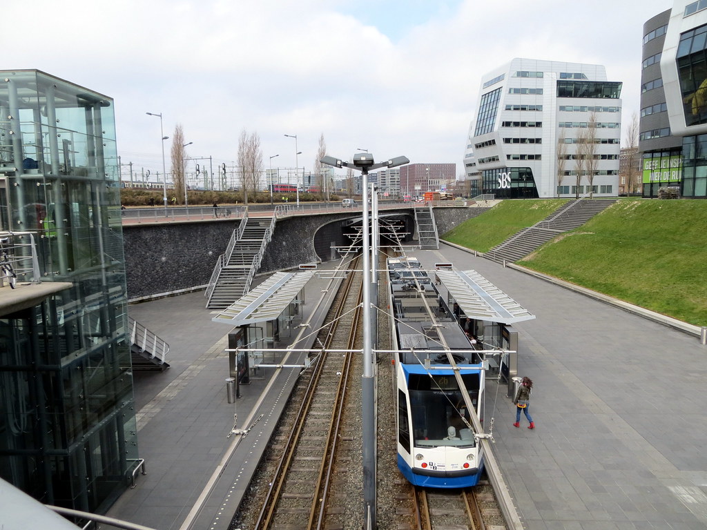
However, the ROW configuration from Transit City is probably the worst way to go about building this. The Richview Corridor and Eglinton Flats provide us with an enormous amount of unused land on the north side of Eglinton from Mt. Dennis to Scarlett and from Jane to Renforth. Building the LRT in a trench (pictured below), would cost a little more, but allow for full grade separation, automatic train control and speeds of 30kph. Between Scarlett and Jane the line could go elevated or underground, to avoid interacting with road traffic.

It's one of those things that are so stupidly obvious that it will probably never be done :rolleyes:

10548090146_171d5d7ccb_b.jpg


Another option is just to elevate the whole thing, which I'm estimating should cost ~$1.5 billion.
 
Last edited:
12 platforms.

  1. Lakeshore EB (EastBound) to Oshawa
  2. Lakeshore WB to Hamilton
  3. Milton (turn around at Union)
  4. UPX (turn around at Untion)
  5. Kitchner EB to Markham
  6. Markham WB to Kitchener
  7. Bolton (turn around at Union)
  8. Barrie EB to Richmond Hill
  9. Richmond Hill WE to Barrie

It looks like 9 platforms would be enough at Union. Whether the platforms (and access/egress) is adequate to handle the passenger flow may be a concern. Also a concern might be the track layout approaching Union.

it isn't that simple because of increased rush hour frequencies. Most trains during rush hour would not be through run as opposite direction commuting isn't needed, and you still need the trains to be able to go to their respective mid-day storage yards.


BurlOak, Milton connects to Markham, not Kitchener I believe. Otherwise, Good plan. But true about rush hour. What about Bathurst yard?
 
It's about 10 km from Mt. Dennis to Pearson. Assuming costs of $70 million per km, it should could out to about $700 million for an at grade ROW LRT. That's also assuming that they can get across Highway 427 without elevating or going underground.

However, the ROW configuration from Transit City is probably the worst way to go about building this. The Richview Corridor and Eglinton Flats provide us with an enormous amount of unused land on the north side of Eglinton from Mt. Dennis to Scarlett and from Jane to Renforth. Building the LRT in a trench (pictured below), would cost a little more, but allow for full grade separation, automatic train control and speeds of 30kph. Between Scarlett and Jane the line could go elevated or underground, to avoid interacting with road traffic.

It's one of those things that are so stupidly obvious that it will probably never be done :rolleyes:

10548090146_171d5d7ccb_b.jpg


Another option is just to elevate the whole thing, which I'm estimating should cost ~$1.5 billion.

Like I said, I'm emailing the MTO. Even Vancouver has a link to the airport. This is sad Tiger.
 
Like I said, I'm emailing the MTO. Even Vancouver has a link to the airport. This is sad Tiger.

It's sad, it's frustrating... there aren't enough words to describe how screwed up transit planning is in this city. We have politicians who know nothing about transit continually drawing politically convenient lines on the map, while at the same time being terrified of paying for them. Metrolinx is helping, but sometimes I have to wonder if those guys know left from right.

By the way, you should probably send your concerns to Metrolinx, city councillor or MPP. I don't believe MTO handles this stuff. Of course they won't care regardless :confused:
 
It's about 10 km from Mt. Dennis to Pearson. Assuming costs of $70 million per km, it should could out to about $700 million for an at grade ROW LRT. That's also assuming that they can get across Highway 427 without elevating or going underground.

However, the ROW configuration from Transit City is probably the worst way to go about building this. The Richview Corridor and Eglinton Flats provide us with an enormous amount of unused land on the north side of Eglinton from Mt. Dennis to Scarlett and from Jane to Renforth. Building the LRT in a trench (pictured below), would cost a little more, but allow for full grade separation, automatic train control and speeds of 30kph. Between Scarlett and Jane the line could go elevated or underground, to avoid interacting with road traffic.

It's one of those things that are so stupidly obvious that it will probably never be done :rolleyes:


Another option is just to elevate the whole thing, which I'm estimating should cost ~$1.5 billion.

isnt the richview corridor already sold to a developer? its nice in theory but if its sold its sold... id rather the row then nothing.
 
isnt the richview corridor already sold to a developer? its nice in theory but if its sold its sold... id rather the row then nothing.

Richview is still City of Toronto owned land. In fact, the Province has declared a moratorium on City owned vacant land stating that they'd remain public space.
 
Richview is still City of Toronto owned land. In fact, the Province has declared a moratorium on City owned vacant land stating that they'd remain public space.

so what part was sold for those townhouses... a map of sold and unsold land would be helpful
 
It's sad, it's frustrating... there aren't enough words to describe how screwed up transit planning is in this city. We have politicians who know nothing about transit continually drawing politically convenient lines on the map, while at the same time being terrified of paying for them. Metrolinx is helping, but sometimes I have to wonder if those guys know left from right.

By the way, you should probably send your concerns to Metrolinx, city councillor or MPP. I don't believe MTO handles this stuff. Of course they won't care regardless :confused:

Richview is still City of Toronto owned land. In fact, the Province has declared a moratorium on City owned vacant land stating that they'd remain public space.

so what part was sold for those townhouses... a map of sold and unsold land would be helpful

I wonder what is going on in Glen Murray's head sometimes. A quick 700 million win and no bite.
 
Last edited:
so what part was sold for those townhouses... a map of sold and unsold land would be helpful

I'm not sure what townhouses you're talking about. Its my understanding that all undeveloped lands are owned by Toronto. The only developed parts are between Scarlett and Royal York.

Regardless of if parts were sold to a developer, all of the undeveloped corridor could be used. The city would just have to buy or expropriate those lands.
 

Back
Top