News   Apr 25, 2024
 193     0 
News   Apr 25, 2024
 350     0 
News   Apr 25, 2024
 546     0 

Population of Toronto (Including Census Counts)

Ugh. Arguing semantics again with nfitz. What I said above is absolutely correct. Guelph is in Wellington County, but for most intents and purposes is not part of it, and the county government has no control over it. Maps do not show thick County/RM/District boundaries around London, Guelph, etc;The MTO does not erect county border signs when leaving a separated city like London with COUNTY MIDDLESEX signs on the 401 like it does at county/RM borders. Judicial districts are absolutely based on county/district lines, and so are Census Divisions.

Yeah, and some in this thread are eager to counterargue that the ambiguities are the result of laziness, deception, etc. Like we should reverse decades of common usage in the name of "correctness". Look, people: just because a city is "separated" in certain critical governance regards doesn't mean it's a Virginia-style Separated City (which *are* depicted as separate on maps and road signage).

Then again, I noticed that the most recent official Ontario road map seems to have gotten awfully wonky about how it depicts division/subdivision boundaries--it'd appear that Guelph *does* have a thick countyish boundary; yet Greater Sudbury for some reason didn't! Though given *everything* out there in the GPS era, it could just as well be that Ontario's official cartographers don't much care anymore and are playing out the string until the province gets out of the official-road-map racket altogether...
 
Does anyone think the Regional Municipalities will disappear completely (e.g. if Brampton and Mississauga were to each become separated cities) or will they merge with the lower tier cities (say if Brampton/Mississauga/Caledon merged into a Peel City)?

Or will the City of Toronto annex the neighbouring RMs and have a kind of "Metropolitan Toronto" in charge of the GTA with smaller "boroughs" like Mississauga and Vaughan and Pickering underneath?

Or will we see the status quo prevail for the foreseeable future?

#3
 
Yeah, and some in this thread are eager to counterargue that the ambiguities are the result of laziness, deception, etc. Like we should reverse decades of common usage in the name of "correctness". Look, people: just because a city is "separated" in certain critical governance regards doesn't mean it's a Virginia-style Separated City (which *are* depicted as separate on maps and road signage).

Then again, I noticed that the most recent official Ontario road map seems to have gotten awfully wonky about how it depicts division/subdivision boundaries--it'd appear that Guelph *does* have a thick countyish boundary; yet Greater Sudbury for some reason didn't! Though given *everything* out there in the GPS era, it could just as well be that Ontario's official cartographers don't much care anymore and are playing out the string until the province gets out of the official-road-map racket altogether...

Two comments.

Who's to say that this "common usage" issue does not exist in Virginia as well?

Perhaps this perceived "wonkyness" (laziness) concerning Ontario road maps is do to the fact that the purpose of said road maps has no use for defining such things. It just isn't information pertinent to navigation.
 
Two comments.

Who's to say that this "common usage" issue does not exist in Virginia as well?

"Common usage" in Virginia does separate the Separated Towns from counties--as affirmed in official highway maps, atlases and whatever else.

Perhaps this perceived "wonkyness" (laziness) concerning Ontario road maps is do to the fact that the purpose of said road maps has no use for defining such things. It just isn't information pertinent to navigation.

Funny; they were evidently deemed "pertinent" back when, well, the official Ontario road map was "pertinent", back in the pre-MapArt/pre-GPS 1960s and 1970s. And likewise, state highway maps and Rand McNally-type atlases--they always depicted counties (and Separated Cities, too, in Virginia's case). Maybe not strictly to navigation; but certainly to giving one a feel of the geographical lay of the land--and to anybody who grew up throughly instilled within and conditioned by that mapping culture, to discard such county coordinates would have been a feat of disinterested idiocy on behalf of the kinds of schmucks who seldom stray from the I-75 en route to Florida.

However, your "just isn't information pertinent to navigation" may help explain why the much more acutely navigation-focused universe of GPS has, for increasing numbers, displaced said maps and atlases--and why the overall trend's been toward the common-geographic illiteracy of Jonny5's friends and peers...

EDIT:...and maybe in that light, if it's strictly a matter of navigation, it's better to let GPS be GPS rather than for maps to lamely, half-heartedly "respond" to the GPS age through letting such traditional mapping stuff as county coordinates go lax and flabby. In which case, the better thing might in fact be to reaffirm the time-honoured county-boundary'n'stuff thing: a sort of gentrified afterlife for the traditional highway map. (Though that may be hard to come by or recapture in Ontario, given all the mega-amalgamations that make a hash out of all those traditional coordinates.)
 
Last edited:
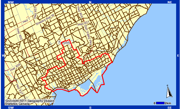
Old Toronto:

2006: 687,166
2011: 736,775
% Growth: 7.2%

I think you may have added in one too many census tracts. The old city only had 676,352 as of the 2006 census.

The census website sucks so bad. At least with the 2006 census you could see the population of the old boroughs directly. It would say

Toronto (dissolved) 676,352
East York (dissolved) xxx,xxx
North York (dissolved) xxx,xxx

Why did they stop doing this.

That Geosearch tool sucks too for just trying to add up populations. There should be a way to just highlight all the census tracts you want, and have it give you the combined population.
Actually, I think they only have info for the old boroughs for 2001. 676,352 is Old Toronto's population for 2001, not 2006. This is the area I used for Old Toronto by the way, I believe it's census tracts up to and including 149.00 plus 152.00 and 167.01.
OldTorontoCTs.png

Old York and York are 150.00-199.00 (except 152.00 and 167.01) and Scarborough, North York and Etobicoke are in the 200s and 300s (200s is W of Yonge, 300s is E of Yonge), although Scarborough also includes 802.01 and 802.02 which are between the Rouge River and Port Union Rd. 400s is York Region, 500s is Peel Region, 600s is Halton Region (except Burlington) and 800s is Ajax-Pickering.
 
And if it's up to 2001, I suspect it's for "comparison purposes" re the previous census, in which the former Metro municipalities *did* still exist...
 
I went ahead and edited the page myself. Someone had written in the description that the 2011 population was 730,xxx. I changed it to your number.
 
Guessing the councillors from Scarborough are hoping for big increase numbers to justify a subway, subway, subway.
I'm fairly confident it will be the slowest growing of the major boroughs.

For fastest growing census tract, I'm thinking the Entertainment District/Fashion District CT. Or maybe Liberty Village/Fleet St area. Humber Bay Shores and Esplanade/West Don Lands/Waterfront east of Yonge should be up there too though.

However, if we're including Greenfield Growth areas, then those should still take the cake. While I can see the King-Spadina area going from 8,000 to 20,000 or so, the census tract in Brampton that includes Springbrook, Spring Valley, El Dorado Park, Alloa and other newly developed areas will probably grow from 16,000 to 70,000. Granted it's supposed to get split into 3 new census tracts for the 2016 census but I can still see some of those growing from about 4,000 to almost 30,000. There's also the North Oakville census tract which had an unusually low population of 600 in 2011, and will probably hit around 4-5k by 2016, so not #1 for net growth, but a possible contender for % growth.

So I'm going for
576.70 for greatest net growth (Bram West).
615.00 for highest % growth (North Oakville)
011.00 for higher net and % growth in Toronto proper (King-Spadina)

I'm excited too in case you couldn't tell. :p
Is the data being released tomorrow morning or tomorrow night?
 

Back
Top