News   Apr 18, 2024
 397     0 
News   Apr 18, 2024
 2.8K     1 
News   Apr 18, 2024
 2.1K     4 

Miscellany Toronto Photographs: Then and Now

Now. The "new" school is coming along nicely.

The top has been stripped of brick and the stonework removed from the doors - because they're using it for the new school. I wonder if it was done when classes were going on. Images from The Republic thread
20100621-old-ntci.jpg

20100629-ntci-courtyard.jpg
 
I've been spending some time on the Toronto Star Archives site (http://www.getstockphotos.ca/), and though the pics are relatively small, they offer a collection that fills in a lot of visual gaps left by the Toronto Archives. One location is at King and Church, particularly the SW corner that has been a parking lot as long as I can remember. At one time, however, it had buildings reminiscent of Gramercey Park (captions by the Star):
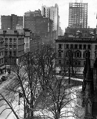
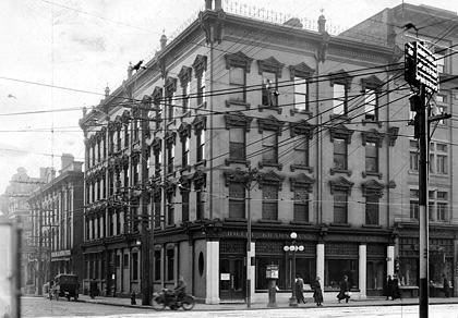
1915:

9bceedd9.png


SW corner:

Soldiers hostel: The Hotel Krausmann at King and Church Sts. was converted by the Salvation army into a hostel for soldiers returning from World War I in 1918. This photo was taken in 1915. Last Published: 2/19/1915
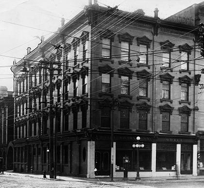
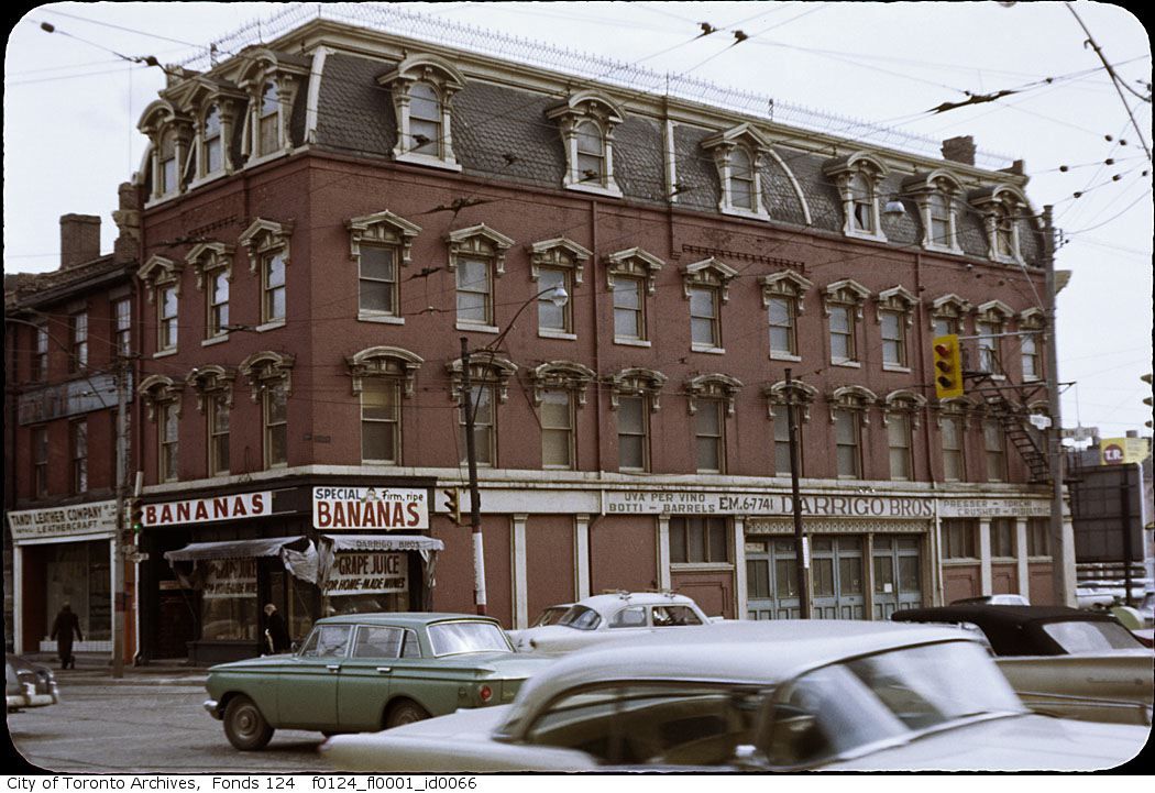
db03cea1.png


1918:

2084800029.jpg


Soldiers hostel: The Hotel Krausmann at King and Church Sts. was converted by the Salvation army into a hostel for soldiers returning from World War I in 1918. The ornate lobby was staffed by Sally Ann members and signs told soldiers of the "Work among the Soldiers of the Empire" by Salvation Army chaplains, medics and others. The rates were also prominently posted: Beds cost 30 cents a night in dormitories; 40 cents in semi-private dormitories; 50 cents in semi-private rooms with baths; $1 a night or $5 a week in single rooms. Bath towels were 2 cents extra.
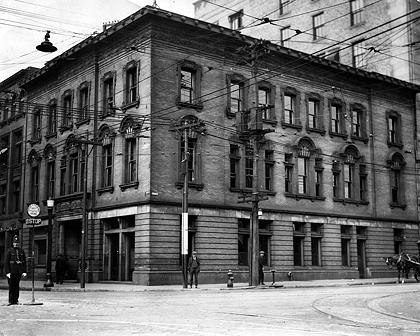
NW corner 1924:

350ef2f9.png


Toronto Railway Chamber building at the corner of King and Church Street, 1924.
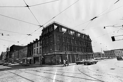
SE corner 1970:

2084800053.jpg


1970 caption: Destruction is planned for this row of ancient buildings on King St. E. just past Church. Against the advice of two groups concerned with conserving the best of Toronto's past, the city of Toronto will demolish these buildings for an as yet undetermined development. Protests have been ignored and wrecking continues. Last Published: 3/28/1970

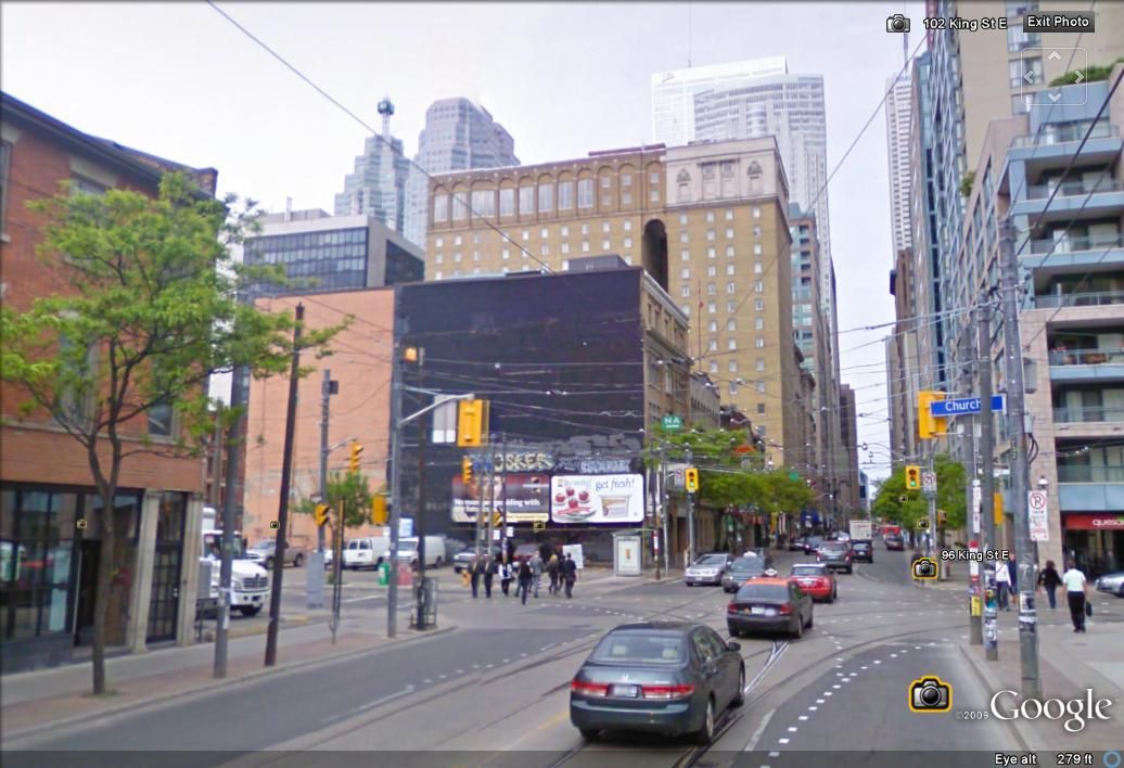
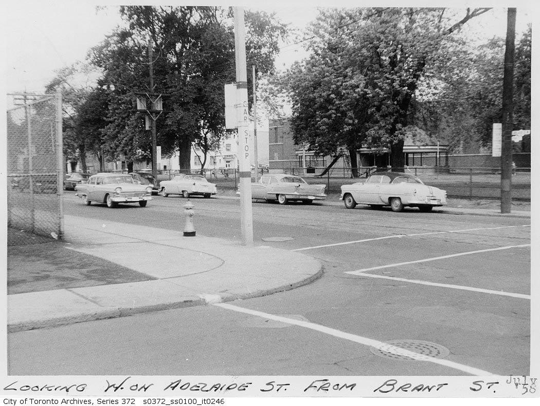
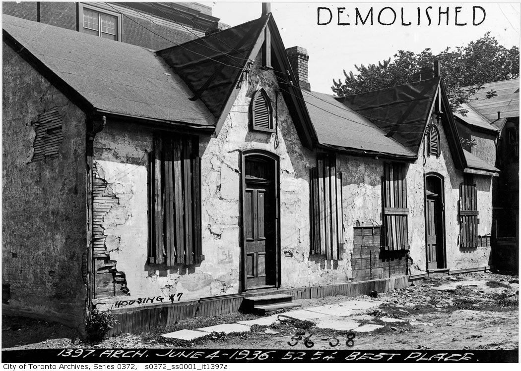
From the Toronto Archives:

f0124_fl0001_id0066.jpg


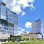
Today (outline of the roof of the Hotel Krausmann can still be seen on the adjacent building; 40 years later, the SE corner has never been developed):

kingchurch2.jpg
 
Last edited:
Yup, same Darrigo Brothers. And incidentally, Krausman is SW, not SE.

9bceedd9.png


What I love about this photo is how sublimely steel and skeletal the Royal Bank was under construction, to the point where it could be mistaken for TD fifty years later...
 
When my parents came to Canada, they lived on Sydenham (with a boatload of other family members) for a few years in the 50's.

Mine stayed on Grange in a rooming house during the 50s. That house is still a rooming house.


August 4 addition.


Then. "Dec 10, 1931. Milan street N of Ramsey".


nofqueenandberkeleygopastramseyslan.jpg


Now. July 2010.


DSC_0157.jpg
 
Interesting how the one-way systems on Richmond and Adelaide have determined that we look at these streets in very one-dimensional ways (unless one walks them of course). Current plans by Adam Vaughan to make them 2-way again will be welcome on many levels, particularly at Adelaide and Bathurst where St. Mary's closes the axis of Adelaide:

adelaide.jpg


adelaide2.jpg
 
Last edited:
We should put together a series of photos looking down one-way streets the "wrong" way (i.e. Queens Park Crescent East looking south, York looking south, Adelaide looking west, Richmond looking east.....). It's a whole new way of looking at familiar scenes.

richmond.jpg
 
Last edited:
thecharioteer, here is another view of a two way Adelaide. Kind of strange to us to look at the old picture... it's one way eastbound only now.

s0372_ss0100_it0246.jpg


August 6 addition.

This isn't a Then and Now in the usual sense. I was walking up Markham street just north of London street when I came upon some very old houses and took a picture. At the Toronto Archives I found a picture of similar houses. What struck me was as far back as 1936 those old houses on Best Place were already past their prime. Here we are in 2010 and I can assume that the homes in my Now picture were occupied as recently as a couple or very few years ago? I realize that regular maintenance can keep an old house going forever but I am still in wonderment these workers cottage style homes still exist on other streets throughout downtown Toronto and many are lovingly maintained by their owners.


s0372_ss0001_it1397a.jpg


DSC_0400.jpg
 
Info on these buildings

Been searching the archives for anything on these two buildings at Eastern and Cherry streets.
With all the construction and the closing of the Canary restaurant, Im suprised they still stand,
I work in the film biz and we shoot in these two all the time.

Anyone?
SEcorner.jpg


And
NEcorner.jpg
 
Been searching the archives for anything on these two buildings at Eastern and Cherry streets.
With all the construction and the closing of the Canary restaurant, Im suprised they still stand,
I work in the film biz and we shoot in these two all the time.

Anyone?
[]

Palace Street School (Canary Restaurant):

Address: 409 FRONT ST E

Ward: 28
Status: Designated Part V
List Date: Aug 18, 1976
Intention Date:
By-Law:
Part IV Date:
Part V Date: Apr 16, 2004
Heritage District: N/A
District Status: N/A
Heritage Easement Ag:
Registration Date:
Building Type: Educational
Architect/Builder:
Construction Yr.:
Details: Palace Street School, 1859, Joseph Sheard, architect; 1869 addition, William Irving, architect; 1890, addition for D'Arcy Hotel, David Roberts Jr., architect; 1891, addition completed by Sproatt and Rolph, architects; 1906, became Cherry Street Hotel -ado
Demolition Date:
Primary Address: 425 CHERRY ST

Railway Police Building"

Address: 433 CHERRY ST

Ward: 28
Status: Listed
List Date: Apr 14, 2005
Intention Date:
By-Law: N/A
Part IV Date:
Part V Date:
Heritage District: N/A
District Status: N/A
Heritage Easement Ag:
Registration Date:
Building Type: Miscellaneous
Architect/Builder:
Construction Yr.:
Details: Canadian National Railways Office Building, 1923; adopted by City Council on April 14, 2005
Demolition Date:
Primary Address: 425 CHERRY ST
 
August 6 addition.

This isn't a Then and Now in the usual sense. I was walking up Markham street just north of London street when I came upon some very old houses and took a picture. At the Toronto Archives I found a picture of similar houses. What struck me was as far back as 1936 those old houses on Best Place were already past their prime. Here we are in 2010 and I can assume that the homes in my Now picture were occupied as recently as a couple or very few years ago? I realize that regular maintenance can keep an old house going forever but I am still in wonderment these workers cottage style homes still exist on other streets throughout downtown Toronto and many are lovingly maintained by their owners.

I guess these were the ‘monster homes’ of their day

s0372_ss0033_it0811.jpg

s0372_ss0033_it0751.jpg
 
Here we are in 2010 and I can assume that the homes in my Now picture were occupied as recently as a couple or very few years ago? I realize that regular maintenance can keep an old house going forever but I am still in wonderment these workers cottage style homes still exist on other streets throughout downtown Toronto and many are lovingly maintained by their owners.

There's a row of a half dozen similar cottages, which look to be well maintained, on my old street - Cambridge Avenue, just east of the Don Valley.
 

Back
Top