Heya, Goldie!
")
Yeah, I know I do... I know I do. I was hoping I'd put it up on my blog when I mentioned this around a year ago but I guess I couldn't be arsed to get my ducks in a row and put it up, which leaves it to future me (now present me) to find it. But I know for sure I do have shots of it. I just need to drill down through all the shots I've taken with umpteen cameras now. I'm as eager to put it up and share it as you are to see it.
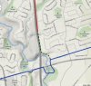
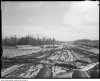
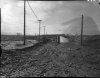
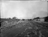
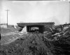
What I can't figure out, when I look at the topographic maps on Google, is why they stopped where they did. They took Woodbine south across the more substantial valley around where Brookbanks is now, but then stopped at the top of a less challenging one. If they'd crossed that, half a mile along the heights and across a minor dip would have brought Woodbine down to Lawrence Avenue pretty much where Old Lawrence Avenue climbed up the hill and headed east. I really don't get why they didn't close a fairly minor gap in the road system like that.
View attachment 11464