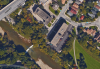
My assumption was that the valley was really tight around the railway crossing at Weston, which is why that's so delayed as a solution could be found. (And the construction of the bridge widening, of course.) I did not know that the few houses on Humberview Crescent had property rights right down to the river, so thanks for the update, Salsa.
The lower Humber gap is annoying more because you have to up and then down some steep hills to get to and from the trail; wayfinding is also poor, though it's slightly better with the painted sharrows. But Stephen Avenue itself isn't too bad.