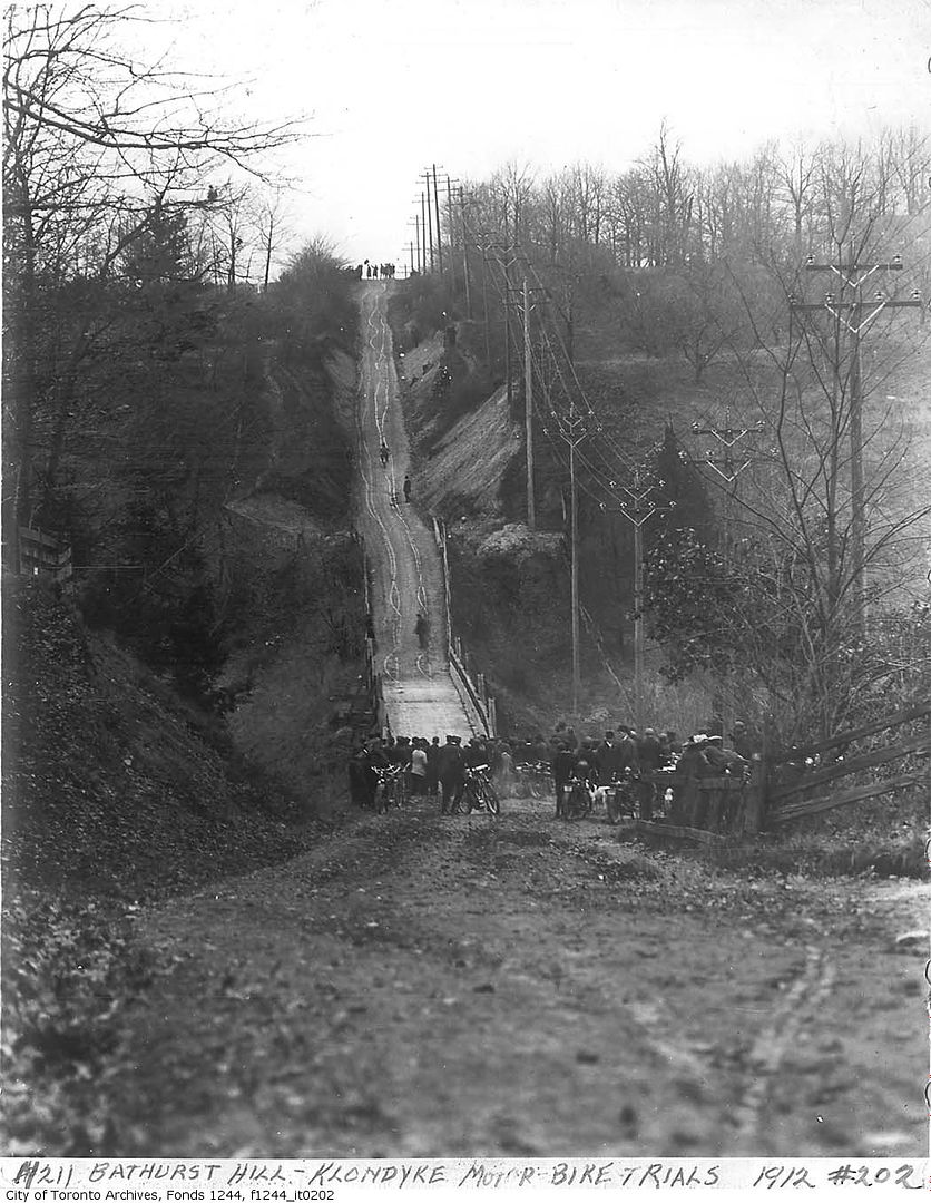
Thanks for the repost, Toronto Lad. Forgot I posted these a long time ago! Regarding the house at the SW corner of the bridge (just north of the Heathdale corner): not sure if we're talking about the same house, but I remember a large Tudor house, set back and fronting Bathurst. It was owned by the Canadian Legion (General Wingate branch) and my father (ex-RCAF) used to go to meetings there. It was expropriated by Metro to allow for an off-ramp for the planned Spadina Expressway and the site remains empty today. Same house you're referring to?
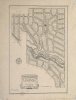
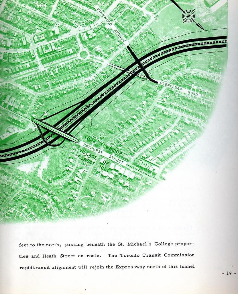
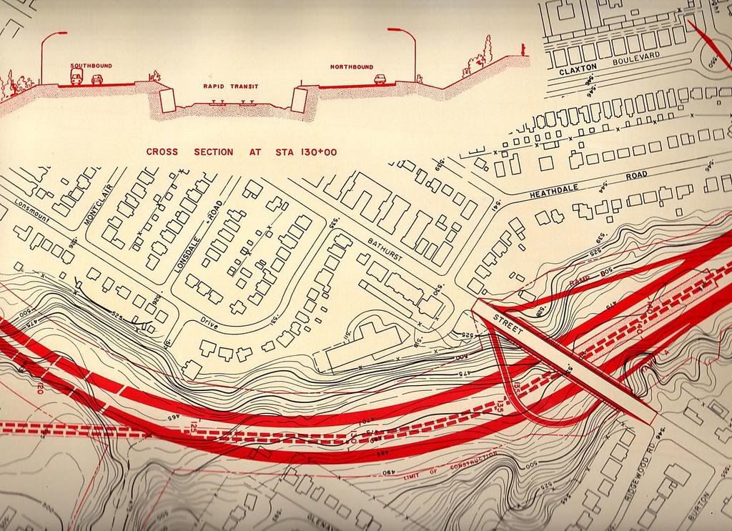
From a planning report on the Spadina Expressway 1961:
I find that very interesting, thank you for that thecharioteer.
To the best of my knowledge there was only one house in that location and my recollection is like yours that it was a Tudor style house set back facing Bathurst, the entrance to the driveway is still discernible as you drive by today, I think we must be talking about the same house, which apparently has an interesting history that I personally would like to hear more about.
We moved to Connaught Circle in May of 1973 and my younger brother attended Cedarvale PS, where he and our neighbors went to school with Guy Paul. I know his family lived in that house and I always assumed the family owned it but I must say I never knew that as a fact. I do know that it wasn't demolished until some time after we moved to that house in '73.
Given the above I would have to assume the house was expropriated in the run up to construction of the extension as you note, but not torn down, then perhaps it was city of Toronto property that the family rented?
About the cedarvale ravine, I was quite interested in that map you posted when I first saw it and the way a "grand" drive was planned for the ravine. For many years I walked into that park by going straight off the end of Heathdale instead of turning, following right on the path of what is shown on that map as the road to the ravine.
As detailed on the map it's a long sweeping right turn that gradually drops down to the lowest elevation in the park. The interesting thing is that you naturally end up taking the exact path of the map because of the way it has been graded and the shade cast by the mature trees that lined the route on both sides.
From the first time I walked through that park I've always felt like at one time Heathdale must have run straight down into the park and not turned a sharp 90 and south to Windley and Vaughan, and that somewhere just under that grass was old pavement.