


chriskayTO
Active Member
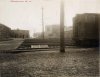
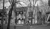
Kind of creepy that my favourite neighbourhood pizza joint is on land formerly occupied by a morgue.
But seriously - check them out - Bellissimo is really good pizza, and cheap. Great neighbourhood vibe, especially when the patio is open.
But seriously - check them out - Bellissimo is really good pizza, and cheap. Great neighbourhood vibe, especially when the patio is open.