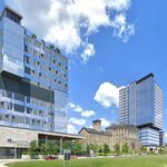
News   Apr 18, 2024
 694     0 
News   Apr 18, 2024
 6.2K     2 
News   Apr 18, 2024
 2.4K     4 

Toronto built-up area since 1901

King of Kensington

Senior Member
Member Bio
Joined
Oct 5, 2007
Messages
2,818
Reaction score
596
These maps show the growth of built-up area of Toronto over the 20th century (note they are for Toronto only not the 905 suburbs).

http://www.torontotransforms.com/maps-of-the-urban-growth-of-the-city-of-toronto-feb-2014/

You can see that in 1901, the built-up area more or less corresponds with the city's boundaries at the time, stretching out to Riverdale and Parkdale. During the 1900s and 1910s, "streetcar suburbs" such St. Clair West, the Beaches and the Danforth develop. North Toronto takes off largely in the 1920s, but a lot of the growth is now outside the city with streetcar lines leading to growth in the Lakeshore communities of Mimico, New Toronto and Long Branch and out to Birch Cliff, Scarborough. By 1931, the City of Toronto is fully built up, as is most of York and a good amount of East York.

Growth continues to spread outward in the 1930s and 1940s, but the big expansion to suburbia occurs in the 1950s, with much of North York, Etobicoke and the southern half of Scarborough built up in 1961. North York and Etobicoke are pretty much completely built up by 1971, and Scarborough north of the 401 - the final frontier - by 1991.
 
Last edited:
K of K: Interesting maps concerning Toronto's growth over 114 years...

This is why I am a member of UT - I can learn about Toronto history from links and posts like these...

LI MIKE
 
That is really interesting. My parents tell me about how the suburbs we drive through were farmland when they were a kid.
 
From an earlier post for early 20th century growth (1901, 1911, 1921 and 1941 - I couldn't get 1931 figures):

Riverdale 11,179; 24,387; 33,747; 44,297
Parkdale and Brockton 27,549; 67,954; 91,186; 94,591
York East* 4,633; 28,151; 66,204; 85,835
Junction 6,091; 18,860; 34,938; 44,908
North Toronto (1911 and 1941) 5,362; 72,953
York South remainder** (1911 and 1941) 8,269; 53,524

* York East is the part of the old York East federal riding in the old city of Toronto, east of Pape and south of Danforth.
** York South was a riding that contained some areas that were the last additions of the pre-1914 annexations, including north of the Danforth, Earlscourt area and North Toronto. York South here is the first two, with North Toronto subtracted out.

http://urbantoronto.ca/forum/showth...minent-than-the-east-side?p=942539#post942539

Many suburban municipalities were carved out of the surrounding townships during the 1920s. Annexations stopped and it was during the 1920s that raw growth began to eclipse growth in the City of Toronto. The city of Toronto population increased by 109,000 (from 521,000 to 631,000); the remainder of Metro Toronto increased by 97,000 (from 90,000 to 187,000).

Some populations (1921, 1931, 1941):

York (1921 boundaries): 57,448; 129,121; 164,526

East York (inc 1924) n/a; 36,080; 41,821
Forest Hill (1924) n/a; 5,207; 11,757
North York (1923) n/a; 13,210; 22,908
Swansea (1925) n/a; 5,031; 6,988
York (1925 boundaries) n/a; 69,593; 81,052

Etobicoke and Lakeshore communities: 16,865; 31,677; 41,719

Long Branch (1930) n/a; 3,962; 5,172
Mimico 3,751; 6,800; 8,070
New Toronto 2,669; 7,146; 9,504
Etobicoke (1930 boundaries) n/a; 13,769; 18,973

Scarborough 11,746; 20,682; 24,303

2 other suburban towns:

Weston 3,116; 4,723; 5,172
Leaside 325; 938; 6,183
 
Last edited:
Really interesting. Gives a good impression of how the city grew and why our city looks the way it is.

I'd be curious to see the 905 grow as well, including the more recent developments like Brampton or parts of Markham.

It would also be interesting if they showed the streetcar lines on the maps to show how they directed growth.
 
I'd be curious to see the 905 grow as well, including the more recent developments like Brampton or parts of Markham.
A bit dated, but this may help. Go to Section 3 (p. 49) and in particular pages 53-55.

http://www.urbancentre.utoronto.ca/pdfs/gtuo/Suttor2007GrowthManagementAffordableHousing.pdf

Of the 905 suburbs, Port Credit, Clarkson-Lorne Park, the Cooksville area of Mississauga, Oakville south of the QEW, central Brampton, Bramalea and Malton, and Thornhill-Markham were built up before 1980.
 
Really interesting. Gives a good impression of how the city grew and why our city looks the way it is.

I'd be curious to see the 905 grow as well, including the more recent developments like Brampton or parts of Markham.

It would also be interesting if they showed the streetcar lines on the maps to show how they directed growth.

For the 905. I think it's by census tract.
http://env-blogs.uwaterloo.ca/atlas/files/2012/05/TorontoAge_processed_1024.png

Anyways, what the Toronto transforms site shows to me is that the Victorian part of Toronto is quite small. Much of Victorian Toronto was swallowed up by Downtown. Victorian Toronto is basically Cabbagetown, Trinity Bellwoods, The Annex, Palmerston, Chinatown/Grange/Kensington area and parts of Parkdale, The Junction and South Riverdale. Most of the East end, many west end neighbourhoods, plus just about everything north of the North Toronto sub are Edwardian or newer.
 
From my perspective, Toronto's lands have been more or less "fully developed" my entire life. It's a little mind-blowing to think that parts of Toronto remained undeveloped up until the 1970s.
 
I believe what the video is showing is the date existing buildings were built rather than initial development. I've seen a similar thing for NYC. Date-of-constuction is relatively simple data to get from city tax roles. It can be a proxy for the age for development, but it doesn't take into account places where development occurred and then all the buildings were later replaced. There are lots of former villages and hamlets, such as around Yonge and Eglinton that don't show up on this map because the old buildings have all been replaced by new buildings. What this map is good for is locating old buildings that still exist, or buildings from a certain era.
 
For the 905. I think it's by census tract.
http://env-blogs.uwaterloo.ca/atlas/files/2012/05/TorontoAge_processed_1024.png

Anyways, what the Toronto transforms site shows to me is that the Victorian part of Toronto is quite small. Much of Victorian Toronto was swallowed up by Downtown. Victorian Toronto is basically Cabbagetown, Trinity Bellwoods, The Annex, Palmerston, Chinatown/Grange/Kensington area and parts of Parkdale, The Junction and South Riverdale. Most of the East end, many west end neighbourhoods, plus just about everything north of the North Toronto sub are Edwardian or newer.

Toronto only had a population of about 200,000 in 1901 and it had tripled by 1931 (and more than tripled if you include suburban areas that developed during the 1920s).

The North American metro that saw the most similar post-war growth pattern was Washington DC. Both metro Toronto and metro Washington had populations of about 900,000 in 1940/1941. And both sizeable inner cities that were already built up then, yet are relatively "new" in terms of suburban development (i.e. lots of post-1980 suburbs).
 
The North Eastern part of Scarborough were built only in the last decade or so, and still has some greenfield industrial development occurring.

Toronto technically isn't done sprawling yet.

Its actually interesting, Pickering and Markham have been pushing Toronto to widen Steeles in the northeastern corner of the city, but Toronto hasn't widened a road in over a decade and has been very reserved about it. Its the last 2 lane arterial left in the city, from my understanding.
 

Back
Top