News   Apr 26, 2024
 2.4K     4 
News   Apr 26, 2024
 611     0 
News   Apr 26, 2024
 1.2K     1 

Simcoe St. Underpass & Extension

Lower Simcoe

1 Lane Each Way + Bike Lanes both directions is my understanding.

Simcoe is supposed to be the extension of the St. George/Beverly Bike Lanes.

Originally those lanes supposed to south of Queen via Peter/Blue Jays Way; but would then move over to Simcoe from Front to the Lake.

My understanding is that this has been revised to Simcoe from Queen to the Lake.

I know Simcoe is to be 2-way south of King, not sure if they intend to change it all the way to Queen or not.

Should happen this year in conjuntion with the opening of the underpass.
 
problem is that there are 2 buildings on either side of the existing "stump" road south of Front. They could never had widened this to 2 lanes each way.
 
Photos taken Jan 2 of the Lower Simcoe St underpass construction looking south

2160800072_02efeac489_b.jpg


2160449579_07e7cfe081_b.jpg
 
That's a 4 lane bridge with 2 bike lanes unless the new LRT's lines are to run up the middle. North of the bridge is 3 lanes wide

This extension will feed Fort York Blvd which is already 4 lanes to get traffic to do the Spadina-Bathurst-Lake Shore route faster and take some of the load off Front and around the SkyDome.

The west sidewalk has to move to the outside line of the building line and this is where the road becomes 2-2. You can see this in the photo's and also when you visited the site as it quite clear seeing it in person.
 
Joining the two Simcoe Streets
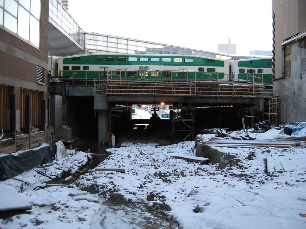
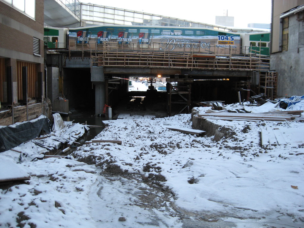
A tunnel under the rail yard at Union Station opens more land for development
JAMES RUSK
January 21, 2008


After decades of lying barren and vacant, one of the prime areas of undeveloped land adjacent to the city core is on the verge of rapid development, with the extension of a new road under the Union Station rail yard.

About mid-year, the road through a recently completed tunnel will be opened to traffic, extending Simcoe Street, which in the 19th century ended at the Lake Ontario shore at Front Street, back to its historic waterside terminus.

The cost of the $45-million project is being shared between the city and Fairmont Hotels and Resorts, the company that owns the historic Royal York Hotel across from Union Station, said John Bryson, the official in charge of bridges at the Toronto Transportation Department.

Fairmont's obligation to build the tunnel dates back to the 1980s, when the city first wrestled with the fate of the railway lands, the large swaths of waterfront owned by Canada's two national railways who a century earlier made a place for railroads in Toronto by filling in a large part of the harbour.

Through its landholding company, CPR agreed to finance a tunnel that would open up its rail lands and the obligation was passed on when it turned its downtown landholding over to Fairmont, a company created out of Canadian Pacific Hotels.

Some of the land south of the rail yard has been sold, while Fairmont still retains part of it, said the company's spokesman Mike Taylor.

"The construction of the tunnel was to get into that land," Mr. Taylor said.

Although the agreement to build has been in place since 1983, construction did not start until last year.

City officials said that two factors were responsible for the 25-year delay: the timing was a commercial decision by Fairmont, and once the developer decided to go ahead, it took time to get all the necessary approvals, including a 2005 rail-safety clearance by the Federal Transportation Agency.

City traffic officials are still studying what changes they will make in the flow of Simcoe Street, which currently is one-way southbound between Queen Street and Front Street, where it ends.

While they expect a portion of it will have to be turned into a two-way street, they said it is not likely Simcoe will be a two-way street all the way north from Front to Queen.

The commercial climate for the development of the lands bounded by York Street, the extended Simcoe Street, the rail yard and the Gardner Expressway, has changed dramatically since CP first signed its agreement with the city.

To the east, Air Canada Centre has been built, and a mixed-use development, Maple Leaf Square, is being built in front of it. To the west, lies the Metro Toronto Convention Centre and the Roundhouse. And the city has built Bremner Boulevard, a city street running east-west from York Street to Spadina Ave. across the tract.

While Fairmont still owns one piece of the tract - Mr. Young would not say what the company might do with it - other sites have been sold to heavyweight operators.

Cadillac-Fairview and Lanterra developments, partners in Maple Leaf Square, bought a major site on the west side of York Street, across from their current project.

The Conservatory Group of Markham, which is just finishing the Infinity Condos on the south side of Bremner, bought an adjacent site on the south side of Grand Trunk Crescent, a street named after an early railway.

And on the northwest corner of Bremner and York, BCIMC Realty Corp, which is controlled by public-sector pension plans in British Columbia, is building a 26-storey office-tower.

Get ready for gridlock at Bathurst bridge this fall

While the extension of Simcoe Street under the rail yards this summer will make it easier for traffic between the lakefront and the city core, the relief will not last long.

This fall, after the CNE is over, Bathurst Street south of Front Street will be closed for about a year, while the bridge over railway lines is taken down and replaced.

City traffic officials said that new bridge will be wider than the old, with a dedicated roadway for street cars as well as two lanes of traffic, bike lanes and sidewalks.

While the new bridge is being built, the city will also build a new intersection on the south side to link Fort York Boulevard and Bremner Boulevard, which is being extended from Spadina Avenue to Bathurst.

James Rusk
 
This fall, after the CNE is over, Bathurst Street south of Front Street will be closed for about a year, while the bridge over railway lines is taken down and replaced.

WHAT- that bridge is really a nice piece and is very much worth saving-

Bathurst_Street_Bridge.jpg

say goodbye to this^^

another piece of history bites the dust. The worst part is, you can only imagine how beautifully utilitarian the replacement will be. Can anyone say concrete a la every other pile of shit bridge in this city?

Kennedy%20BridgeB.gif

oh...and hello to this^^

p5
 
Rats. That's terrible. I always suspected that the jig was up when they didn't do a thorough overhaul of the streetcar tracks like they did on pretty much every bridge over the Don River.

We haven't heard anything about a design process so you're assumptions about the replacement being anything other than your standard MTO concrete overpass is almost certainly correct.

At least there's a ROW and some bicycle lanes.
 
I'm pretty sure that that bridge is heritage-protected and therefore they'll have to work with it. Someone please correct me if I'm wrong.

Wikipedia says it dates from 1903.
 
You also have to love how shortsighted the city is to be doing the bridge construction and intersection construction at the same time which is only going to cause gridlock extending from Spadina to Dufferin. If they had any brains they would be completing the intersection of Fort York Blvd and Bathurst so that when they have to close the bridge, cars and people which normally use front street could now use Ft York Blvd. For anyone wanting to get down towards the condos in that area, they are now forced to walk all the way around Spadina or Dufferin just to circle back to bathurst. Ft York Blvd is pretty much paved and completed and ready to go.
 
You also have to love how shortsighted the city is to be doing the bridge construction and intersection construction at the same time which is only going to cause gridlock extending from Spadina to Dufferin. If they had any brains they would be completing the intersection of Fort York Blvd and Bathurst so that when they have to close the bridge, cars and people which normally use front street could now use Ft York Blvd. For anyone wanting to get down towards the condos in that area, they are now forced to walk all the way around Spadina or Dufferin just to circle back to bathurst. Ft York Blvd is pretty much paved and completed and ready to go.

If you walk through the intersection you'll see that with the design of the current Bathurst Street bridge, Fort York Blvd meets Bathurst where Bathurst is still a viaduct and is part of what needs to be replaced. Bathurst is 5-6m ABOVE Fort York Blvd in Cityplace. Simply, building the intersection and rebuilding the bridge is all one job and can't be done independently.

There's also Strachan for a route around the construction.
 
consultingwhore explained this before:

http://urbantoronto.ca/showthread.php?p=122755#post122755

The heritage truss portion of the Bathurst bridge won't be touched - that was rehabbed about 10 years ago. It is the structures south of that which will be rebuilt. Odd that they've poured concrete curbs right up to Bathurst Street when the grade needs to be changed at that location...IIRC they will be altering the FYB/Bathurst intersection to flatten it out, allowing streetcars to turn there. As for why a central median streetcar ROW was protected for in advance of an EA...well, that is an interesting question and one which was debated a good deal at the time. The short story is it was better to protect now than have to go back and take away a lane of traffic later (WES wanted the Bremner extension built as a four-laner). Kind of a shame this was done before the Cherry Street EA concept...a dedicated streetcar ROW on the south side of FYB, along the north edge of the park, would have been an interesting concept.
 
I don't get it? What are they removing and what is staying? Is the truss section which is illustrated in above photograph going to stay or is it being removed? There seem to be some conflicting opinions in this thread.

cheers,

p5
 

Back
Top